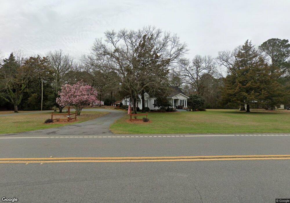
441 Ga Highway 49 N Americus, GA 31709
Estimated Value: $93,000 - $210,000
2
Beds
3
Baths
1,188
Sq Ft
$107/Sq Ft
Est. Value
About This Home
This home is located at 441 Ga Highway 49 N, Americus, GA 31709 and is currently estimated at $127,522, approximately $107 per square foot. 441 Ga Highway 49 N is a home located in Sumter County with nearby schools including Sumter County Primary School, Sumter County Elementary School, and Sumter County Middle School.
Ownership History
Date
Name
Owned For
Owner Type
Purchase Details
Closed on
Jul 10, 2025
Sold by
Satterfield Carl Roland
Bought by
Satterfield Randall and Satterfield Terri
Current Estimated Value
Purchase Details
Closed on
Dec 2, 2008
Sold by
Central Bank Of Georgia
Bought by
Central Bank Of Georgia
Purchase Details
Closed on
Jan 1, 1991
Sold by
Jones Walter
Bought by
Jones Addie R
Purchase Details
Closed on
Feb 1, 1972
Bought by
Jones Walter
Create a Home Valuation Report for This Property
The Home Valuation Report is an in-depth analysis detailing your home's value as well as a comparison with similar homes in the area
Home Values in the Area
Average Home Value in this Area
Purchase History
| Date | Buyer | Sale Price | Title Company |
|---|---|---|---|
| Satterfield Randall | -- | -- | |
| Central Bank Of Georgia | -- | -- | |
| Jones Addie R | -- | -- | |
| Jones Walter | -- | -- |
Source: Public Records
Tax History Compared to Growth
Tax History
| Year | Tax Paid | Tax Assessment Tax Assessment Total Assessment is a certain percentage of the fair market value that is determined by local assessors to be the total taxable value of land and additions on the property. | Land | Improvement |
|---|---|---|---|---|
| 2024 | $1,080 | $19,720 | $4,200 | $15,520 |
| 2023 | $1,061 | $19,720 | $4,200 | $15,520 |
| 2022 | $1,061 | $19,720 | $4,200 | $15,520 |
| 2021 | $1,062 | $19,720 | $4,200 | $15,520 |
| 2020 | $1,083 | $19,720 | $4,200 | $15,520 |
| 2019 | $1,010 | $19,720 | $4,200 | $15,520 |
| 2018 | $1,010 | $19,720 | $4,200 | $15,520 |
| 2017 | $1,010 | $19,720 | $4,200 | $15,520 |
| 2016 | $1,043 | $20,760 | $5,240 | $15,520 |
| 2015 | $1,555 | $37,800 | $7,320 | $30,480 |
| 2014 | $1,273 | $28,600 | $7,320 | $21,280 |
| 2013 | -- | $28,600 | $7,320 | $21,280 |
Source: Public Records
Map
Nearby Homes
- 254 Georgia 49
- 279 Upper River Rd
- 401 Rigas Rd
- 108 Southland Ridge Dr
- TBD Hillside Dr
- 118 Southland Ridge Dr
- 118 Sharon Cir
- TBD District Line Rd
- 111 Cedar Ridge Dr
- 303 Sun Valley Dr
- 0 Littlefield Dr Unit 10594401
- 113 Clearview Cir
- TBD Bumphead Rd
- 400 Georgia 27
- 1302 Crawford St
- 0 Ashley Rd
- Lot 52 Dellwood Dr
- lot 47 Greenwood Dr
- 515 Eastview Dr
- 234 Edgewood Dr
- 448 Ga Highway 49 N
- 428 Ga Highway 49 N
- 461 Ga Highway 49 N
- 411 Ga Highway 49 N
- 456 Ga Highway 49 N
- 484 Ga Highway 49 N
- 491 Ga Highway 49 N
- 492 Ga Highway 49 N
- 536 Ga Highway 49 N
- 547 Ga Highway 49 N
- 547 Georgia 49
- 114 Country Lane Rd
- 320 Ga Highway 49 N
- 471 Upper River Rd
- 303 Ga Highway 49 N
- 149 Country Lane Rd
- 574 Ga Highway 49 N
- 157 Country Lane Rd
- 585 Upper River Rd
- 585 Upper River Rd