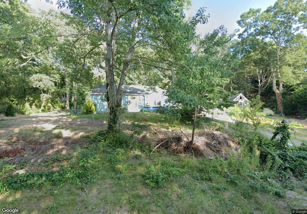
441 Lund Farm Way Brewster, MA 02631
Estimated Value: $622,258 - $671,000
2
Beds
1
Bath
998
Sq Ft
$646/Sq Ft
Est. Value
About This Home
This home is located at 441 Lund Farm Way, Brewster, MA 02631 and is currently estimated at $644,565, approximately $645 per square foot. 441 Lund Farm Way is a home located in Barnstable County with nearby schools including Stony Brook Elementary School, Eddy Elementary School, and Nauset Regional Middle School.
Ownership History
Date
Name
Owned For
Owner Type
Purchase Details
Closed on
Feb 28, 2006
Sold by
Nover Helen
Bought by
Ross Nancy S
Current Estimated Value
Home Financials for this Owner
Home Financials are based on the most recent Mortgage that was taken out on this home.
Original Mortgage
$277,600
Outstanding Balance
$156,888
Interest Rate
6.17%
Mortgage Type
Purchase Money Mortgage
Estimated Equity
$487,677
Purchase Details
Closed on
Jun 29, 2004
Sold by
Edith M Hart Ret and Hart Edith M
Bought by
Nover Helen
Create a Home Valuation Report for This Property
The Home Valuation Report is an in-depth analysis detailing your home's value as well as a comparison with similar homes in the area
Home Values in the Area
Average Home Value in this Area
Purchase History
| Date | Buyer | Sale Price | Title Company |
|---|---|---|---|
| Ross Nancy S | $347,000 | -- | |
| Nover Helen | $340,000 | -- |
Source: Public Records
Mortgage History
| Date | Status | Borrower | Loan Amount |
|---|---|---|---|
| Open | Ross Nancy S | $277,600 | |
| Closed | Ross Nancy S | $52,050 |
Source: Public Records
Tax History Compared to Growth
Tax History
| Year | Tax Paid | Tax Assessment Tax Assessment Total Assessment is a certain percentage of the fair market value that is determined by local assessors to be the total taxable value of land and additions on the property. | Land | Improvement |
|---|---|---|---|---|
| 2025 | $3,699 | $537,600 | $270,200 | $267,400 |
| 2024 | $3,481 | $511,100 | $255,000 | $256,100 |
| 2023 | $3,148 | $450,400 | $227,600 | $222,800 |
| 2022 | $2,937 | $374,200 | $189,600 | $184,600 |
| 2021 | $2,798 | $326,100 | $164,800 | $161,300 |
| 2020 | $2,745 | $318,500 | $164,800 | $153,700 |
| 2019 | $0 | $308,700 | $158,500 | $150,200 |
| 2018 | $2,502 | $302,900 | $158,500 | $144,400 |
| 2017 | $0 | $285,500 | $158,500 | $127,000 |
| 2016 | $2,362 | $280,200 | $155,500 | $124,700 |
| 2015 | $2,277 | $275,700 | $152,400 | $123,300 |
Source: Public Records
Map
Nearby Homes
- 277 Lund Farm Way
- 410 Blueberry Pond Dr
- 153 Red Fawn Rd
- 190 Blueberry Pond Dr
- 100 Fletcher Ln Unit E
- 81 Fletcher Ln Unit I
- 81 Fletcher Ln Unit C
- 80 Fletcher Ln Unit E
- 60 Fletcher Ln Unit H
- 60 Fletcher Ln Unit C
- 61 Fletcher Ln Unit H
- 62 Fletcher Ln Unit N
- 82 Fletcher Ln Unit I
- 28 Middlecott Ln
- 0 Old Chatham Rd
- 137 Eaton Ln
- 49 Eaton Ln Unit 10
- 49 Eaton Ln
- 38 Eaton Ln Unit 38
- 82 Pinewood Dr
- 449 Lund Farm Way
- 64 Pinewood Dr
- 431 Lund Farm Way
- 167 Pinewood Dr
- 0 Pinewood Dr
- 452 Lund Farm Way
- 102 Pinewood Dr
- 459 Lund Farm Way
- 432 Lund Farm Way
- 44 Sandpiper Ln
- 61 Pinewood Dr
- 423 Lund Farm Way
- 43 Sandpiper Ln
- 56 Pinewood Dr
- 110 Horseshoe Way
- 469 Lund Farm Way
- 474 Lund Farm Way
- 100 Horseshoe Way
- 417 Lund Farm Way