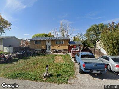
441 N 200 W Payson, UT 84651
Estimated Value: $399,000 - $419,000
2
Beds
1
Bath
725
Sq Ft
$565/Sq Ft
Est. Value
About This Home
This home is located at 441 N 200 W, Payson, UT 84651 and is currently estimated at $409,922, approximately $565 per square foot. 441 N 200 W is a home located in Utah County with nearby schools including Taylor Elementary School, Mt. Nebo Junior High School, and Salem Junior High School.
Ownership History
Date
Name
Owned For
Owner Type
Purchase Details
Closed on
Nov 10, 2022
Sold by
Nay Carolyn Gentry
Bought by
Nay Samuel Kelly
Current Estimated Value
Home Financials for this Owner
Home Financials are based on the most recent Mortgage that was taken out on this home.
Original Mortgage
$165,000
Outstanding Balance
$161,425
Interest Rate
7.08%
Estimated Equity
$233,842
Purchase Details
Closed on
Nov 3, 2022
Sold by
Nay Samuel Kelly and Nay Carolyn
Bought by
Nay Samuel Kelly and Nay Ethan
Home Financials for this Owner
Home Financials are based on the most recent Mortgage that was taken out on this home.
Original Mortgage
$165,000
Outstanding Balance
$161,425
Interest Rate
7.08%
Estimated Equity
$233,842
Create a Home Valuation Report for This Property
The Home Valuation Report is an in-depth analysis detailing your home's value as well as a comparison with similar homes in the area
Home Values in the Area
Average Home Value in this Area
Purchase History
| Date | Buyer | Sale Price | Title Company |
|---|---|---|---|
| Nay Samuel Kelly | -- | -- |
Source: Public Records
Mortgage History
| Date | Status | Borrower | Loan Amount |
|---|---|---|---|
| Open | Nay Samuel Kelly | $165,000 | |
| Closed | Nay Samuel Kelly | $165,000 | |
| Previous Owner | Nay Samuel Kelly | $100,000 | |
| Previous Owner | Nay Samuel Kelly | $71,225 | |
| Previous Owner | Nay Carolyn Gentry | $26,006 | |
| Previous Owner | Nay Carolyn Gentry | $21,230 |
Source: Public Records
Tax History Compared to Growth
Tax History
| Year | Tax Paid | Tax Assessment Tax Assessment Total Assessment is a certain percentage of the fair market value that is determined by local assessors to be the total taxable value of land and additions on the property. | Land | Improvement |
|---|---|---|---|---|
| 2024 | $1,794 | $182,600 | $0 | $0 |
| 2023 | $1,834 | $187,165 | $0 | $0 |
| 2022 | $1,929 | $193,600 | $0 | $0 |
| 2021 | $1,644 | $264,700 | $88,700 | $176,000 |
| 2020 | $1,558 | $245,400 | $80,600 | $164,800 |
| 2019 | $1,335 | $215,500 | $72,200 | $143,300 |
| 2018 | $1,225 | $190,700 | $64,500 | $126,200 |
| 2017 | $1,080 | $90,420 | $0 | $0 |
| 2016 | $1,005 | $83,600 | $0 | $0 |
| 2015 | $912 | $75,350 | $0 | $0 |
| 2014 | $884 | $73,535 | $0 | $0 |
Source: Public Records
Map
Nearby Homes
- 426 N 200 W Unit 21
- 539 N Douglass Dr
- 541 N Douglass Dr
- 383 W 625 N Unit A-D
- 351 W Utah Ave
- 244 E 300 N
- 90 S 300 W
- 323 W 100 S Unit 2
- 591 W 100 N
- 9672 S 3550 W
- 592 W Utah Ave
- 23 W 100 S
- 197 E Utah Ave
- 324 W 200 S Unit 3
- 184 S 300 W
- 1357 N 1525 E Unit 61
- 433 E 450 N Unit 11
- 443 E 450 N Unit 12
- 517 N 450 E
- 155 E 100 S