Estimated Value: $282,000 - $341,000
4
Beds
2
Baths
1,644
Sq Ft
$181/Sq Ft
Est. Value
About This Home
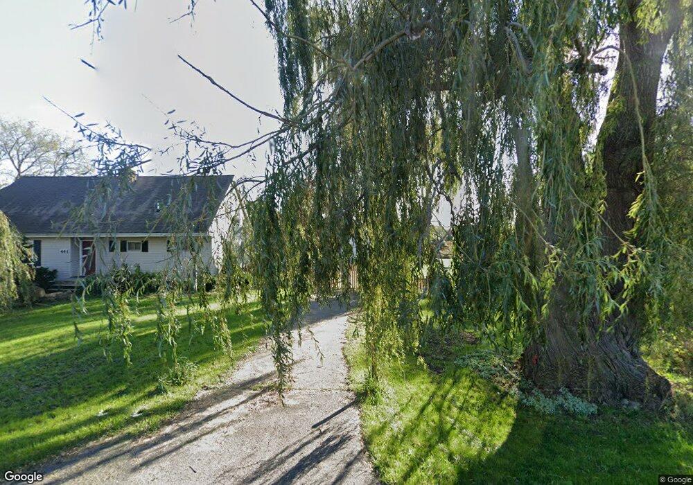
This home is located at 441 S Aurelius Rd, Mason, MI 48854 and is currently estimated at $298,273, approximately $181 per square foot. 441 S Aurelius Rd is a home located in Ingham County with nearby schools including Mason High School.
Ownership History
Date
Name
Owned For
Owner Type
Purchase Details
Closed on
Aug 19, 2024
Sold by
Spillemaeckers Dirk Louis
Bought by
Spillemaeckers Dirk Louis
Current Estimated Value
Purchase Details
Closed on
Mar 25, 2019
Sold by
Spillemaeckers Dirk
Bought by
Bogataj Debra Ann
Purchase Details
Closed on
Oct 3, 2006
Sold by
Mace Kathy
Bought by
Spillemaeckers Dirk
Purchase Details
Closed on
Nov 12, 2002
Sold by
Mace Kathy
Bought by
Mace Kathy
Purchase Details
Closed on
Jun 12, 2002
Sold by
Mace Kathy
Bought by
Mace Kathy
Purchase Details
Closed on
May 12, 1997
Sold by
Hecker John G and Hecker Theresa M
Bought by
Conley Katherine A
Create a Home Valuation Report for This Property
The Home Valuation Report is an in-depth analysis detailing your home's value as well as a comparison with similar homes in the area
Home Values in the Area
Average Home Value in this Area
Purchase History
| Date | Buyer | Sale Price | Title Company |
|---|---|---|---|
| Spillemaeckers Dirk Louis | -- | None Listed On Document | |
| Bogataj Debra Ann | -- | None Available | |
| Spillemaeckers Dirk | $168,000 | None Available | |
| Mace Kathy | -- | -- | |
| Mace Kathy | -- | -- | |
| Conley Katherine A | $129,900 | -- |
Source: Public Records
Tax History
| Year | Tax Paid | Tax Assessment Tax Assessment Total Assessment is a certain percentage of the fair market value that is determined by local assessors to be the total taxable value of land and additions on the property. | Land | Improvement |
|---|---|---|---|---|
| 2025 | $4,900 | $129,300 | $36,000 | $93,300 |
| 2024 | $4,645 | $124,600 | $35,800 | $88,800 |
| 2023 | $4,645 | $107,900 | $22,800 | $85,100 |
| 2022 | $2,961 | $93,600 | $26,100 | $67,500 |
| 2021 | $2,917 | $91,400 | $0 | $91,400 |
| 2020 | $3,392 | $93,500 | $33,100 | $60,400 |
| 2019 | $3,299 | $81,400 | $20,900 | $60,500 |
| 2018 | $2,824 | $76,600 | $20,900 | $55,700 |
| 2017 | $2,347 | $76,600 | $20,900 | $55,700 |
| 2016 | -- | $72,900 | $20,900 | $52,000 |
| 2015 | -- | $70,700 | $41,840 | $28,860 |
| 2014 | -- | $67,200 | $41,840 | $25,360 |
Source: Public Records
Map
Nearby Homes
- 380 Spicetree Ln Unit 48
- 376 Spicetree Ln Unit 47
- 4939 W Columbia Rd
- 0 S Aurelius Rd Unit 292647
- 4789 Nichols Rd
- 300 S College Rd
- 3725 W Howell Rd
- 331 N College Rd
- 0 Eifert Rd
- 248 Maple Run
- 607 Carom Cir
- 902 Eagles Nest Ct
- 1075 N Edgar Rd
- 323 Oak Ridge St
- 311 Carom Cir Unit 59
- 105 Carom Cir
- 106 Carom Cir
- 501 Middlebury Ln
- 1028 Hogsback Rd
- 1219 Wildflower Dr
- 400 S Aurelius Rd
- 386 S Aurelius Rd
- 385 S Aurelius Rd
- 389 S Aurelius Rd
- 513 S Aurelius Rd
- 516 S Aurelius Rd
- 4412 Curtice Rd
- 365 S Aurelius Rd
- 376 S Aurelius Rd
- 4400 Curtice Rd
- 338 S Aurelius Rd
- 4384 Curtice Rd
- 4364 Curtice Rd
- 355 S Aurelius Rd
- 326 S Aurelius Rd
- 295 S Aurelius Rd
- 4360 Curtice Rd
- 4650 Curtice Rd
- 4633 Curtice Rd
- 4660 Curtice Rd
Your Personal Tour Guide
Ask me questions while you tour the home.