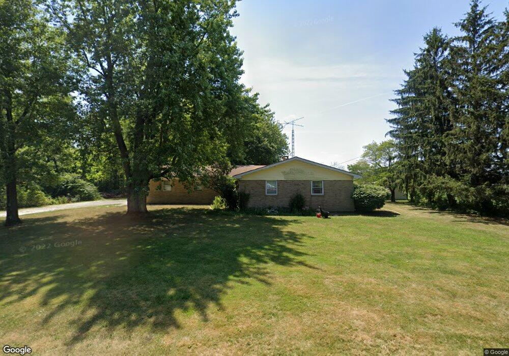
441 W 650 N West Lafayette, IN 47906
Estimated Value: $244,000 - $317,000
--
Bed
--
Bath
1,528
Sq Ft
$188/Sq Ft
Est. Value
About This Home
This home is located at 441 W 650 N, West Lafayette, IN 47906 and is currently estimated at $287,602, approximately $188 per square foot. 441 W 650 N is a home located in Tippecanoe County with nearby schools including Burnett Creek Elementary School, Battle Ground Middle School, and William Henry Harrison High School.
Ownership History
Date
Name
Owned For
Owner Type
Purchase Details
Closed on
Jul 2, 2020
Sold by
Brower Annetta
Bought by
Brower Annetta
Current Estimated Value
Home Financials for this Owner
Home Financials are based on the most recent Mortgage that was taken out on this home.
Original Mortgage
$105,000
Outstanding Balance
$93,280
Interest Rate
3.2%
Mortgage Type
New Conventional
Estimated Equity
$194,322
Purchase Details
Closed on
Sep 27, 2014
Sold by
Harrioson Highlands Ii Llc
Bought by
Keene Homes Inc
Purchase Details
Closed on
Dec 16, 2005
Sold by
Wilson Harold F and Wilson Beverly P
Bought by
Schmidt Annetta J
Home Financials for this Owner
Home Financials are based on the most recent Mortgage that was taken out on this home.
Original Mortgage
$88,065
Interest Rate
9.6%
Mortgage Type
Stand Alone First
Create a Home Valuation Report for This Property
The Home Valuation Report is an in-depth analysis detailing your home's value as well as a comparison with similar homes in the area
Home Values in the Area
Average Home Value in this Area
Purchase History
| Date | Buyer | Sale Price | Title Company |
|---|---|---|---|
| Brower Annetta | -- | None Available | |
| Keene Homes Inc | -- | -- | |
| Schmidt Annetta J | -- | None Available |
Source: Public Records
Mortgage History
| Date | Status | Borrower | Loan Amount |
|---|---|---|---|
| Open | Brower Annetta | $105,000 | |
| Previous Owner | Schmidt Annetta J | $88,065 |
Source: Public Records
Tax History Compared to Growth
Tax History
| Year | Tax Paid | Tax Assessment Tax Assessment Total Assessment is a certain percentage of the fair market value that is determined by local assessors to be the total taxable value of land and additions on the property. | Land | Improvement |
|---|---|---|---|---|
| 2024 | $1,121 | $189,900 | $24,000 | $165,900 |
| 2023 | $1,053 | $182,600 | $24,000 | $158,600 |
| 2022 | $1,016 | $161,500 | $24,000 | $137,500 |
| 2021 | $840 | $140,600 | $24,000 | $116,600 |
| 2020 | $679 | $130,900 | $24,000 | $106,900 |
| 2019 | $634 | $126,100 | $24,000 | $102,100 |
| 2018 | $609 | $124,500 | $24,000 | $100,500 |
| 2017 | $651 | $128,600 | $24,000 | $104,600 |
| 2016 | $616 | $125,200 | $24,000 | $101,200 |
| 2014 | $557 | $118,200 | $24,000 | $94,200 |
| 2013 | $605 | $120,500 | $24,000 | $96,500 |
Source: Public Records
Map
Nearby Homes
- 6519 Ironclad Way
- 1189 Groom Ln
- 5781 Elswick (Lot 27 Mat) Dr
- 5751 Elswick (Lot 30) Dr
- 397 Augusta Ln
- Lincoln Plan at The Preserve
- Van Buren Plan at The Preserve
- Jefferson Plan at The Preserve
- Harrison Plan at The Preserve
- Reagan Plan at The Preserve
- Taylor Plan at The Preserve
- Arthur Plan at The Preserve
- Eisenhower Plan at The Preserve
- Monroe Plan at The Preserve
- 631 Tamarind Dr
- 641 Tamarind Dr
- 661 Tamarind Dr
- Promenade Plan at The Courtyards at Belle Terra
- Capri Plan at The Courtyards at Belle Terra
- Palazzo Plan at The Courtyards at Belle Terra
- 6314 N 50 W
- 6648 N 50 W
- 420 Sinclair Dr
- 438 Sinclair Dr
- 402 Sinclair Dr
- 456 Sinclair Dr
- 394 Sinclair Dr
- 474 Sinclair Dr
- 6400 Cherry Creek Ct
- 380 Sinclair Dr
- 492 Sinclair Dr
- 366 Sinclair Dr
- 125 W 650 N
- 352 Sinclair Dr
- 338 Sinclair Dr
- 324 Sinclair Dr
- 6425 Cherry Creek Ct
- 310 Sinclair Dr
- 6197 Buchannan Dr
- 6197 Buchanan Dr