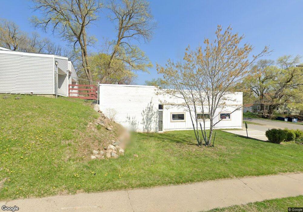
4411 SW 9th St Des Moines, IA 50315
Watrous Heights NeighborhoodEstimated Value: $236,596
--
Bed
1
Bath
3,096
Sq Ft
$76/Sq Ft
Est. Value
About This Home
This home is located at 4411 SW 9th St, Des Moines, IA 50315 and is currently estimated at $236,596, approximately $76 per square foot. 4411 SW 9th St is a home located in Polk County with nearby schools including South Union Elementary School, Brody Middle School, and Lincoln High School.
Ownership History
Date
Name
Owned For
Owner Type
Purchase Details
Closed on
Sep 20, 2019
Sold by
Mcconnaha Grant
Bought by
Papoose Properties Llc
Current Estimated Value
Purchase Details
Closed on
May 10, 2017
Sold by
Cochran Darrell
Bought by
Mcconnaha Grant
Purchase Details
Closed on
Jan 5, 2012
Sold by
Cooper Jeffery E and Cooper Nadine A
Bought by
Bayview Loan Servicing Llc
Purchase Details
Closed on
Oct 31, 2007
Sold by
Stuart Jack A and Stuart Mary J
Bought by
Cooper Jeffery E and Cooper Nadine A
Home Financials for this Owner
Home Financials are based on the most recent Mortgage that was taken out on this home.
Original Mortgage
$112,500
Interest Rate
6.38%
Mortgage Type
Commercial
Create a Home Valuation Report for This Property
The Home Valuation Report is an in-depth analysis detailing your home's value as well as a comparison with similar homes in the area
Home Values in the Area
Average Home Value in this Area
Purchase History
| Date | Buyer | Sale Price | Title Company |
|---|---|---|---|
| Papoose Properties Llc | $162,500 | None Available | |
| Mcconnaha Grant | $150,000 | None Available | |
| Bayview Loan Servicing Llc | $77,200 | None Available | |
| Cooper Jeffery E | $149,500 | None Available |
Source: Public Records
Mortgage History
| Date | Status | Borrower | Loan Amount |
|---|---|---|---|
| Previous Owner | Cooper Jeffery E | $112,500 |
Source: Public Records
Tax History Compared to Growth
Tax History
| Year | Tax Paid | Tax Assessment Tax Assessment Total Assessment is a certain percentage of the fair market value that is determined by local assessors to be the total taxable value of land and additions on the property. | Land | Improvement |
|---|---|---|---|---|
| 2025 | $6,526 | $268,000 | $110,000 | $158,000 |
| 2024 | $6,526 | $235,000 | $96,800 | $138,200 |
| 2023 | $5,640 | $235,000 | $96,800 | $138,200 |
| 2022 | $4,848 | $197,000 | $81,000 | $116,000 |
| 2021 | $3,828 | $197,000 | $81,000 | $116,000 |
| 2020 | $3,966 | $146,000 | $73,600 | $72,400 |
| 2019 | $6,100 | $146,000 | $73,600 | $72,400 |
| 2018 | $6,174 | $137,000 | $73,600 | $63,400 |
| 2017 | $3,664 | $137,000 | $73,600 | $63,400 |
| 2016 | $3,320 | $126,000 | $61,000 | $65,000 |
| 2015 | $3,320 | $126,000 | $61,000 | $65,000 |
| 2014 | $3,082 | $116,000 | $61,000 | $55,000 |
Source: Public Records
Map
Nearby Homes
- . Herold Ave
- 518 Maxwelton Dr
- 930 Emma Ave
- 612 Emma Ave
- 515 Emma Ave
- 936 Mckinley Ave Unit 14
- 1116 Herold Ave
- 1204 Elder Ln
- 1207 Emma Ave
- 1203 Herold Ave
- 304 Herold Ave
- 3903 SW 9th St
- 4108 SW 12th St
- 4020 SW 12th St
- 1219 Elder Ln
- 1223 Emma Ave
- 520 Hackley Ave
- 1229 Evans St
- 931 Rose Ave
- 1222 Watrous Ave
- 4407 SW 9th St
- 827 Maxwelton Dr
- 830 Maxwelton Dr
- 826 Maxwelton Dr
- 825 Maxwelton Dr
- 904 Lewis Ave
- 720 Maxwelton Dr
- 804 Philip St
- 713 Maxwelton Dr
- 910 Lewis Ave
- 903 Emma Ave
- 714 Maxwelton Dr
- 808 Philip St
- 907 Lewis Ave
- 909 Emma Ave
- 805 Philip St
- 802 Philip St
- 4306 SW 9th St
- 709 Maxwelton Dr
- 912 Lewis Ave