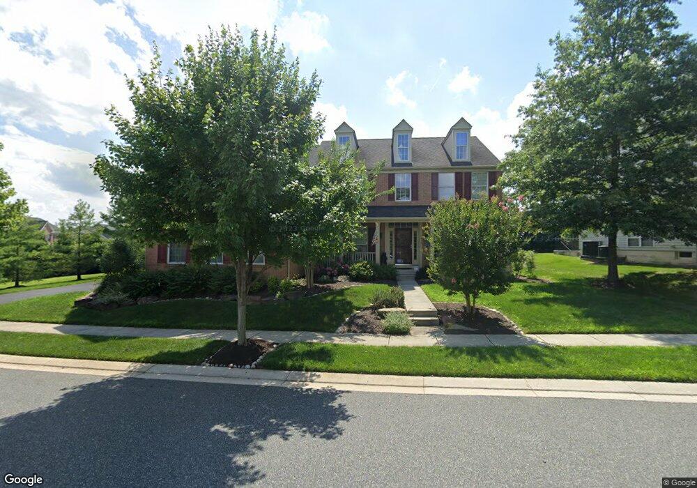
4412 Cross Brook Dr Perry Hall, MD 21128
Estimated Value: $760,000 - $897,000
--
Bed
4
Baths
3,690
Sq Ft
$218/Sq Ft
Est. Value
About This Home
This home is located at 4412 Cross Brook Dr, Perry Hall, MD 21128 and is currently estimated at $804,808, approximately $218 per square foot. 4412 Cross Brook Dr is a home located in Baltimore County with nearby schools including Honeygo Elementary School, Perry Hall Middle School, and Perry Hall High School.
Ownership History
Date
Name
Owned For
Owner Type
Purchase Details
Closed on
Sep 5, 2008
Sold by
Nvr Inc
Bought by
Green Dale D and Green Michelle P
Current Estimated Value
Home Financials for this Owner
Home Financials are based on the most recent Mortgage that was taken out on this home.
Original Mortgage
$417,000
Outstanding Balance
$275,765
Interest Rate
6.4%
Mortgage Type
Purchase Money Mortgage
Estimated Equity
$529,043
Purchase Details
Closed on
Aug 8, 2008
Sold by
Nvr Inc
Bought by
Green Dale D and Green Michelle P
Home Financials for this Owner
Home Financials are based on the most recent Mortgage that was taken out on this home.
Original Mortgage
$417,000
Outstanding Balance
$275,765
Interest Rate
6.4%
Mortgage Type
Purchase Money Mortgage
Estimated Equity
$529,043
Purchase Details
Closed on
May 8, 2008
Sold by
Cross Honeygo Llc
Bought by
Nvr Inc
Create a Home Valuation Report for This Property
The Home Valuation Report is an in-depth analysis detailing your home's value as well as a comparison with similar homes in the area
Home Values in the Area
Average Home Value in this Area
Purchase History
| Date | Buyer | Sale Price | Title Company |
|---|---|---|---|
| Green Dale D | $605,566 | -- | |
| Green Dale D | $605,566 | -- | |
| Nvr Inc | $225,000 | -- |
Source: Public Records
Mortgage History
| Date | Status | Borrower | Loan Amount |
|---|---|---|---|
| Open | Green Dale D | $417,000 | |
| Closed | Green Dale D | $417,000 |
Source: Public Records
Tax History Compared to Growth
Tax History
| Year | Tax Paid | Tax Assessment Tax Assessment Total Assessment is a certain percentage of the fair market value that is determined by local assessors to be the total taxable value of land and additions on the property. | Land | Improvement |
|---|---|---|---|---|
| 2025 | $8,034 | $671,600 | -- | -- |
| 2024 | $8,034 | $625,900 | $0 | $0 |
| 2023 | $3,798 | $580,200 | $140,800 | $439,400 |
| 2022 | $7,558 | $580,200 | $140,800 | $439,400 |
| 2021 | $7,901 | $580,200 | $140,800 | $439,400 |
| 2020 | $7,901 | $597,300 | $140,800 | $456,500 |
| 2019 | $7,616 | $587,400 | $0 | $0 |
| 2018 | $7,546 | $577,500 | $0 | $0 |
| 2017 | $7,207 | $567,600 | $0 | $0 |
| 2016 | $6,874 | $549,000 | $0 | $0 |
| 2015 | $6,874 | $530,400 | $0 | $0 |
| 2014 | $6,874 | $511,800 | $0 | $0 |
Source: Public Records
Map
Nearby Homes
- 4413 Pensel Rd
- 9506 Amberleigh Ln Unit A
- 9606 Amberleigh Ln Unit C
- 9608 Amberleigh Ln Unit R
- 4501 Talcott Terrace Unit Q
- 9601 Amberleigh Ln Unit F
- 9603 Amberleigh Ln
- 9603 Amberleigh Ln Unit H
- 9501 Kingscroft Terrace Unit K
- 4501 Dunton Terrace
- 9509 Kingscroft Terrace Unit F
- 4503 Dunton Terrace
- 9511 Kingscroft Terrace Unit A
- 4502 Dunton Terrace Unit 4502P
- 4502 Dunton Terrace Unit J
- 9602 Haven Farm Rd
- 4341 Chapel Rd
- 5012 Strawbridge Terrace
- 9809 Redwing Dr
- 9606 Haven Farm Rd Unit M
- 4410 Cross Brook Dr
- 4412 Pensel Rd
- 4410 Pensel Rd
- 4408 Cross Brook Dr
- 4408 Pensel Rd
- 4413 Cross Brook Dr
- 9431 Barnside Ct
- 4411 Cross Brook Dr
- 4406 Cross Brook Dr
- 4409 Cross Brook Dr
- 4406 Pensel Rd
- 4411 Pensel Rd
- 9429 Barnside Ct
- 9501 Robin Meadow Ct
- 4409 Pensel Rd
- 4404 Cross Brook Dr
- 9427 Barnside Ct
- 9503 Robin Meadow Ct
- 4314 Stoss Rd
- 4404 Pensel Rd