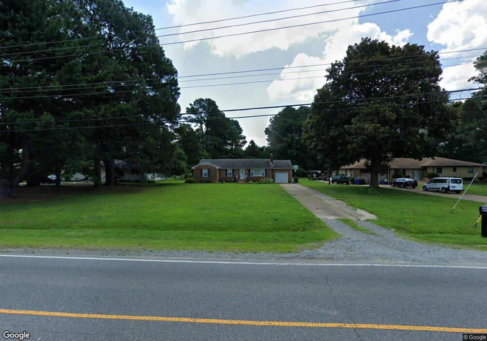
4413 Airline Blvd Chesapeake, VA 23321
Western Branch NeighborhoodEstimated Value: $307,000 - $339,034
3
Beds
3
Baths
1,515
Sq Ft
$214/Sq Ft
Est. Value
About This Home
This home is located at 4413 Airline Blvd, Chesapeake, VA 23321 and is currently estimated at $324,509, approximately $214 per square foot. 4413 Airline Blvd is a home located in Chesapeake City with nearby schools including Southwestern Elementary School, Jolliff Middle School, and Western Branch High School.
Ownership History
Date
Name
Owned For
Owner Type
Purchase Details
Closed on
Jun 10, 2010
Sold by
Hm4 Llc
Bought by
Wilson Alyson L
Current Estimated Value
Home Financials for this Owner
Home Financials are based on the most recent Mortgage that was taken out on this home.
Original Mortgage
$172,800
Outstanding Balance
$116,604
Interest Rate
5.11%
Mortgage Type
New Conventional
Estimated Equity
$207,905
Create a Home Valuation Report for This Property
The Home Valuation Report is an in-depth analysis detailing your home's value as well as a comparison with similar homes in the area
Home Values in the Area
Average Home Value in this Area
Purchase History
| Date | Buyer | Sale Price | Title Company |
|---|---|---|---|
| Wilson Alyson L | $172,800 | -- |
Source: Public Records
Mortgage History
| Date | Status | Borrower | Loan Amount |
|---|---|---|---|
| Open | Wilson Alyson L | $172,800 |
Source: Public Records
Tax History Compared to Growth
Tax History
| Year | Tax Paid | Tax Assessment Tax Assessment Total Assessment is a certain percentage of the fair market value that is determined by local assessors to be the total taxable value of land and additions on the property. | Land | Improvement |
|---|---|---|---|---|
| 2025 | $2,887 | $305,300 | $135,000 | $170,300 |
| 2024 | $2,887 | $285,800 | $125,000 | $160,800 |
| 2023 | $2,457 | $273,400 | $125,000 | $148,400 |
| 2022 | $2,473 | $244,900 | $110,000 | $134,900 |
| 2021 | $2,118 | $201,700 | $78,800 | $122,900 |
| 2020 | $2,107 | $200,700 | $78,800 | $121,900 |
| 2019 | $2,071 | $197,200 | $78,800 | $118,400 |
| 2018 | $2,034 | $186,900 | $80,000 | $106,900 |
| 2017 | $1,962 | $186,900 | $80,000 | $106,900 |
| 2016 | $1,962 | $186,900 | $80,000 | $106,900 |
| 2015 | $1,962 | $186,900 | $80,000 | $106,900 |
| 2014 | $1,962 | $186,900 | $80,000 | $106,900 |
Source: Public Records
Map
Nearby Homes
- 1408 Ashton St
- 4052 Sunkist Rd
- 0.4AC Flintfield Crescent
- 904 Flintfield Crescent
- 1543 Burrowin Dr
- 1630 Dock Landing Rd
- 4235 Meander Way
- 4195 Taughtline Loop
- 4021 Holly Cove Dr
- 4132 Taughtline Loop
- 4305 Mast Head Way
- 4183 Taughtline Loop
- 4308 Center Mast Crest
- 3931 Port Rd
- 3721 Bay Crescent
- 4232 Schooner Trail
- 4044 River Breeze Cir
- 3861 Ahoy Dr
- 3973 Grand Isle Dr
- 1704 Rowlock Ct
- 4417 Airline Blvd
- 4409 Airline Blvd
- 4421 Airline Blvd
- 4405 Airline Blvd
- 4425 Airline Blvd
- 4401 Airline Blvd
- 4420 Airline Blvd
- 1344 Sunnybrook Terrace
- 3902 Spring Meadow Crescent
- 4410 Airline Blvd
- 1340 Sunnybrook Terrace
- 3904 Spring Meadow Crescent
- 3900 Spring Meadow Crescent
- 1305 Riddick St
- 1341 Goodman St
- 1400 Ashton St
- 4429 Airline Blvd
- 1401 Riddick St
- 1402 Ashton St
- 3906 Spring Meadow Crescent