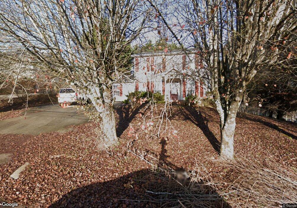
4413 Raj Rd Knoxville, TN 37921
West Knoxville NeighborhoodEstimated Value: $398,697 - $455,000
3
Beds
4
Baths
2,078
Sq Ft
$204/Sq Ft
Est. Value
About This Home
This home is located at 4413 Raj Rd, Knoxville, TN 37921 and is currently estimated at $422,924, approximately $203 per square foot. 4413 Raj Rd is a home located in Knox County with nearby schools including Amherst Elementary School, Northwest Middle School, and Karns High School.
Ownership History
Date
Name
Owned For
Owner Type
Purchase Details
Closed on
Jan 4, 2007
Sold by
Mynatt Joseph C and Mynatt Barbara B
Bought by
Branham Jimmie R and Branham Martha K
Current Estimated Value
Home Financials for this Owner
Home Financials are based on the most recent Mortgage that was taken out on this home.
Original Mortgage
$218,500
Outstanding Balance
$129,409
Interest Rate
6.05%
Mortgage Type
Purchase Money Mortgage
Estimated Equity
$293,515
Purchase Details
Closed on
Mar 19, 1999
Sold by
Darnbush Darrell D and Darnbush Margaret C
Bought by
Mynatt Joseph C and Mynatt Barbara B
Home Financials for this Owner
Home Financials are based on the most recent Mortgage that was taken out on this home.
Original Mortgage
$98,949
Interest Rate
6.74%
Mortgage Type
FHA
Purchase Details
Closed on
Nov 21, 1994
Sold by
Breeden Kimberly D
Bought by
Darnbush Darrell D
Create a Home Valuation Report for This Property
The Home Valuation Report is an in-depth analysis detailing your home's value as well as a comparison with similar homes in the area
Home Values in the Area
Average Home Value in this Area
Purchase History
| Date | Buyer | Sale Price | Title Company |
|---|---|---|---|
| Branham Jimmie R | $159,900 | None Available | |
| Mynatt Joseph C | $99,000 | Abstract Title Company | |
| Darnbush Darrell D | $88,900 | -- |
Source: Public Records
Mortgage History
| Date | Status | Borrower | Loan Amount |
|---|---|---|---|
| Open | Branham Jimmie R | $218,500 | |
| Previous Owner | Mynatt Joseph C | $98,949 |
Source: Public Records
Tax History Compared to Growth
Tax History
| Year | Tax Paid | Tax Assessment Tax Assessment Total Assessment is a certain percentage of the fair market value that is determined by local assessors to be the total taxable value of land and additions on the property. | Land | Improvement |
|---|---|---|---|---|
| 2024 | $993 | $63,925 | $0 | $0 |
| 2023 | $993 | $63,925 | $0 | $0 |
| 2022 | $993 | $63,925 | $0 | $0 |
| 2021 | $961 | $45,325 | $0 | $0 |
| 2020 | $961 | $45,325 | $0 | $0 |
| 2019 | $961 | $45,325 | $0 | $0 |
| 2018 | $961 | $45,325 | $0 | $0 |
| 2017 | $961 | $45,325 | $0 | $0 |
| 2016 | $965 | $0 | $0 | $0 |
| 2015 | $965 | $0 | $0 | $0 |
| 2014 | $965 | $0 | $0 | $0 |
Source: Public Records
Map
Nearby Homes
- 2823 Sood Rd
- 4433 Balraj Ln
- 2834 Barnard Rd
- 2620 Woods Smith Rd
- 6212 Handley Ln
- 6400 Mill Creek Ln Unit 3
- 6416 Trousdale Rd
- 6417 Trousdale Rd NW
- 2308 Woods Smith Rd
- 5812 Rockwood Ln
- 4304 Schaad Rd
- 5704 Wooded Acres Dr
- 6702 Albatross Ln
- 5812 Wexford Ln
- 6409 Shrewsbury Dr NW
- 6008 Autumn Oaks Ln
- 6721 Ellesmere Dr NW
- 5910 Autumn Oaks Ln
- 6420 Cadbury Dr NW
- 6905 Ellesmere Dr