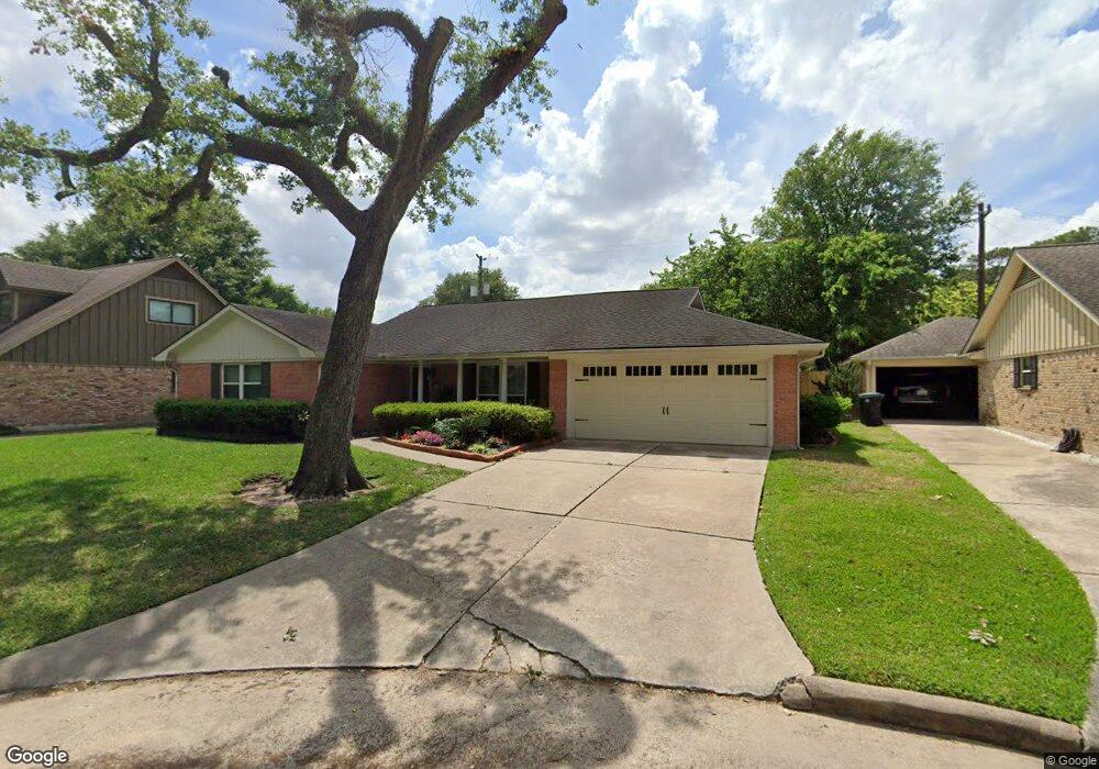
4415 Sumner Dr Houston, TX 77018
Oak Forest-Garden Oaks NeighborhoodEstimated Value: $519,634 - $683,000
3
Beds
2
Baths
2,174
Sq Ft
$274/Sq Ft
Est. Value
About This Home
This home is located at 4415 Sumner Dr, Houston, TX 77018 and is currently estimated at $595,659, approximately $273 per square foot. 4415 Sumner Dr is a home located in Harris County with nearby schools including Stevens Elementary School, Frank Black Middle School, and Waltrip High School.
Ownership History
Date
Name
Owned For
Owner Type
Purchase Details
Closed on
Jan 6, 1994
Sold by
Newcomb John Michael
Bought by
Dejohn Vincent J and Dejohn Sylvia A
Current Estimated Value
Home Financials for this Owner
Home Financials are based on the most recent Mortgage that was taken out on this home.
Original Mortgage
$116,850
Interest Rate
7.29%
Create a Home Valuation Report for This Property
The Home Valuation Report is an in-depth analysis detailing your home's value as well as a comparison with similar homes in the area
Home Values in the Area
Average Home Value in this Area
Purchase History
| Date | Buyer | Sale Price | Title Company |
|---|---|---|---|
| Dejohn Vincent J | -- | Regency Title Company |
Source: Public Records
Mortgage History
| Date | Status | Borrower | Loan Amount |
|---|---|---|---|
| Closed | Dejohn Vincent J | $116,850 |
Source: Public Records
Tax History
| Year | Tax Paid | Tax Assessment Tax Assessment Total Assessment is a certain percentage of the fair market value that is determined by local assessors to be the total taxable value of land and additions on the property. | Land | Improvement |
|---|---|---|---|---|
| 2025 | $4,033 | $456,549 | $327,238 | $129,311 |
| 2024 | $4,033 | $527,537 | $278,500 | $249,037 |
| 2023 | $4,033 | $505,363 | $278,500 | $226,863 |
| 2022 | $10,391 | $493,000 | $243,688 | $249,312 |
| 2021 | $9,999 | $429,000 | $243,688 | $185,312 |
| 2020 | $10,268 | $424,000 | $243,688 | $180,312 |
| 2019 | $10,414 | $411,568 | $243,688 | $167,880 |
| 2018 | $7,415 | $379,316 | $208,875 | $170,441 |
| 2017 | $9,721 | $416,500 | $208,875 | $207,625 |
| 2016 | $8,837 | $420,000 | $208,875 | $211,125 |
| 2015 | $5,791 | $374,000 | $208,875 | $165,125 |
| 2014 | $5,791 | $333,400 | $174,063 | $159,337 |
Source: Public Records
Map
Nearby Homes
- 1843 Candlelight Place Dr
- 1850 Viking Dr
- 1914 Viking Dr
- 4032 Delta Rose St
- 4027 Starbright St
- 1902 De Milo Dr
- 3919 Pinemont Dr
- 1802 Del Norte St Unit C
- 1804 Del Norte St Unit D
- 1802 Del Norte St Unit B
- 3913 Pinemont Dr
- 4402 Fallbrook Dr
- 2023 Viking Dr
- 5128 Rosslyn Rd
- 5132 Rosslyn Rd
- 5142 Rosslyn Rd
- 2038 Viking Dr
- 1623 Latexo Dr
- Lot 21 & 22 Creekmont Dr
- 1735 W 43rd St
- 4411 Sumner Dr
- 4419 Sumner Dr
- 4410 Lavell Dr
- 4407 Sumner Dr
- 4418 Lavell Dr
- 4414 Sumner Dr
- 4406 Lavell Dr
- 4410 Sumner Dr
- 4402 Lavell Dr
- 4406 Sumner Dr
- 4415 Lavell Dr
- 1839 Candlelight Place Dr
- 4415 Lorinda Dr
- 4411 Lavell Dr
- 4419 Lavell Dr
- 4402 Sumner Dr
- 4411 Lorinda Dr
- 4419 Lorinda Dr
- 4407 Lavell Dr
- 1835 Candlelight Place Dr
Your Personal Tour Guide
Ask me questions while you tour the home.