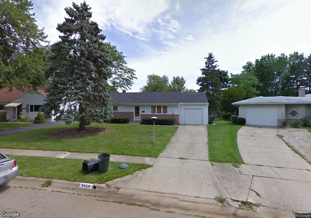
4416 Densmore Rd Columbus, OH 43224
Clinton Estates NeighborhoodEstimated Value: $232,000 - $300,000
2
Beds
2
Baths
1,560
Sq Ft
$172/Sq Ft
Est. Value
About This Home
This home is located at 4416 Densmore Rd, Columbus, OH 43224 and is currently estimated at $268,545, approximately $172 per square foot. 4416 Densmore Rd is a home located in Franklin County with nearby schools including Maize Road Elementary School, Medina Middle School, and Mifflin High School.
Ownership History
Date
Name
Owned For
Owner Type
Purchase Details
Closed on
Jun 16, 2020
Sold by
Farkas Michael J and Farkas Shannon
Bought by
Farkas Michael J
Current Estimated Value
Home Financials for this Owner
Home Financials are based on the most recent Mortgage that was taken out on this home.
Original Mortgage
$64,495
Interest Rate
3.1%
Mortgage Type
FHA
Purchase Details
Closed on
Sep 23, 2003
Sold by
Dambrans Juris and Dambrans Verena
Bought by
Farkas Michael J and Chafin Erika E
Home Financials for this Owner
Home Financials are based on the most recent Mortgage that was taken out on this home.
Original Mortgage
$96,222
Interest Rate
6.43%
Mortgage Type
FHA
Create a Home Valuation Report for This Property
The Home Valuation Report is an in-depth analysis detailing your home's value as well as a comparison with similar homes in the area
Home Values in the Area
Average Home Value in this Area
Purchase History
| Date | Buyer | Sale Price | Title Company |
|---|---|---|---|
| Farkas Michael J | -- | Vylla Title Llc | |
| Farkas Michael J | $97,000 | -- |
Source: Public Records
Mortgage History
| Date | Status | Borrower | Loan Amount |
|---|---|---|---|
| Closed | Farkas Michael J | $64,495 | |
| Closed | Farkas Michael J | $96,222 |
Source: Public Records
Tax History Compared to Growth
Tax History
| Year | Tax Paid | Tax Assessment Tax Assessment Total Assessment is a certain percentage of the fair market value that is determined by local assessors to be the total taxable value of land and additions on the property. | Land | Improvement |
|---|---|---|---|---|
| 2024 | $3,274 | $72,950 | $21,040 | $51,910 |
| 2023 | $3,232 | $72,940 | $21,035 | $51,905 |
| 2022 | $2,217 | $42,740 | $9,140 | $33,600 |
| 2021 | $2,221 | $42,740 | $9,140 | $33,600 |
| 2020 | $2,224 | $42,740 | $9,140 | $33,600 |
| 2019 | $2,047 | $33,750 | $7,320 | $26,430 |
| 2018 | $2,065 | $33,750 | $7,320 | $26,430 |
| 2017 | $2,172 | $33,750 | $7,320 | $26,430 |
| 2016 | $2,298 | $34,690 | $7,110 | $27,580 |
| 2015 | $2,086 | $34,690 | $7,110 | $27,580 |
| 2014 | $2,091 | $34,690 | $7,110 | $27,580 |
| 2013 | $1,086 | $36,505 | $7,490 | $29,015 |
Source: Public Records
Map
Nearby Homes
- 4455 Kenfield Rd
- 4143 Karl Rd Unit 314
- 4145 Karl Rd Unit 223
- 4119 Karl Rd Unit 108
- 1266 Pershing Dr
- 1191 Bryson Rd
- 4761 Colonel Perry Dr
- 4441 Wetmore Rd E
- 4057 Estates Place
- 1130 Carbone Dr
- 3967 Karl Rd Unit 125
- 3965 Karl Rd Unit 208
- 4791 Bourke Rd
- 4800 Bourke Rd
- 3941 Karl Rd Unit 326
- 3939 Karl Rd Unit 108
- 4815 Bourke Rd
- 4816 Bourke Rd
- 1734 Ferris Rd
- 1071 Loring Rd
- 4424 Densmore Rd
- 1458 Fowler Dr
- 4425 Kenfield Rd
- 4415 Kenfield Rd
- 4431 Kenfield Rd
- 4432 Densmore Rd
- 4407 Kenfield Rd
- 4439 Kenfield Rd
- 1474 Fowler Dr
- 1436 Fowler Dr
- 4423 Densmore Rd
- 4440 Densmore Rd
- 4447 Kenfield Rd
- 1447 Fowler Dr
- 1455 Fowler Dr
- 4431 Densmore Rd
- 1439 Fowler Dr
- 1463 Fowler Dr
- 4448 Densmore Rd
- 1431 Fowler Dr