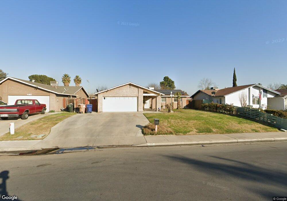
4416 Lantados St Unit B Bakersfield, CA 93307
Rexland Acres NeighborhoodEstimated Value: $302,904 - $335,000
3
Beds
2
Baths
1,248
Sq Ft
$256/Sq Ft
Est. Value
About This Home
This home is located at 4416 Lantados St Unit B, Bakersfield, CA 93307 and is currently estimated at $319,226, approximately $255 per square foot. 4416 Lantados St Unit B is a home located in Kern County with nearby schools including Leo G. Pauly Elementary School, Sequoia Middle School, and South High School.
Ownership History
Date
Name
Owned For
Owner Type
Purchase Details
Closed on
Jun 28, 2024
Sold by
Zavala Huerta Jose
Bought by
Zavala Family Trust and Huerta
Current Estimated Value
Purchase Details
Closed on
May 14, 2002
Sold by
Zavala Raquel Rubio
Bought by
Huerta Jose Zavala
Home Financials for this Owner
Home Financials are based on the most recent Mortgage that was taken out on this home.
Original Mortgage
$71,992
Interest Rate
6.94%
Purchase Details
Closed on
May 1, 2002
Sold by
Gonzalez Domingo H and Gonzalez San Juana H
Bought by
Huerta Jose Zavala
Home Financials for this Owner
Home Financials are based on the most recent Mortgage that was taken out on this home.
Original Mortgage
$71,992
Interest Rate
6.94%
Create a Home Valuation Report for This Property
The Home Valuation Report is an in-depth analysis detailing your home's value as well as a comparison with similar homes in the area
Home Values in the Area
Average Home Value in this Area
Purchase History
| Date | Buyer | Sale Price | Title Company |
|---|---|---|---|
| Zavala Family Trust | -- | None Listed On Document | |
| Huerta Jose Zavala | -- | Stewart Title Of Ca Inc | |
| Huerta Jose Zavala | $90,000 | Stewart Title Of Ca Inc |
Source: Public Records
Mortgage History
| Date | Status | Borrower | Loan Amount |
|---|---|---|---|
| Previous Owner | Huerta Jose Zavala | $71,992 |
Source: Public Records
Tax History Compared to Growth
Tax History
| Year | Tax Paid | Tax Assessment Tax Assessment Total Assessment is a certain percentage of the fair market value that is determined by local assessors to be the total taxable value of land and additions on the property. | Land | Improvement |
|---|---|---|---|---|
| 2025 | $2,158 | $132,918 | $29,533 | $103,385 |
| 2024 | $2,158 | $130,312 | $28,954 | $101,358 |
| 2023 | $2,107 | $127,758 | $28,387 | $99,371 |
| 2022 | $2,050 | $125,254 | $27,831 | $97,423 |
| 2021 | $1,944 | $122,799 | $27,286 | $95,513 |
| 2020 | $1,907 | $121,541 | $27,007 | $94,534 |
| 2019 | $1,869 | $121,541 | $27,007 | $94,534 |
| 2018 | $1,826 | $116,823 | $25,959 | $90,864 |
| 2017 | $1,813 | $114,533 | $25,450 | $89,083 |
| 2016 | $1,673 | $112,288 | $24,951 | $87,337 |
| 2015 | $1,660 | $110,603 | $24,577 | $86,026 |
| 2014 | $1,605 | $108,437 | $24,096 | $84,341 |
Source: Public Records
Map
Nearby Homes
- 4600 Lantados St
- 4300 Kenny St
- 4519 Vern St
- 4205 Lantados St
- 4404 Brunswick St
- 4208 Santa Cruz St
- 4508 Axminster St
- 609 White Ln
- 904 San Vicente Dr
- 4209 Alexander St
- 3905 Fambrough Dr
- 499 Pacheco Rd Unit 155
- 499 Pacheco Rd Unit 255
- 499 Pacheco Rd Unit 126
- 499 Pacheco Rd Unit 214
- 3809 Edith Ln
- 1320 White Ln
- 1328 Malerbi Ct
- 4908 Jonah St
- 1404 Ivan Ave
- 4412 Lantados St
- 4500 Lantados St
- 616 Joe Ave
- 4505 Barry St
- 4501 Barry St Unit B
- 801 Calcutta Dr
- 612 Joe Ave
- 4417 Lantados St Unit B
- 4408 Lantados St Unit B
- 4508 Lantados St
- 4317 Deborah Ave
- 4413 Lantados St
- 4509 Barry St
- 4500 Barry St Unit B
- 800 Banjo Ct
- 805 Calcutta Dr
- 4409 Lantados St
- 4512 Lantados St
- 4404 Lantados St
- 4313 Deborah Ave