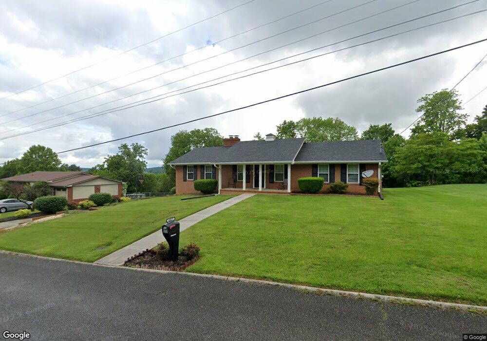
4417 Brockland Dr Morristown, TN 37813
Estimated Value: $233,503 - $326,000
--
Bed
1
Bath
1,620
Sq Ft
$178/Sq Ft
Est. Value
About This Home
This home is located at 4417 Brockland Dr, Morristown, TN 37813 and is currently estimated at $288,626, approximately $178 per square foot. 4417 Brockland Dr is a home located in Hamblen County with nearby schools including John Hay Elementary School, Meadowview Middle School, and Morristown East High School.
Ownership History
Date
Name
Owned For
Owner Type
Purchase Details
Closed on
Oct 11, 2000
Sold by
Logan Todd A
Bought by
Hoard Darryl K
Current Estimated Value
Purchase Details
Closed on
Jan 23, 1998
Bought by
Logan Todd A
Purchase Details
Closed on
Mar 8, 1996
Sold by
Logan Todd A and Logan Kathy
Bought by
Logan Todd A
Purchase Details
Closed on
Mar 7, 1996
Bought by
Logan Todd A and Logan Kathy
Purchase Details
Closed on
May 1, 1972
Bought by
Holtsinger Gilbert and Holtsinger Shirley
Create a Home Valuation Report for This Property
The Home Valuation Report is an in-depth analysis detailing your home's value as well as a comparison with similar homes in the area
Home Values in the Area
Average Home Value in this Area
Purchase History
| Date | Buyer | Sale Price | Title Company |
|---|---|---|---|
| Hoard Darryl K | $143,000 | -- | |
| Logan Todd A | -- | -- | |
| Logan Todd A | $90,000 | -- | |
| Logan Todd A | $90,000 | -- | |
| Holtsinger Gilbert | -- | -- |
Source: Public Records
Tax History Compared to Growth
Tax History
| Year | Tax Paid | Tax Assessment Tax Assessment Total Assessment is a certain percentage of the fair market value that is determined by local assessors to be the total taxable value of land and additions on the property. | Land | Improvement |
|---|---|---|---|---|
| 2024 | $767 | $38,925 | $5,775 | $33,150 |
| 2023 | $767 | $38,925 | $0 | $0 |
| 2022 | $767 | $38,925 | $5,775 | $33,150 |
| 2021 | $767 | $38,925 | $5,775 | $33,150 |
| 2020 | $767 | $38,925 | $5,775 | $33,150 |
| 2019 | $714 | $33,525 | $5,875 | $27,650 |
| 2018 | $714 | $33,525 | $5,875 | $27,650 |
| 2017 | $714 | $33,525 | $5,875 | $27,650 |
| 2016 | $667 | $33,525 | $5,875 | $27,650 |
| 2015 | $620 | $33,525 | $5,875 | $27,650 |
| 2014 | -- | $33,525 | $5,875 | $27,650 |
| 2013 | -- | $35,450 | $0 | $0 |
Source: Public Records
Map
Nearby Homes
- 4458 Brockland Dr
- 4270 Brockland Dr
- 576 Jones-Franklin Rd
- 4705 E Hampton Blvd
- 670 Jones Franklin Rd
- 4581 Lockley Ct
- 288 Fuller Estate Cir
- 4907 Barton Springs Dr
- 1148 George Byrd Rd
- 3661 Halifax Cir
- 1342 Slop Creek Rd
- 1689 Carroll Rd
- 00 Shinbone E Sugar Hollow Rd
- 4027 White Wood Cir
- 1496 Dover Rd
- 4271 Stansberry Rd
- 1134 Shannons Little Mountain Rd
- 1744 Carroll Rd
- 5085 Old Kentucky Rd
- 4427 Brockland Dr
- 4418 Brockland Dr
- 4428 Brockland Dr
- 4407 Brockland Dr
- 4437 Brockland Dr
- 4408 Brockland Dr
- 4448 Brockland Dr
- 4405 Brockwood Dr
- 4397 Brockland Dr
- 4415 Brockwood Dr
- 4398 Brockland Dr
- 4447 Brockland Dr
- 4525 Brockland Dr
- 4395 Brockwood Dr
- 4457 Brockland Dr
- 4442 Whitecliff St
- 4435 Brockwood Dr
- 4387 Brockland Dr
- 4388 Brockland Dr
- 4385 Brockwood Dr