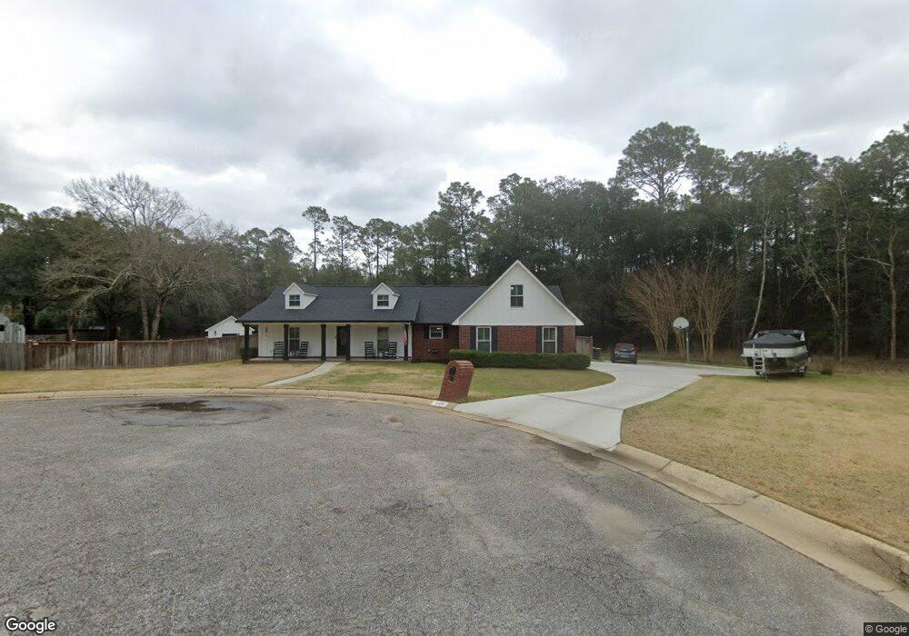
4419 Cedarbrook Cir Pensacola, FL 32526
Beulah NeighborhoodEstimated Value: $339,804 - $419,000
--
Bed
2
Baths
2,110
Sq Ft
$173/Sq Ft
Est. Value
About This Home
This home is located at 4419 Cedarbrook Cir, Pensacola, FL 32526 and is currently estimated at $364,451, approximately $172 per square foot. 4419 Cedarbrook Cir is a home located in Escambia County with nearby schools including Beulah Elementary School, Beulah Middle School, and Pine Forest High School.
Ownership History
Date
Name
Owned For
Owner Type
Purchase Details
Closed on
Jun 30, 2011
Sold by
Rawls William R and Rawls Debra C
Bought by
Rawls Weston R and Rawls Misty L
Current Estimated Value
Home Financials for this Owner
Home Financials are based on the most recent Mortgage that was taken out on this home.
Original Mortgage
$140,000
Outstanding Balance
$96,860
Interest Rate
4.63%
Mortgage Type
New Conventional
Estimated Equity
$267,591
Create a Home Valuation Report for This Property
The Home Valuation Report is an in-depth analysis detailing your home's value as well as a comparison with similar homes in the area
Home Values in the Area
Average Home Value in this Area
Purchase History
| Date | Buyer | Sale Price | Title Company |
|---|---|---|---|
| Rawls Weston R | $175,000 | None Available |
Source: Public Records
Mortgage History
| Date | Status | Borrower | Loan Amount |
|---|---|---|---|
| Open | Rawls Weston R | $140,000 |
Source: Public Records
Tax History Compared to Growth
Tax History
| Year | Tax Paid | Tax Assessment Tax Assessment Total Assessment is a certain percentage of the fair market value that is determined by local assessors to be the total taxable value of land and additions on the property. | Land | Improvement |
|---|---|---|---|---|
| 2024 | $1,909 | $180,020 | -- | -- |
| 2023 | $1,909 | $174,777 | $0 | $0 |
| 2022 | $1,861 | $169,687 | $0 | $0 |
| 2021 | $1,856 | $164,745 | $0 | $0 |
| 2020 | $1,805 | $162,471 | $0 | $0 |
| 2019 | $1,771 | $158,819 | $0 | $0 |
| 2018 | $1,768 | $155,858 | $0 | $0 |
| 2017 | $1,762 | $152,653 | $0 | $0 |
| 2016 | $1,747 | $149,514 | $0 | $0 |
| 2015 | $1,736 | $148,475 | $0 | $0 |
| 2014 | $1,730 | $147,297 | $0 | $0 |
Source: Public Records
Map
Nearby Homes
- 7631 Klondike Rd
- 3247 Keegun Loop
- 3343 Keegun Loop
- 3152 Camphor Rd Unit 22 (lot )
- 3139 Camphor Rd Unit 5 (lot )
- 3156 Camphor Rd Unit 23 (lot )
- 3156 Camphor Rd
- 3144 Camphor Rd Unit 20 (lot )
- 3147 Camphor Rd Unit 3 (lot )
- 7950 Klondike Rd Unit 25 (lot )
- 7950 Klondike Rd
- 8210 Klondike Rd Unit LOT 2
- 2083 Juno Cir
- 8042 Mossy Creek
- 7300 Glidden Ln
- 7416 Dunwalt Rd
- 4630 Deerfield Dr
- 5053 Quarter Deck St
- 6646 Boatswain Rd
- 4526 Deerfield Dr
- 4427 Cedarbrook Cir
- 4420 Cedarbrook Dr
- 0 Cedarbrook Dr
- 4416 Cedarbrook Dr
- 4401 Cedarbrook Dr
- 4428 Cedarbrook Ct
- 0 Cedarbrook Cir
- 4447 Cedarbrook Dr
- 4412 Cedarbrook Dr
- 3404 Holt Cir
- 3408 Holt Cir
- 4425 Cedarbrook Cir
- 4432 Cedarbrook Ct
- 3400 Holt Cir
- 4409 Cedarbrook Dr
- 3412 Holt Cir
- 3396 Holt Cir
- 4435 Cedarbrook Dr
- 0 Cedarbrook Ct
- 3416 Holt Cir