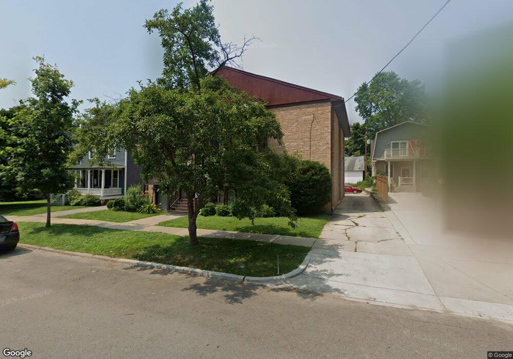
442 3rd St Ann Arbor, MI 48103
Old West Side NeighborhoodEstimated Value: $1,514,652
2
Beds
1
Bath
--
Sq Ft
8,712
Sq Ft Lot
About This Home
This home is located at 442 3rd St, Ann Arbor, MI 48103 and is currently estimated at $1,514,652. 442 3rd St is a home located in Washtenaw County with nearby schools including Bach Elementary School, Slauson Middle School, and Pioneer High School.
Ownership History
Date
Name
Owned For
Owner Type
Purchase Details
Closed on
Oct 3, 2013
Sold by
Hoag Paul F
Bought by
Cabrio On Third Llc
Current Estimated Value
Home Financials for this Owner
Home Financials are based on the most recent Mortgage that was taken out on this home.
Original Mortgage
$565,000
Outstanding Balance
$424,554
Interest Rate
4.5%
Mortgage Type
Future Advance Clause Open End Mortgage
Estimated Equity
$1,090,098
Purchase Details
Closed on
Jan 12, 2009
Sold by
Hoag Paul F
Bought by
Hoag Paul F
Purchase Details
Closed on
Sep 4, 2008
Sold by
Hoag Paul F and Hoag Bok Soon
Bought by
Hoag Bok Soon
Purchase Details
Closed on
Mar 2, 2000
Sold by
Botsford Alice M
Bought by
Hoag Paul F
Create a Home Valuation Report for This Property
The Home Valuation Report is an in-depth analysis detailing your home's value as well as a comparison with similar homes in the area
Home Values in the Area
Average Home Value in this Area
Purchase History
| Date | Buyer | Sale Price | Title Company |
|---|---|---|---|
| Cabrio On Third Llc | $750,000 | None Available | |
| Hoag Paul F | -- | None Available | |
| Hoag Bok Soon | -- | None Available | |
| Hoag Paul F | $150,000 | -- |
Source: Public Records
Mortgage History
| Date | Status | Borrower | Loan Amount |
|---|---|---|---|
| Open | Cabrio On Third Llc | $565,000 |
Source: Public Records
Tax History
| Year | Tax Paid | Tax Assessment Tax Assessment Total Assessment is a certain percentage of the fair market value that is determined by local assessors to be the total taxable value of land and additions on the property. | Land | Improvement |
|---|---|---|---|---|
| 2025 | $22,937 | $641,400 | $0 | $0 |
| 2024 | $22,308 | $604,500 | $0 | $0 |
| 2023 | $20,599 | $588,100 | $0 | $0 |
| 2022 | $24,931 | $535,700 | $0 | $0 |
| 2021 | $24,227 | $495,600 | $0 | $0 |
| 2020 | $23,465 | $487,300 | $0 | $0 |
| 2019 | $22,382 | $456,300 | $456,300 | $0 |
| 2018 | $21,959 | $419,600 | $0 | $0 |
| 2017 | $21,184 | $390,800 | $0 | $0 |
| 2016 | $16,483 | $333,597 | $0 | $0 |
| 2015 | $20,913 | $332,600 | $0 | $0 |
| 2014 | $20,913 | $306,483 | $0 | $0 |
| 2013 | -- | $306,483 | $0 | $0 |
Source: Public Records
Map
Nearby Homes
- 315 2nd St Unit 513
- 717 W Liberty St
- 404 W Liberty St
- 441 S Ashley St Unit 405
- 140 Ashley Mews Dr Unit 27
- 814 W Jefferson St
- 414 S Main St Unit 10
- 101 W Liberty St Unit 310
- 220 W Mosley St
- 614 S 7th St
- 111 N Ashley St Unit 513
- 322 E Liberty St Unit 16 & 17
- 222 Buena Vista Ave
- 212 Miller Ave Unit 203
- 212 Miller Ave Unit 301
- 410 N 1st St Unit 302
- 223 E Ann St Unit 6
- 217 N 5th Ave
- 911 S Main St
- 1405 W Liberty St
Your Personal Tour Guide
Ask me questions while you tour the home.