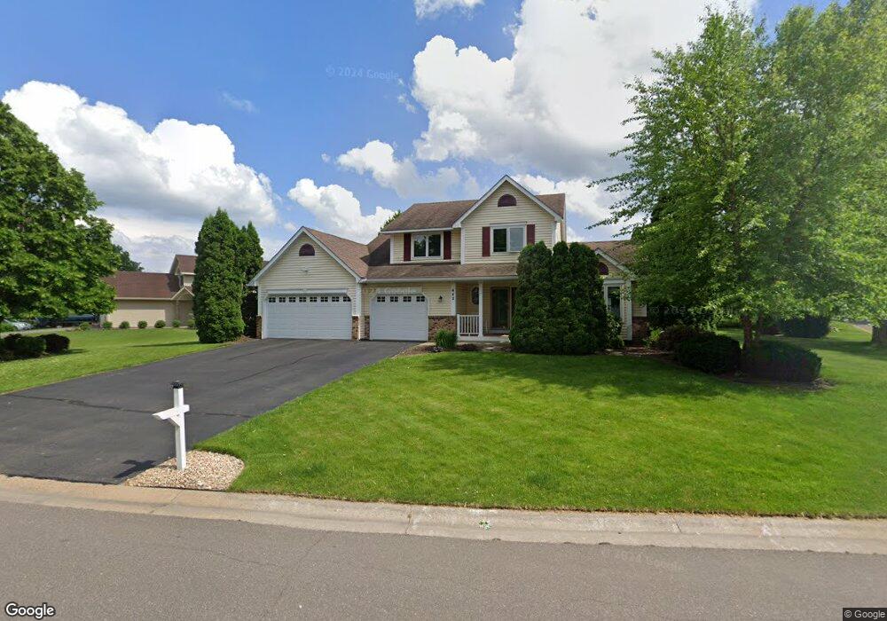
442 Hawthorn Rd Circle Pines, MN 55014
Estimated Value: $485,822 - $529,000
4
Beds
4
Baths
2,056
Sq Ft
$244/Sq Ft
Est. Value
About This Home
This home is located at 442 Hawthorn Rd, Circle Pines, MN 55014 and is currently estimated at $502,206, approximately $244 per square foot. 442 Hawthorn Rd is a home located in Anoka County with nearby schools including Rice Lake Elementary School, Centennial Middle School, and Centennial High School.
Ownership History
Date
Name
Owned For
Owner Type
Purchase Details
Closed on
Apr 9, 2019
Sold by
Wenda Keith T and Smith Michelle M
Bought by
Wenda Keith T and Jlt Michelle M
Current Estimated Value
Purchase Details
Closed on
Sep 2, 1997
Sold by
Rodriguez Frank P and Rodriguez Jacqueline M
Bought by
Wenda Keith T
Purchase Details
Closed on
Dec 23, 1996
Sold by
Garner David C and Garner Joette M
Bought by
Rodriquez Frank P and Rodriquez Jacqueline M
Create a Home Valuation Report for This Property
The Home Valuation Report is an in-depth analysis detailing your home's value as well as a comparison with similar homes in the area
Home Values in the Area
Average Home Value in this Area
Purchase History
| Date | Buyer | Sale Price | Title Company |
|---|---|---|---|
| Wenda Keith T | -- | None Available | |
| Wenda Keith T | $187,000 | -- | |
| Rodriquez Frank P | $183,700 | -- |
Source: Public Records
Tax History Compared to Growth
Tax History
| Year | Tax Paid | Tax Assessment Tax Assessment Total Assessment is a certain percentage of the fair market value that is determined by local assessors to be the total taxable value of land and additions on the property. | Land | Improvement |
|---|---|---|---|---|
| 2025 | $5,531 | $469,800 | $120,000 | $349,800 |
| 2024 | $5,531 | $465,100 | $113,800 | $351,300 |
| 2023 | $5,150 | $469,400 | $113,800 | $355,600 |
| 2022 | $4,843 | $464,900 | $102,500 | $362,400 |
| 2021 | $4,784 | $376,800 | $78,000 | $298,800 |
| 2020 | $4,940 | $363,100 | $78,000 | $285,100 |
| 2019 | $4,702 | $360,700 | $72,500 | $288,200 |
| 2018 | $4,177 | $326,900 | $0 | $0 |
| 2017 | $4,156 | $317,700 | $0 | $0 |
| 2016 | $4,428 | $308,400 | $0 | $0 |
| 2015 | $4,266 | $308,400 | $93,500 | $214,900 |
| 2014 | -- | $267,000 | $79,000 | $188,000 |
Source: Public Records
Map
Nearby Homes
- 376 Arrowhead Dr
- 6356 Hodgson Rd
- 6275 W Shadow Lake Dr
- 6217 Hodgson Rd
- 563 Doris Ave
- 548 Doris Ave
- 907 Fox Rd
- 6457 Fox Rd
- 510 Elaine Ave
- 5986 Pheasant Dr
- 6478 Fox Rd
- 5920 Hodgson Rd
- 592X Hodgson Rd
- 5919 Carlson St
- 105 South Dr Unit D
- 5860 Hodgson Rd
- 104 South Dr
- 6484 Killdeer Dr
- 100 South Dr Unit E
- 9 Oak Leaf Ln
- 456 Hawthorn Rd
- 445 Lonesome Pine Trail
- 437 Hawthorn Rd
- 441 Hawthorn Rd
- 451 Lonesome Pine Trail
- 6371 Red Hawk Trail
- 449 Hawthorn Rd
- 457 Hawthorn Rd
- 6365 Red Hawk Trail
- 463 Hawthorn Rd
- 457 Lonesome Pine Trail
- 6357 Red Hawk Trail
- 476 Hawthorn Rd
- 469 Hawthorn Rd
- 463 Lonesome Pine Trail
- 444 Lonesome Pine Trail
- 6351 Red Hawk Trail
- 454 Lonesome Pine Trail
- 475 Hawthorn Rd
- 6366 Ware Rd