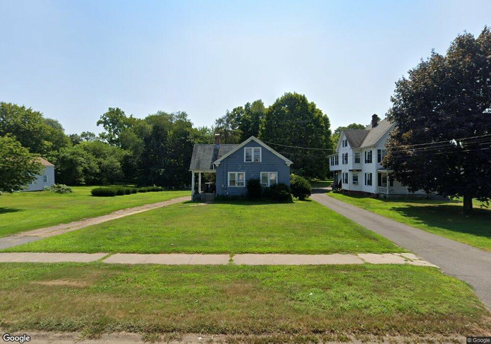
442 Hazard Ave Enfield, CT 06082
Estimated Value: $248,000 - $330,000
3
Beds
2
Baths
1,326
Sq Ft
$213/Sq Ft
Est. Value
About This Home
This home is located at 442 Hazard Ave, Enfield, CT 06082 and is currently estimated at $281,788, approximately $212 per square foot. 442 Hazard Ave is a home located in Hartford County with nearby schools including Nathan Hale Elementary School, Eli Whitney Elementary School, and John F. Kennedy Middle School.
Ownership History
Date
Name
Owned For
Owner Type
Purchase Details
Closed on
Aug 24, 1994
Sold by
Rocke Marguerite
Bought by
Marocchini Philip J and Marocchini David A
Current Estimated Value
Home Financials for this Owner
Home Financials are based on the most recent Mortgage that was taken out on this home.
Original Mortgage
$75,000
Interest Rate
7%
Mortgage Type
Unknown
Create a Home Valuation Report for This Property
The Home Valuation Report is an in-depth analysis detailing your home's value as well as a comparison with similar homes in the area
Home Values in the Area
Average Home Value in this Area
Purchase History
| Date | Buyer | Sale Price | Title Company |
|---|---|---|---|
| Marocchini Philip J | $75,000 | -- |
Source: Public Records
Mortgage History
| Date | Status | Borrower | Loan Amount |
|---|---|---|---|
| Open | Marocchini Philip J | $72,000 | |
| Closed | Marocchini Philip J | $75,000 |
Source: Public Records
Tax History Compared to Growth
Tax History
| Year | Tax Paid | Tax Assessment Tax Assessment Total Assessment is a certain percentage of the fair market value that is determined by local assessors to be the total taxable value of land and additions on the property. | Land | Improvement |
|---|---|---|---|---|
| 2025 | $4,307 | $122,700 | $51,900 | $70,800 |
| 2024 | $4,148 | $122,700 | $51,900 | $70,800 |
| 2023 | $4,118 | $122,700 | $51,900 | $70,800 |
| 2022 | $3,790 | $122,700 | $51,900 | $70,800 |
| 2021 | $3,571 | $95,040 | $42,880 | $52,160 |
| 2020 | $3,547 | $95,040 | $42,880 | $52,160 |
| 2019 | $3,542 | $95,040 | $42,880 | $52,160 |
| 2018 | $3,447 | $95,040 | $42,880 | $52,160 |
| 2017 | $3,239 | $95,040 | $42,880 | $52,160 |
| 2016 | $3,439 | $103,090 | $42,880 | $60,210 |
| 2015 | $3,334 | $103,090 | $42,880 | $60,210 |
| 2014 | $3,250 | $103,090 | $42,880 | $60,210 |
Source: Public Records
Map
Nearby Homes
- 32 N Maple St
- 40 North St
- 6 Cedar St
- 56 N Maple St
- 287 Hazard Ave
- 9 Hamilton Ct
- 3 Coolidge Dr
- 3 Martin Terrace
- 102 N Maple St Unit 8B
- 102 N Maple St Unit 11B
- 3 Homestead Dr
- 8 Victory St
- 14 Avon St
- 45 Monroe Rd
- 4 S George Washington Rd
- 93 Green Manor Rd
- 83 Oldefield Farms Unit 83
- 85 Oldefield Farms Unit 85
- 2 Oakridge Dr
- 31 Putnam Ln
- 438 Hazard Ave
- 444 Hazard Ave
- 444 Hazard Ave Unit 448
- 444 Hazard Ave Unit 450
- 444 Hazard Ave Unit 3
- 444 Hazard Ave Unit 446
- 434 Hazard Ave
- 451 Hazard Ave
- 447 Hazard Ave
- 437 Hazard Ave
- 446 Hazard Ave
- 448 Hazard Ave
- 2 Randolph St
- 453 Hazard Ave
- 6 Randolph St
- 452 Hazard Ave
- 2 Park St
- 4 Park St
- 456 Hazard Ave
- 1 Parky Dr