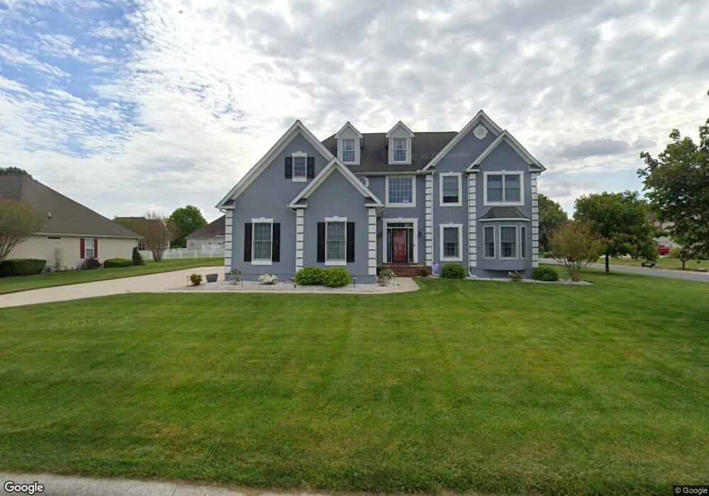
442 Orchard Grove Dr Unit 3 Camden Wyoming, DE 19934
Rising Sun-Lebanon NeighborhoodEstimated Value: $526,000 - $573,000
5
Beds
3
Baths
3,339
Sq Ft
$162/Sq Ft
Est. Value
About This Home
This home is located at 442 Orchard Grove Dr Unit 3, Camden Wyoming, DE 19934 and is currently estimated at $539,432, approximately $161 per square foot. 442 Orchard Grove Dr Unit 3 is a home located in Kent County with nearby schools including Star Hill Elementary School, F. Niel Postlethwait Middle School, and Caesar Rodney High School.
Ownership History
Date
Name
Owned For
Owner Type
Purchase Details
Closed on
Oct 3, 2002
Bought by
Williams Mark E and Beiler John I
Current Estimated Value
Create a Home Valuation Report for This Property
The Home Valuation Report is an in-depth analysis detailing your home's value as well as a comparison with similar homes in the area
Home Values in the Area
Average Home Value in this Area
Purchase History
| Date | Buyer | Sale Price | Title Company |
|---|---|---|---|
| Williams Mark E | $265,200 | -- |
Source: Public Records
Tax History Compared to Growth
Tax History
| Year | Tax Paid | Tax Assessment Tax Assessment Total Assessment is a certain percentage of the fair market value that is determined by local assessors to be the total taxable value of land and additions on the property. | Land | Improvement |
|---|---|---|---|---|
| 2025 | $2,642 | $515,800 | $118,200 | $397,600 |
| 2024 | $2,642 | $515,800 | $118,200 | $397,600 |
| 2023 | $2,454 | $75,200 | $6,000 | $69,200 |
| 2022 | $2,308 | $75,200 | $6,000 | $69,200 |
| 2021 | $2,322 | $75,200 | $6,000 | $69,200 |
| 2020 | $2,217 | $75,200 | $6,000 | $69,200 |
| 2019 | $2,137 | $75,200 | $6,000 | $69,200 |
| 2018 | $2,081 | $75,200 | $6,000 | $69,200 |
| 2017 | $2,041 | $75,200 | $0 | $0 |
| 2016 | $1,932 | $75,200 | $0 | $0 |
| 2015 | $1,663 | $75,200 | $0 | $0 |
| 2014 | $1,691 | $75,200 | $0 | $0 |
Source: Public Records
Map
Nearby Homes
- 464 Orchard Grove Dr
- 106 Steffens Blvd
- 83 Homestead Dr
- 45 Brookfield Dr
- 42 Brookfield Dr
- 103 Osprey Ct
- LOT 102 AST King Henry Ct
- LOT 105 SYC Brookfield Dr
- Aster Plan at Brookfield
- Linden Plan at Brookfield
- Beech Plan at Brookfield
- Garrett Plan at Brookfield
- Sycamore Plan at Brookfield
- Red Maple Plan at Brookfield
- 256 Headstart Ln
- 224 King Henry Ct
- 57 Sisal Way
- Lot 22 Bee Brookfield Dr
- 870 Brookfield Dr
- 272 King Henry Ct
- 442 Orchard Grove Dr
- 15 Orchard Grove Ct
- 447 Orchard Grove Dr
- 37 Orchard Grove Ct
- 429 Orchard Grove Dr
- 484 Orchard Grove Dr
- 463 Orchard Grove Dr
- 427 Orchard Grove Dr
- 399 Orchard Grove Dr
- 55 Orchard Grove Ct
- 483 Orchard Grove Dr
- 365 Orchard Grove Dr
- 381 Orchard Grove Dr
- 506 Orchard Grove Dr
- 348 Orchard Grove Dr
- 501 Orchard Grove Dr
- 79 Orchard Grove Ct
- 343 Orchard Grove Dr
- 326 Orchard Grove Dr
- 521 Orchard Grove Dr