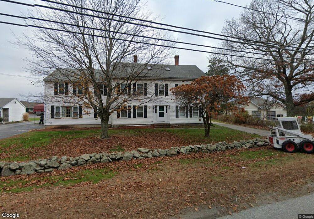
442 Quaker Hwy Uxbridge, MA 01569
--
Bed
--
Bath
17,924
Sq Ft
5.62
Acres
About This Home
This home is located at 442 Quaker Hwy, Uxbridge, MA 01569. 442 Quaker Hwy is a home located in Worcester County with nearby schools including Uxbridge High School and Our Lady of the Valley Regional School.
Ownership History
Date
Name
Owned For
Owner Type
Purchase Details
Closed on
Jun 9, 2022
Sold by
Mani Raman Llc
Bought by
442 Quaker Highway Rt and Leino
Home Financials for this Owner
Home Financials are based on the most recent Mortgage that was taken out on this home.
Original Mortgage
$6,300,000
Outstanding Balance
$5,967,949
Interest Rate
5.1%
Mortgage Type
Commercial
Purchase Details
Closed on
Mar 12, 2021
Sold by
Viththal Llc
Bought by
Mani Raman Llc
Home Financials for this Owner
Home Financials are based on the most recent Mortgage that was taken out on this home.
Original Mortgage
$1,600,000
Interest Rate
2.7%
Mortgage Type
Commercial
Purchase Details
Closed on
Feb 23, 2016
Sold by
Nirmala Llc
Bought by
Viththal Llc
Home Financials for this Owner
Home Financials are based on the most recent Mortgage that was taken out on this home.
Original Mortgage
$1,400,000
Interest Rate
3.97%
Mortgage Type
Commercial
Purchase Details
Closed on
Apr 8, 2004
Sold by
Quaker Mgmt Llc
Bought by
Nirmala Llc
Home Financials for this Owner
Home Financials are based on the most recent Mortgage that was taken out on this home.
Original Mortgage
$640,500
Interest Rate
5.6%
Mortgage Type
Commercial
Create a Home Valuation Report for This Property
The Home Valuation Report is an in-depth analysis detailing your home's value as well as a comparison with similar homes in the area
Home Values in the Area
Average Home Value in this Area
Purchase History
| Date | Buyer | Sale Price | Title Company |
|---|---|---|---|
| 442 Quaker Highway Rt | $2,275,000 | None Available | |
| Mani Raman Llc | $1,800,000 | None Available | |
| Viththal Llc | $1,800,000 | -- | |
| Nirmala Llc | $1,950,000 | -- | |
| Quaker Mgmt Llc | $23,250 | -- | |
| Uxbridge Town Of | -- | -- | |
| Nirmala Llc | $1,950,000 | -- | |
| Quaker Mgmt Llc | $23,250 | -- | |
| Uxbridge Town Of | -- | -- |
Source: Public Records
Mortgage History
| Date | Status | Borrower | Loan Amount |
|---|---|---|---|
| Open | 442 Quaker Highway Rt | $6,300,000 | |
| Previous Owner | Mani Raman Llc | $1,600,000 | |
| Previous Owner | Viththal Llc | $1,400,000 | |
| Previous Owner | Uxbridge Town Of | $640,500 | |
| Previous Owner | Nirmala Llc | $915,000 |
Source: Public Records
Tax History Compared to Growth
Tax History
| Year | Tax Paid | Tax Assessment Tax Assessment Total Assessment is a certain percentage of the fair market value that is determined by local assessors to be the total taxable value of land and additions on the property. | Land | Improvement |
|---|---|---|---|---|
| 2025 | $0 | $2,227,200 | $303,400 | $1,923,800 |
| 2024 | $29,552 | $2,172,700 | $303,400 | $1,869,300 |
| 2023 | $29,552 | $2,118,400 | $303,400 | $1,815,000 |
| 2022 | $30,168 | $1,990,000 | $290,400 | $1,699,600 |
| 2021 | $31,482 | $1,990,000 | $290,400 | $1,699,600 |
| 2020 | $32,491 | $1,940,900 | $290,400 | $1,650,500 |
| 2019 | $30,026 | $1,730,600 | $290,400 | $1,440,200 |
| 2018 | $29,659 | $1,727,400 | $290,400 | $1,437,000 |
| 2017 | $22,489 | $1,326,000 | $108,500 | $1,217,500 |
| 2016 | $25,299 | $1,439,900 | $386,200 | $1,053,700 |
| 2015 | $24,480 | $1,406,900 | $386,200 | $1,020,700 |
Source: Public Records
Map
Nearby Homes
- 127 Old Millville Rd
- 70 Chocolog Rd
- 215 Chestnut St
- 119 Albee Rd
- 129 Quaker Hwy Unit 6
- 346 Millville Rd
- 15 Turner Farm Rd
- 12 Turner Farm Rd
- 18 Turner Farm Rd
- 23 Rifleman Way
- 328 Millville Rd
- 45 Turner Farm Rd
- 46 Turner Farm Rd
- 36 Clark Rd
- 117 Turner Farm Rd
- 127 Turner Farm Rd
- 139 Turner Farm Rd
- The Contemporary Villager Plan at Patriot's Landing
- Karenrose Sunnery Plan at Patriot's Landing
- 7 Gentry Ln Unit 7
- 414 Quaker Hwy
- 466 Quaker Hwy
- 404 Quaker Hwy
- 71 Commerce Dr
- 2 Aldrich St
- 437 Quaker Hwy
- 394 Quaker Hwy
- 2 Chocolog Rd
- 10 River Rd
- lot 1 Chocolog Rd
- 1 Chocolog Rd
- 10 River Rd Unit 104
- 10 River Rd Unit 202
- 10 River Rd
- 10 River Rd Unit 201
- 10 River Rd Unit 103
- 10 River Rd Unit 206
- 10 River Rd Unit 203
- 10 River Rd Unit 102
- 492 Quaker Hwy