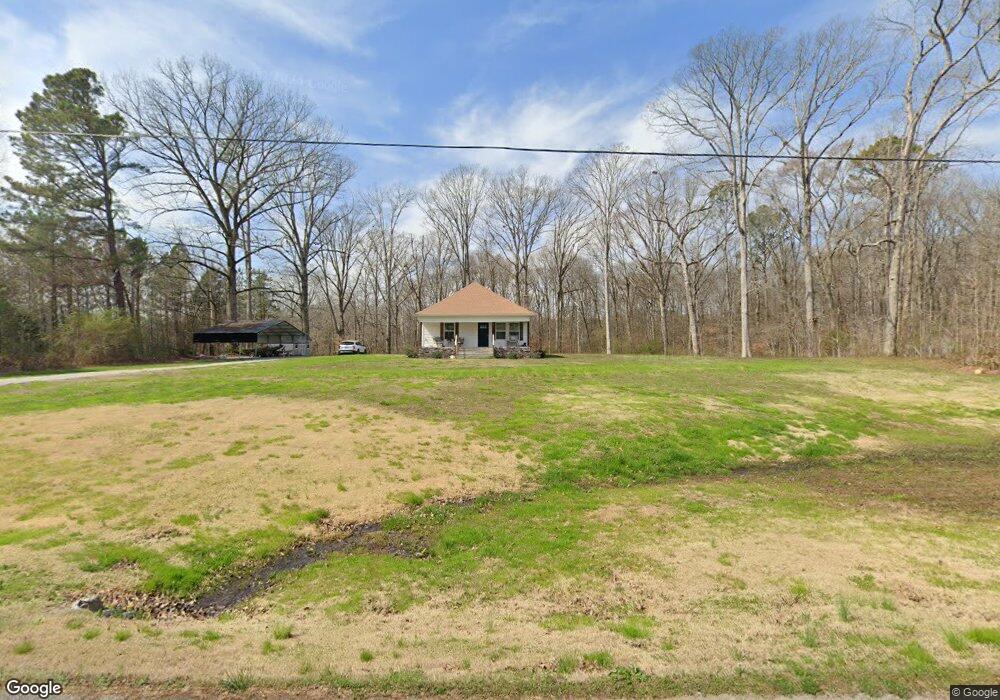
442 Roy Bird Rd Rock Spring, GA 30739
Rock Spring NeighborhoodEstimated Value: $115,000 - $216,000
--
Bed
--
Bath
1,037
Sq Ft
$172/Sq Ft
Est. Value
About This Home
This home is located at 442 Roy Bird Rd, Rock Spring, GA 30739 and is currently estimated at $178,743, approximately $172 per square foot. 442 Roy Bird Rd is a home with nearby schools including Rock Spring Elementary School and Lafayette High School.
Ownership History
Date
Name
Owned For
Owner Type
Purchase Details
Closed on
Oct 9, 2019
Sold by
Thompson Zachary D
Bought by
Thompson Zachary D and Thompson Savannah F
Current Estimated Value
Home Financials for this Owner
Home Financials are based on the most recent Mortgage that was taken out on this home.
Original Mortgage
$108,759
Outstanding Balance
$95,278
Interest Rate
3.5%
Mortgage Type
New Conventional
Estimated Equity
$83,465
Purchase Details
Closed on
Oct 5, 2018
Sold by
Day Brady
Bought by
Thompson Zachary D and Mcgee Savanah F
Purchase Details
Closed on
Mar 19, 2009
Sold by
Gilbreath John H
Bought by
Gilbreath John H
Purchase Details
Closed on
Nov 10, 1999
Sold by
Lipscomb Eunice Bird
Bought by
Lipscomb Thomas L and Lipscomb Gail L
Purchase Details
Closed on
Oct 20, 1999
Sold by
Bird Roy L
Bought by
Lipscomb Eunice Bird
Purchase Details
Closed on
May 25, 1993
Sold by
Bird Roy and Bird Kittie
Bought by
Bird Roy L
Purchase Details
Closed on
Dec 28, 1992
Sold by
Bird Roy
Bought by
Bird Roy and Bird Kittie
Purchase Details
Closed on
Jan 1, 1972
Bought by
Bird Roy
Create a Home Valuation Report for This Property
The Home Valuation Report is an in-depth analysis detailing your home's value as well as a comparison with similar homes in the area
Home Values in the Area
Average Home Value in this Area
Purchase History
| Date | Buyer | Sale Price | Title Company |
|---|---|---|---|
| Thompson Zachary D | -- | -- | |
| Thompson Zachary D | $65,000 | -- | |
| Gilbreath John H | -- | -- | |
| Gilbreath John H | -- | -- | |
| Lipscomb Thomas L | -- | -- | |
| Lipscomb Eunice Bird | -- | -- | |
| Bird Roy L | -- | -- | |
| Bird Roy | -- | -- | |
| Bird Roy | -- | -- |
Source: Public Records
Mortgage History
| Date | Status | Borrower | Loan Amount |
|---|---|---|---|
| Open | Thompson Zachary D | $108,759 |
Source: Public Records
Tax History Compared to Growth
Tax History
| Year | Tax Paid | Tax Assessment Tax Assessment Total Assessment is a certain percentage of the fair market value that is determined by local assessors to be the total taxable value of land and additions on the property. | Land | Improvement |
|---|---|---|---|---|
| 2024 | $1,520 | $69,706 | $22,292 | $47,414 |
| 2023 | $1,442 | $62,601 | $17,692 | $44,909 |
| 2022 | $1,394 | $55,518 | $16,859 | $38,659 |
| 2021 | $1,179 | $41,803 | $16,859 | $24,944 |
| 2020 | $1,100 | $37,323 | $16,859 | $20,464 |
| 2019 | $657 | $20,435 | $16,859 | $3,576 |
| 2018 | $500 | $18,897 | $16,859 | $2,038 |
| 2017 | $566 | $18,897 | $16,859 | $2,038 |
| 2016 | $458 | $18,717 | $16,859 | $1,858 |
| 2015 | $472 | $18,131 | $16,459 | $1,672 |
| 2014 | $457 | $18,131 | $16,459 | $1,672 |
| 2013 | -- | $27,187 | $25,321 | $1,865 |
Source: Public Records
Map
Nearby Homes
- 5602 Georgia 95
- 00 Georgia 95
- 1003 Highway N Old 27
- 1370 Old Highway 27
- 1902 Long Hollow Rd
- 10180 Us Highway 27
- 195 Honeysuckle Dr
- 701 Bicentennial Trail
- 36 Pheonix Cir
- 285 Cooper Rd
- 1476 Arnold Rd
- 0 Cheshire Crossing Dr Unit 1387793
- 1121 Arnold Rd
- 23 Willow Cir
- 16 Willow Cir
- 11 Willow Cir
- The Pearson Plan at Laurel Ridge
- The Benson II Plan at Laurel Ridge
- The Langford Plan at Laurel Ridge
- The Lawson Plan at Laurel Ridge
- 380 Roy Bird Rd
- 355 Roy Bird Rd
- 337 Roy Bird Rd
- 409 Roy Bird Rd
- 560 Roy Bird Rd
- 445 Roy Bird Rd
- 318 Roy Bird Rd
- 295 Roy Bird Rd
- 487 Roy Bird Rd
- 615 Roy Bird Rd
- 261 Roy Bird Rd
- 515 Roy Bird Rd
- 578 Roy Bird Rd
- 233 Roy Bird Rd
- 663 Roy Bird Rd
- 3301 Peavine Rd
- 3271 Peavine Rd
- 94 Roy Bird Rd
- 3135 Peavine Rd
- 301 Meadow Brook Dr