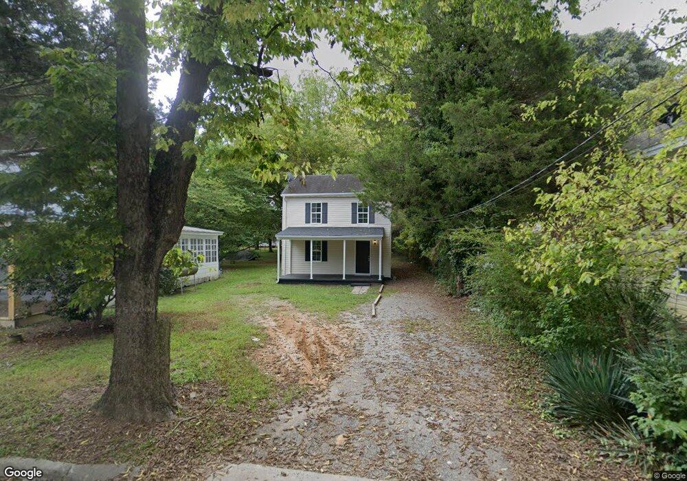
442 Virginia St Tappahannock, VA 22560
Estimated Value: $211,000 - $241,000
3
Beds
2
Baths
1,408
Sq Ft
$158/Sq Ft
Est. Value
About This Home
This home is located at 442 Virginia St, Tappahannock, VA 22560 and is currently estimated at $222,518, approximately $158 per square foot. 442 Virginia St is a home located in Essex County with nearby schools including Tappahannock Elementary School, James H. Cary Intermediate School, and Essex High School.
Ownership History
Date
Name
Owned For
Owner Type
Purchase Details
Closed on
Jul 2, 2025
Sold by
442 Virginia Street Land Trust and Reic Advisors Llc
Bought by
Gw Burton Holdings 1 Llc
Current Estimated Value
Home Financials for this Owner
Home Financials are based on the most recent Mortgage that was taken out on this home.
Original Mortgage
$129,250
Outstanding Balance
$129,032
Interest Rate
6.86%
Mortgage Type
New Conventional
Estimated Equity
$93,486
Purchase Details
Closed on
Jun 6, 2023
Sold by
Brisa Enterprises Of Virginia Llc
Bought by
Cramber Properties Deer Llc
Create a Home Valuation Report for This Property
The Home Valuation Report is an in-depth analysis detailing your home's value as well as a comparison with similar homes in the area
Home Values in the Area
Average Home Value in this Area
Purchase History
| Date | Buyer | Sale Price | Title Company |
|---|---|---|---|
| Gw Burton Holdings 1 Llc | -- | Quality Title | |
| Cramber Properties Deer Llc | $20,000 | Old Republic National Title |
Source: Public Records
Mortgage History
| Date | Status | Borrower | Loan Amount |
|---|---|---|---|
| Open | Gw Burton Holdings 1 Llc | $129,250 |
Source: Public Records
Tax History Compared to Growth
Tax History
| Year | Tax Paid | Tax Assessment Tax Assessment Total Assessment is a certain percentage of the fair market value that is determined by local assessors to be the total taxable value of land and additions on the property. | Land | Improvement |
|---|---|---|---|---|
| 2025 | $1,000 | $181,800 | $34,200 | $147,600 |
| 2024 | $929 | $127,300 | $25,000 | $102,300 |
| 2023 | $929 | $127,300 | $25,000 | $102,300 |
| 2022 | $929 | $127,300 | $25,000 | $102,300 |
| 2021 | $1 | $127,300 | $25,000 | $102,300 |
| 2020 | $658 | $76,500 | $25,000 | $51,500 |
| 2019 | $673 | $81,100 | $25,000 | $56,100 |
| 2018 | $220 | $81,100 | $25,000 | $56,100 |
| 2017 | -- | $0 | $0 | $0 |
| 2016 | $714 | $81,100 | $0 | $0 |
| 2015 | -- | $0 | $0 | $0 |
| 2014 | -- | $0 | $0 | $0 |
| 2013 | -- | $0 | $0 | $0 |
Source: Public Records
Map
Nearby Homes
- 436 Duke St
- 00 N Church Ln
- 801 Cralle Ave
- 701 Lewis St
- 155 N Water Ln
- 155 Rouzie Dr
- 160 Rouzie Dr
- 19841 Tidewater Trail
- 1113 Dillard St
- 1591 Mount Landing Rd
- 1 Heron Point Dr
- 467 Daingerfield Rd
- 58 Hobbs Hole Ln
- 56 Hobbs Hole Ln
- 233 Mitchells Ln
- 129 Coopers Point Ln
- 129 Cooper Point Rd
- Lot D Benton Point Rd
- 0 Logan Way Unit VAES2000806
- 0 Logan Way Unit 2500182