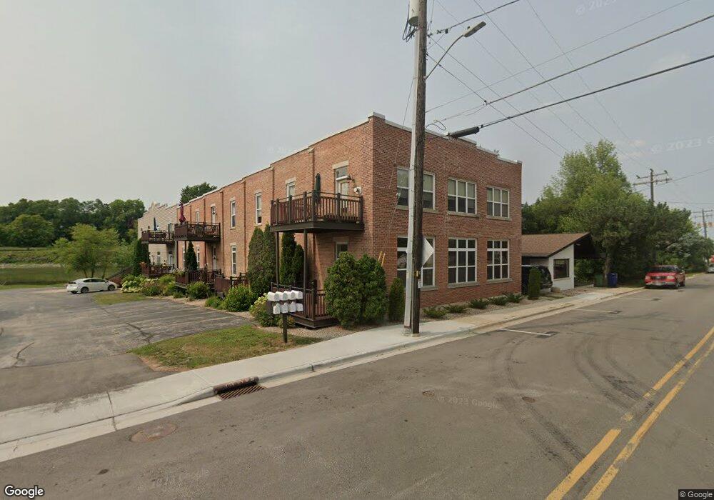
442 Washington St Unit 442 Wrightstown, WI 54180
Estimated Value: $223,122 - $296,000
Studio
--
Bath
--
Sq Ft
44,910
Sq Ft
About This Home
This home is located at 442 Washington St Unit 442, Wrightstown, WI 54180 and is currently estimated at $264,781. 442 Washington St Unit 442 is a home located in Brown County with nearby schools including Wrightstown Elementary School, Wrightstown Middle School, and Wrightstown High School.
Ownership History
Date
Name
Owned For
Owner Type
Purchase Details
Closed on
Oct 12, 2006
Sold by
Bridgeview Of Wrightstown Condominium Ll
Bought by
Schenk Suzanne and Schmechel Jason
Current Estimated Value
Home Financials for this Owner
Home Financials are based on the most recent Mortgage that was taken out on this home.
Original Mortgage
$94,400
Outstanding Balance
$63,840
Interest Rate
9.02%
Mortgage Type
Unknown
Estimated Equity
$200,941
Purchase Details
Closed on
Jun 30, 2004
Sold by
Bridgeview Of Wrightstown Inc
Bought by
Bridgeview Of Wrightstown Condominiums L
Create a Home Valuation Report for This Property
The Home Valuation Report is an in-depth analysis detailing your home's value as well as a comparison with similar homes in the area
Home Values in the Area
Average Home Value in this Area
Purchase History
| Date | Buyer | Sale Price | Title Company |
|---|---|---|---|
| Schenk Suzanne | $118,000 | Liberty Title | |
| Bridgeview Of Wrightstown Condominiums L | -- | -- |
Source: Public Records
Mortgage History
| Date | Status | Borrower | Loan Amount |
|---|---|---|---|
| Open | Schenk Suzanne | $94,400 |
Source: Public Records
Tax History
| Year | Tax Paid | Tax Assessment Tax Assessment Total Assessment is a certain percentage of the fair market value that is determined by local assessors to be the total taxable value of land and additions on the property. | Land | Improvement |
|---|---|---|---|---|
| 2024 | $2,289 | $170,600 | $13,400 | $157,200 |
| 2023 | $2,451 | $170,600 | $13,400 | $157,200 |
| 2022 | $2,651 | $119,800 | $10,000 | $109,800 |
| 2021 | $2,566 | $119,800 | $10,000 | $109,800 |
| 2020 | $2,546 | $119,800 | $10,000 | $109,800 |
| 2019 | $2,389 | $119,800 | $10,000 | $109,800 |
| 2018 | $2,241 | $119,800 | $10,000 | $109,800 |
| 2017 | $2,131 | $107,800 | $20,000 | $87,800 |
| 2016 | $2,210 | $107,800 | $20,000 | $87,800 |
| 2015 | $2,340 | $107,800 | $20,000 | $87,800 |
| 2014 | $2,285 | $107,800 | $20,000 | $87,800 |
| 2013 | $2,285 | $107,800 | $20,000 | $87,800 |
Source: Public Records
Map
Nearby Homes
- 361 Main St
- 735 Park St
- 421 Fawnwood Ct
- 309 Louise Dr
- 109 Nicole Ln
- 217 Patricia Ln
- 119 Main St
- 30 Golden Wheat Ln
- 544 Nicole Ln
- 548 Nicole Ln
- 4207 Lost Dauphin Rd
- 113 Beckerae Ct
- 248 Kerrigan Dr
- 110 Beckerae Ct
- 278 Kerrigan Dr
- 269 Kerrigan Dr
- 128 Beckerae Ct
- 230 Kerrigan Dr
- 287 Kerrigan Dr
- 308 Kerrigan Dr
- 510 Washington St Unit 510
- 448 Washington St Unit 448
- 446 Washington St Unit 446C
- 436 Washington St Unit 436
- 448 Washington St Unit 2D
- 505 Washington St
- 434 Washington St Unit 434
- 444 Washington St Unit 444
- 440 Washington St Unit 440
- 512 Washington St Unit A512
- 508 Washington St
- 504 Washington St Unit 504
- 502 Washington St Unit 502
- 513 Washington St
- 109 High St
- 224 Mueller St
- 531 Washington St
- 228 Mueller St
- 423 Washington St
- 112 High St
Your Personal Tour Guide
Ask me questions while you tour the home.