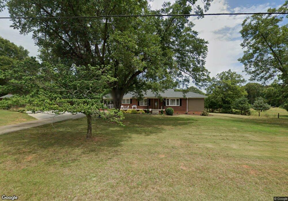
4420 Dobbins Bridge Rd Anderson, SC 29626
Estimated Value: $171,022 - $289,000
--
Bed
--
Bath
1,147
Sq Ft
$189/Sq Ft
Est. Value
About This Home
This home is located at 4420 Dobbins Bridge Rd, Anderson, SC 29626 and is currently estimated at $216,506, approximately $188 per square foot. 4420 Dobbins Bridge Rd is a home with nearby schools including McLees Elementary School, Robert Anderson Middle School, and Westside High School.
Ownership History
Date
Name
Owned For
Owner Type
Purchase Details
Closed on
Aug 25, 2016
Sold by
Sheriff Gary
Bought by
Sheriff Gary and Sheriff Shannon E
Current Estimated Value
Home Financials for this Owner
Home Financials are based on the most recent Mortgage that was taken out on this home.
Original Mortgage
$100,000
Outstanding Balance
$79,927
Interest Rate
3.45%
Mortgage Type
New Conventional
Estimated Equity
$136,579
Purchase Details
Closed on
Sep 17, 2015
Sold by
Sheriff Gary and Estate Of J W Sherife
Bought by
Sheriff Gary
Purchase Details
Closed on
Dec 28, 2010
Sold by
Estate Of Marguerite Sheriff
Bought by
Sheriff J W and Sheriff Gary
Create a Home Valuation Report for This Property
The Home Valuation Report is an in-depth analysis detailing your home's value as well as a comparison with similar homes in the area
Home Values in the Area
Average Home Value in this Area
Purchase History
| Date | Buyer | Sale Price | Title Company |
|---|---|---|---|
| Sheriff Gary | -- | None Available | |
| Sheriff Gary | -- | None Available | |
| Sheriff J W | -- | -- |
Source: Public Records
Mortgage History
| Date | Status | Borrower | Loan Amount |
|---|---|---|---|
| Open | Sheriff Gary | $100,000 |
Source: Public Records
Tax History Compared to Growth
Tax History
| Year | Tax Paid | Tax Assessment Tax Assessment Total Assessment is a certain percentage of the fair market value that is determined by local assessors to be the total taxable value of land and additions on the property. | Land | Improvement |
|---|---|---|---|---|
| 2024 | $532 | $3,700 | $320 | $3,380 |
| 2023 | $532 | $3,700 | $320 | $3,380 |
| 2022 | $501 | $3,700 | $320 | $3,380 |
| 2021 | $483 | $3,430 | $320 | $3,110 |
| 2020 | $476 | $3,430 | $320 | $3,110 |
| 2019 | $476 | $3,430 | $320 | $3,110 |
| 2018 | $483 | $3,430 | $320 | $3,110 |
| 2017 | -- | $3,430 | $320 | $3,110 |
| 2016 | $430 | $2,980 | $320 | $2,660 |
| 2015 | $231 | $2,980 | $320 | $2,660 |
| 2014 | $230 | $2,980 | $320 | $2,660 |
Source: Public Records
Map
Nearby Homes
- 135 Westwood Cir
- LTS C+1 Scarborough Rd
- 2153 Scarborough Rd
- 105 Sugar Pine Rd
- 3824 Dobbins Bridge Rd
- 102 Country Garden Ln
- 385 New Hope Rd
- 401 New Hope Rd
- 143 Pheasant Ridge Dr
- 433 Shore Line Dr
- 424 Shore Line Dr
- 108 Lakewood Ln
- 4082 Old Portman Rd
- 4123 Old Portman Rd
- 0 Marshall Rd
- 1215 Grady Hall Rd
- 0 Cloverdale Dr
- Lot 1 Cloverdale Dr
- TR 1-A, TR-2, TR-S Singleton Rd
- 924 Axmann Dr
- 4426 Dobbins Bridge Rd
- 4421 Dobbins Bridge Rd
- 4413 Dobbins Bridge Rd
- 4436 Dobbins Bridge Rd
- 4410 Dobbins Bridge Rd
- 4438 Dobbins Bridge Rd
- 129 Heidi Dr
- 129 Heidi Dr
- 4314 Dobbins Bridge Rd
- 4443 Dobbins Bridge Rd
- 4440 Dobbins Bridge Rd
- 125 Heidi Dr
- 4312 Dobbins Bridge Rd
- 132 Strawberry Rd
- 111 Heidi Dr
- 315 Coker Rd
- 119 Heidi Dr
- 126 Heidi Dr
- 319 Coker Rd
- 130 Strawberry Rd
