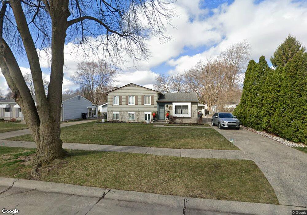
44231 Carrnation Dr Unit Bldg-Unit Sterling Heights, MI 48313
Estimated Value: $285,000 - $322,000
--
Bed
2
Baths
1,638
Sq Ft
$185/Sq Ft
Est. Value
About This Home
This home is located at 44231 Carrnation Dr Unit Bldg-Unit, Sterling Heights, MI 48313 and is currently estimated at $302,227, approximately $184 per square foot. 44231 Carrnation Dr Unit Bldg-Unit is a home located in Macomb County with nearby schools including Havel Elementary School, Bemis Junior High School, and Henry Ford II High School.
Ownership History
Date
Name
Owned For
Owner Type
Purchase Details
Closed on
Jul 31, 2018
Sold by
Serra Ashley
Bought by
Urbin Andrea R
Current Estimated Value
Purchase Details
Closed on
Jan 17, 2018
Sold by
Serra Ashley and Watkins Cadence
Bought by
Serra Ashley
Purchase Details
Closed on
Apr 10, 2015
Sold by
Zallaj Pashk and Zallaj Margarita
Bought by
Serra Ashley A
Purchase Details
Closed on
Dec 20, 2013
Sold by
Simonaj Vera
Bought by
Zallaj Pashk
Purchase Details
Closed on
Apr 22, 2010
Sold by
Zallaj Pashk and Zallaj Margarita
Bought by
Simonaj Vera
Purchase Details
Closed on
Sep 19, 2008
Sold by
Lau Tracy A and Lau Christopher J
Bought by
Nationstar Mortgage Llc
Purchase Details
Closed on
Oct 13, 2000
Sold by
Krencicki Donna L
Bought by
Lau Christopher J
Create a Home Valuation Report for This Property
The Home Valuation Report is an in-depth analysis detailing your home's value as well as a comparison with similar homes in the area
Home Values in the Area
Average Home Value in this Area
Purchase History
| Date | Buyer | Sale Price | Title Company |
|---|---|---|---|
| Urbin Andrea R | $172,500 | None Available | |
| Serra Ashley | -- | None Available | |
| Serra Ashley A | $152,000 | Fidelity National Title | |
| Zallaj Pashk | -- | None Available | |
| Simonaj Vera | -- | None Available | |
| Nationstar Mortgage Llc | $84,750 | None Available | |
| Lau Christopher J | $153,000 | -- |
Source: Public Records
Tax History Compared to Growth
Tax History
| Year | Tax Paid | Tax Assessment Tax Assessment Total Assessment is a certain percentage of the fair market value that is determined by local assessors to be the total taxable value of land and additions on the property. | Land | Improvement |
|---|---|---|---|---|
| 2025 | $3,719 | $131,400 | $0 | $0 |
| 2024 | $3,400 | $117,800 | $0 | $0 |
| 2023 | $3,210 | $106,900 | $0 | $0 |
| 2022 | $3,347 | $93,300 | $0 | $0 |
| 2021 | $3,278 | $85,600 | $0 | $0 |
| 2020 | $2,923 | $83,800 | $0 | $0 |
| 2019 | $3,004 | $82,500 | $0 | $0 |
| 2018 | $2,739 | $75,700 | $0 | $0 |
| 2017 | $2,617 | $70,500 | $13,500 | $57,000 |
| 2016 | $2,528 | $70,500 | $0 | $0 |
| 2015 | -- | $63,700 | $0 | $0 |
| 2014 | -- | $56,800 | $0 | $0 |
Source: Public Records
Map
Nearby Homes
- 12843 Jasmine Ct
- 12115 Canal Rd
- 12862 Beechnut Dr
- 11827 Shetland Ct
- 13185 Canopy Dr Unit 119
- 13370 Forest Ridge Blvd Unit 172
- 43629 Vivian Dr
- 43263 Hartwick Dr
- 44361 Mathison Dr
- 44312 Patricia Dr Unit 2
- 11503 Silver Dr
- 11479 Silver Dr
- 12133 Chattman Dr
- 44395 Patricia Dr Unit 90
- 12840 19 Mile Rd
- 11423 Delvin Dr
- 8958 Shannon Dr
- 11214 Canal Rd
- 43489 Pendleton Cir Unit 13
- 42811 Wilmington Dr
- 44231 Carrnation Dr
- 44219 Carrnation Dr
- 12444 Kenilworth Dr
- 12428 Kenilworth Dr
- 44207 Carrnation Dr
- 44288 Felstone Dr
- 44276 Felstone Dr
- 12412 Kenilworth Dr
- 44264 Felstone Dr
- 44195 Carrnation Dr
- 44228 Carrnation Dr
- 44240 Carrnation Dr
- 44216 Carrnation Dr
- 44252 Felstone Dr
- 44252 Carrnation Dr
- 44204 Carrnation Dr
- 44183 Carrnation Dr
- 12443 Kenilworth Dr
- 12429 Kenilworth Dr
- 44192 Carrnation Dr