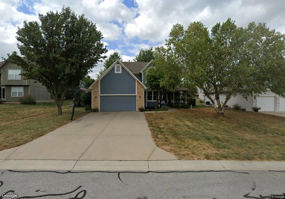
4424 SW Rivulet Dr Lees Summit, MO 64082
Estimated Value: $341,000 - $414,000
4
Beds
3
Baths
1,646
Sq Ft
$230/Sq Ft
Est. Value
About This Home
This home is located at 4424 SW Rivulet Dr, Lees Summit, MO 64082 and is currently estimated at $378,943, approximately $230 per square foot. 4424 SW Rivulet Dr is a home located in Jackson County with nearby schools including Summit Pointe Elementary School, Summit Lakes Middle School, and Lee's Summit West High School.
Ownership History
Date
Name
Owned For
Owner Type
Purchase Details
Closed on
May 31, 2006
Sold by
Woodland Glenn Llc
Bought by
Sixta Homes Llc
Current Estimated Value
Home Financials for this Owner
Home Financials are based on the most recent Mortgage that was taken out on this home.
Original Mortgage
$299,500
Outstanding Balance
$175,040
Interest Rate
6.56%
Mortgage Type
Purchase Money Mortgage
Estimated Equity
$203,903
Purchase Details
Closed on
Jun 20, 2001
Sold by
Penrod Homes Inc
Bought by
Brink Jason S and Brink Sabrina D
Home Financials for this Owner
Home Financials are based on the most recent Mortgage that was taken out on this home.
Original Mortgage
$166,807
Interest Rate
7.08%
Mortgage Type
FHA
Create a Home Valuation Report for This Property
The Home Valuation Report is an in-depth analysis detailing your home's value as well as a comparison with similar homes in the area
Home Values in the Area
Average Home Value in this Area
Purchase History
| Date | Buyer | Sale Price | Title Company |
|---|---|---|---|
| Sixta Homes Llc | -- | Stewart Title Of Kansas City | |
| Brink Jason S | -- | Coffelt Land Title |
Source: Public Records
Mortgage History
| Date | Status | Borrower | Loan Amount |
|---|---|---|---|
| Open | Sixta Homes Llc | $299,500 | |
| Previous Owner | Brink Jason S | $166,807 |
Source: Public Records
Tax History Compared to Growth
Tax History
| Year | Tax Paid | Tax Assessment Tax Assessment Total Assessment is a certain percentage of the fair market value that is determined by local assessors to be the total taxable value of land and additions on the property. | Land | Improvement |
|---|---|---|---|---|
| 2025 | $3,416 | $54,403 | $14,497 | $39,906 |
| 2024 | $3,391 | $47,308 | $9,299 | $38,009 |
| 2023 | $3,391 | $47,308 | $9,158 | $38,150 |
| 2022 | $3,681 | $45,600 | $5,060 | $40,540 |
| 2021 | $3,757 | $45,600 | $5,060 | $40,540 |
| 2020 | $3,455 | $41,516 | $5,060 | $36,456 |
| 2019 | $3,360 | $41,516 | $5,060 | $36,456 |
| 2018 | $3,151 | $36,133 | $4,404 | $31,729 |
| 2017 | $3,151 | $36,133 | $4,404 | $31,729 |
| 2016 | $2,985 | $33,877 | $5,852 | $28,025 |
| 2014 | $2,901 | $32,277 | $5,838 | $26,439 |
Source: Public Records
Map
Nearby Homes
- 4400 SW Rivulet Dr
- 1022 SW Cheshire Dr
- 4605 SW Olympia Cir
- 4520 SW Berkshire Dr
- 4510 SW Fenwick Rd
- 4528 SW Berkshire Dr
- 4120 SW Flintrock Dr
- 4641 SW Soldier Dr
- 4647 SW Olympia Place
- 4104 SW Flintrock Dr
- 1100 SW Blackpool Dr
- Serenade Plan at Stoney Creek - Bliss Collection
- Oasis Plan at Stoney Creek - Bliss Collection
- Devotion Plan at Stoney Creek - Bliss Collection
- Brookside Plan at Stoney Creek - Premier Collection
- Serenity Plan at Stoney Creek - Bliss Collection
- Avalon Plan at Stoney Creek - Premier Collection
- Harmony Plan at Stoney Creek - Bliss Collection
- 1937 SW Merryman Dr
- Lexington Plan at Stoney Creek - Premier Collection
- 4428 SW Rivulet Dr
- 4420 SW Rivulet Dr
- 4425 SW Rivulet Dr
- 4421 SW Rivulet Dr
- 4429 SW Rivulet Dr
- 4432 SW Rivulet Dr
- 1125 SW Georgetown Dr
- 4433 SW Rivulet Dr
- 4412 SW Rivulet Dr
- 4436 SW Rivulet Dr
- 4411 SW Rivulet Dr
- 1225 SW Nagona Ln
- 1133 SW Georgetown Dr
- 4420 SW Hillside Dr
- 4424 SW Hillside Dr
- 4437 SW Rivulet Dr
- 4411 SW Briarbrook Dr
- 4440 SW Rivulet Dr
- 1233 SW Nagona Ln
- 4408 SW Rivulet Dr