Estimated Value: $266,000 - $322,158
4
Beds
2
Baths
1,900
Sq Ft
$155/Sq Ft
Est. Value
About This Home
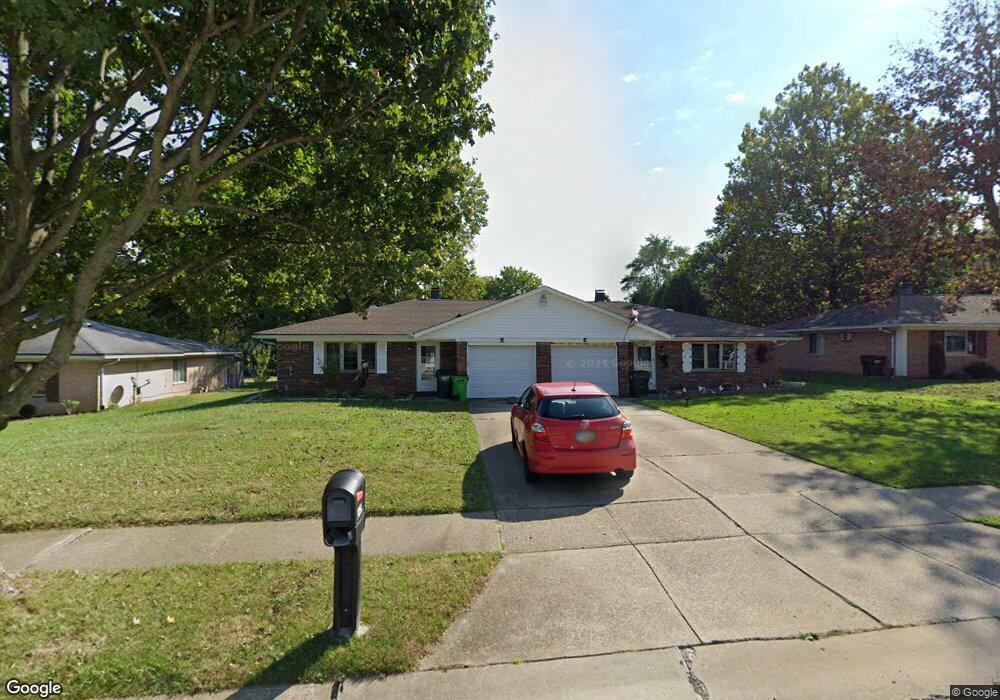
This home is located at 4425 Larkdale Dr Unit 4429, Stow, OH 44224 and is currently estimated at $294,790, approximately $155 per square foot. 4425 Larkdale Dr Unit 4429 is a home located in Summit County with nearby schools including Stow-Munroe Falls High School, Primrose School of Hudson, and Holy Family Elementary School.
Ownership History
Date
Name
Owned For
Owner Type
Purchase Details
Closed on
Feb 15, 2011
Sold by
Piglia Michael A and Piglia Beth M
Bought by
Piglia Michael A and Piglia Beth M
Current Estimated Value
Home Financials for this Owner
Home Financials are based on the most recent Mortgage that was taken out on this home.
Original Mortgage
$101,500
Outstanding Balance
$36,477
Interest Rate
4.5%
Mortgage Type
New Conventional
Estimated Equity
$258,313
Purchase Details
Closed on
Jan 7, 2011
Sold by
Dibiase Sara Jean
Bought by
Piglia Michael A and Piglia Beth M
Home Financials for this Owner
Home Financials are based on the most recent Mortgage that was taken out on this home.
Original Mortgage
$101,500
Outstanding Balance
$36,477
Interest Rate
4.5%
Mortgage Type
New Conventional
Estimated Equity
$258,313
Purchase Details
Closed on
Dec 20, 1994
Sold by
Lawrence Kathleen
Bought by
Dibiase Richard A
Create a Home Valuation Report for This Property
The Home Valuation Report is an in-depth analysis detailing your home's value as well as a comparison with similar homes in the area
Home Values in the Area
Average Home Value in this Area
Purchase History
| Date | Buyer | Sale Price | Title Company |
|---|---|---|---|
| Piglia Michael A | -- | American Certified Title | |
| Piglia Michael A | $145,000 | American Certified Title | |
| Dibiase Richard A | $1,046 | -- |
Source: Public Records
Mortgage History
| Date | Status | Borrower | Loan Amount |
|---|---|---|---|
| Open | Piglia Michael A | $101,500 |
Source: Public Records
Tax History Compared to Growth
Tax History
| Year | Tax Paid | Tax Assessment Tax Assessment Total Assessment is a certain percentage of the fair market value that is determined by local assessors to be the total taxable value of land and additions on the property. | Land | Improvement |
|---|---|---|---|---|
| 2025 | $4,457 | $77,074 | $14,840 | $62,234 |
| 2024 | $4,457 | $77,074 | $14,840 | $62,234 |
| 2023 | $4,457 | $77,074 | $14,840 | $62,234 |
| 2022 | $3,800 | $57,950 | $11,158 | $46,792 |
| 2021 | $3,413 | $57,950 | $11,158 | $46,792 |
| 2020 | $3,356 | $57,950 | $11,160 | $46,790 |
| 2019 | $3,364 | $54,320 | $11,160 | $43,160 |
| 2018 | $3,310 | $54,320 | $11,160 | $43,160 |
| 2017 | $3,116 | $54,320 | $11,160 | $43,160 |
| 2016 | $3,204 | $49,620 | $11,160 | $38,460 |
| 2015 | $3,116 | $49,620 | $11,160 | $38,460 |
| 2014 | $3,119 | $49,620 | $11,160 | $38,460 |
| 2013 | $3,258 | $52,200 | $11,160 | $41,040 |
Source: Public Records
Map
Nearby Homes
- 4462 Timberdale Dr
- 4424 Timberdale Dr Unit 4428
- 1808 Higby Dr Unit A
- 4630 Red Willow Rd
- 1784 Clearbrook Dr
- 2279 Becket Cir
- 4322 Lorwood Dr
- 2188 Duxbury
- 0 Hibbard Dr
- 0 Stow Rd Unit 5102979
- 2055-2059 Bryn Mawr Dr
- 4877 Cedar Crest Ln
- 4846 Garnet Cir
- 1664 Cypress Ct
- 4891 Cedar Crest Ln
- 1525 Spruce Hill Dr
- 2410 Wrens Dr S
- 5112 Commanche Trail
- 1514 & 1516 Robin Ln
- 2260 E Gilwood Dr
- 4417 Larkdale Dr Unit 4421
- 4435 Larkdale Dr Unit 4439
- 4435 4439 Larkdale Dr
- 1972 Crestdale Dr
- 1980 Crestdale Dr
- 4407 4411 Larkdale Dr
- 1966 Crestdale Dr
- 1934 Kingsdale Dr Unit 1938
- 4416 Larkdale Dr Unit 4420
- 4416 Larkdale Dr
- 1944 Kingsdale Dr
- 4406 4410 Larkdale Dr
- 4398 Larkdale Dr
- 4424 Larkdale Dr Unit 4428
- 4406 Larkdale Dr Unit 4410
- 4406 Larkdale Dr Unit 4406 Larkdale
- 4393 Larkdale Dr Unit 4397
- 1988 Crestdale Dr
- 4434 Larkdale Dr Unit 4438
- 1952 Crestdale Dr