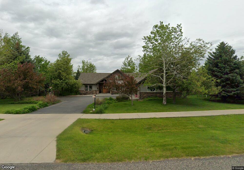
4428 Graf St Bozeman, MT 59715
South Bozeman NeighborhoodEstimated Value: $1,232,000 - $1,683,000
4
Beds
3
Baths
2,818
Sq Ft
$495/Sq Ft
Est. Value
About This Home
This home is located at 4428 Graf St, Bozeman, MT 59715 and is currently estimated at $1,395,525, approximately $495 per square foot. 4428 Graf St is a home located in Gallatin County with nearby schools including Morning Star School, Sacajawea Middle School, and Bozeman High School.
Ownership History
Date
Name
Owned For
Owner Type
Purchase Details
Closed on
Apr 10, 2009
Sold by
Garson Matthew Lawrence
Bought by
Garson Matthew Lawrence and Garson Kimberly
Current Estimated Value
Home Financials for this Owner
Home Financials are based on the most recent Mortgage that was taken out on this home.
Original Mortgage
$348,000
Interest Rate
5.17%
Mortgage Type
New Conventional
Purchase Details
Closed on
Sep 6, 2005
Sold by
Rickenbaugh Elisabeth H
Bought by
Garson Matthew Lawrence
Home Financials for this Owner
Home Financials are based on the most recent Mortgage that was taken out on this home.
Original Mortgage
$359,650
Interest Rate
5.64%
Mortgage Type
Purchase Money Mortgage
Create a Home Valuation Report for This Property
The Home Valuation Report is an in-depth analysis detailing your home's value as well as a comparison with similar homes in the area
Home Values in the Area
Average Home Value in this Area
Purchase History
| Date | Buyer | Sale Price | Title Company |
|---|---|---|---|
| Garson Matthew Lawrence | -- | Security Title Company | |
| Garson Matthew Lawrence | -- | Security Title Company |
Source: Public Records
Mortgage History
| Date | Status | Borrower | Loan Amount |
|---|---|---|---|
| Closed | Garson Matthew Lawrence | $348,000 | |
| Closed | Garson Matthew Lawrence | $359,650 |
Source: Public Records
Tax History Compared to Growth
Tax History
| Year | Tax Paid | Tax Assessment Tax Assessment Total Assessment is a certain percentage of the fair market value that is determined by local assessors to be the total taxable value of land and additions on the property. | Land | Improvement |
|---|---|---|---|---|
| 2025 | $5,634 | $1,132,000 | $0 | $0 |
| 2024 | $8,186 | $1,229,700 | $0 | $0 |
| 2023 | $7,914 | $1,229,700 | $0 | $0 |
| 2022 | $6,580 | $858,100 | $0 | $0 |
| 2021 | $7,261 | $858,100 | $0 | $0 |
| 2020 | $6,220 | $728,500 | $0 | $0 |
| 2019 | $6,362 | $728,500 | $0 | $0 |
| 2018 | $6,105 | $647,900 | $0 | $0 |
| 2017 | $5,707 | $647,900 | $0 | $0 |
| 2016 | $5,387 | $571,300 | $0 | $0 |
| 2015 | $5,392 | $571,300 | $0 | $0 |
| 2014 | $5,470 | $341,014 | $0 | $0 |
Source: Public Records
Map
Nearby Homes
- 4314 Graf St
- 4510 Morning Sun Dr
- Lot 129 Graf St
- 462 Cornell Dr
- 8373 Goldenstein Ln
- 5041 S 3rd Ave
- 3609 Fieldstone Dr W
- 518 Oxford Dr
- 502 Cambridge Dr
- 102 Nostalgia Ln
- 8472 Wagon Boss Rd
- 1621 Cambridge Dr
- 1617 Cambridge Dr
- 1613 Cambridge Dr
- 1609 Cambridge Dr
- 1525 Cambridge Dr
- 1517 Cambridge Dr
- NHN Trooper Trail
- 3214 Hillcrest Dr
- 210 W Graf St