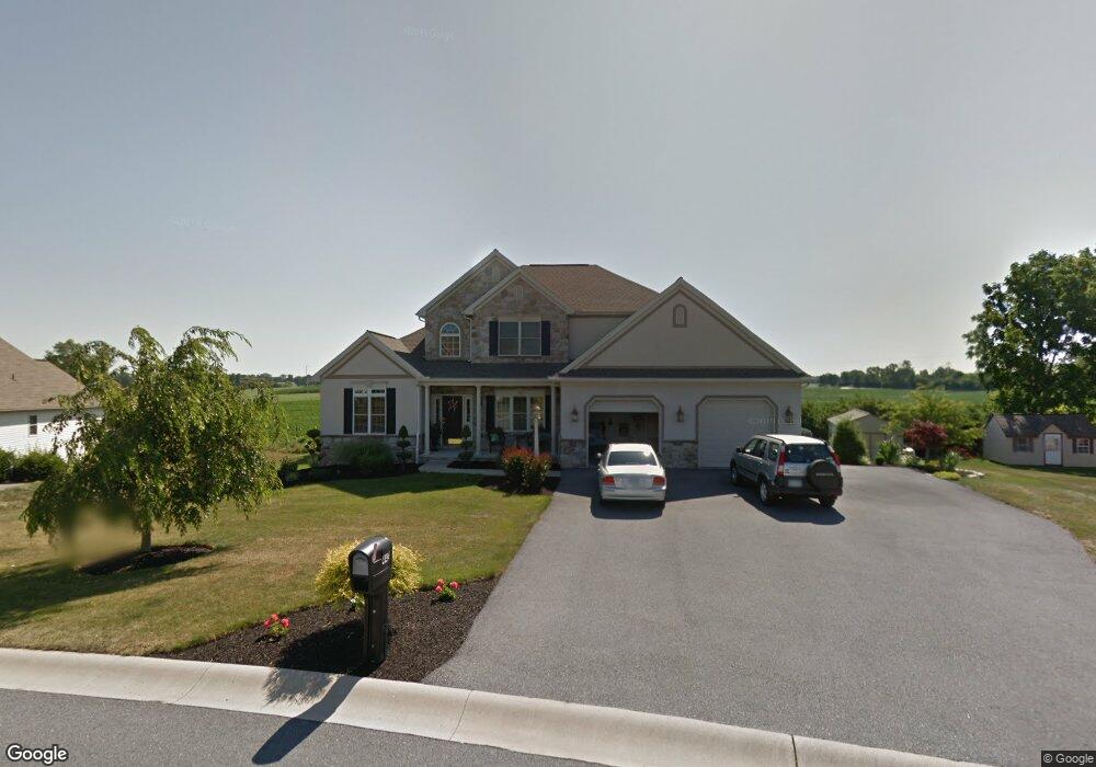
443 Millbridge Dr Lebanon, PA 17042
North Cornwall NeighborhoodEstimated Value: $545,073 - $753,000
3
Beds
3
Baths
2,979
Sq Ft
$205/Sq Ft
Est. Value
About This Home
This home is located at 443 Millbridge Dr, Lebanon, PA 17042 and is currently estimated at $609,268, approximately $204 per square foot. 443 Millbridge Dr is a home located in Lebanon County with nearby schools including Ebenezer Elementary School, Cedar Crest Middle School, and Cedar Crest High School.
Ownership History
Date
Name
Owned For
Owner Type
Purchase Details
Closed on
Oct 20, 2021
Sold by
Raudensky Glenn R and Raudensky Samantha L
Bought by
Raudensky Glenn R and Raudensky Samantha L
Current Estimated Value
Purchase Details
Closed on
Jul 25, 2017
Sold by
Rowe Wanda J
Bought by
Raudensky Glenn R and Raudensky Samantha L
Home Financials for this Owner
Home Financials are based on the most recent Mortgage that was taken out on this home.
Original Mortgage
$268,000
Interest Rate
3.91%
Mortgage Type
New Conventional
Purchase Details
Closed on
Sep 5, 2014
Sold by
Sites Michael S and Sites Tammy J
Bought by
Rowe Wanda J
Home Financials for this Owner
Home Financials are based on the most recent Mortgage that was taken out on this home.
Original Mortgage
$256,000
Interest Rate
4.12%
Mortgage Type
New Conventional
Create a Home Valuation Report for This Property
The Home Valuation Report is an in-depth analysis detailing your home's value as well as a comparison with similar homes in the area
Home Values in the Area
Average Home Value in this Area
Purchase History
| Date | Buyer | Sale Price | Title Company |
|---|---|---|---|
| Raudensky Glenn R | -- | None Listed On Document | |
| Raudensky Glenn R | $335,000 | Edge Abstract Independence L | |
| Rowe Wanda J | $320,000 | None Available |
Source: Public Records
Mortgage History
| Date | Status | Borrower | Loan Amount |
|---|---|---|---|
| Previous Owner | Raudensky Glenn R | $268,000 | |
| Previous Owner | Rowe Wanda J | $256,000 |
Source: Public Records
Tax History Compared to Growth
Tax History
| Year | Tax Paid | Tax Assessment Tax Assessment Total Assessment is a certain percentage of the fair market value that is determined by local assessors to be the total taxable value of land and additions on the property. | Land | Improvement |
|---|---|---|---|---|
| 2025 | $7,598 | $307,900 | $65,300 | $242,600 |
| 2024 | $6,928 | $307,900 | $65,300 | $242,600 |
| 2023 | $6,928 | $307,900 | $65,300 | $242,600 |
| 2022 | $6,411 | $294,300 | $65,300 | $229,000 |
| 2021 | $5,991 | $290,400 | $61,400 | $229,000 |
| 2020 | $5,946 | $290,400 | $61,400 | $229,000 |
| 2019 | $5,708 | $290,400 | $61,400 | $229,000 |
| 2018 | $5,603 | $290,400 | $61,400 | $229,000 |
| 2017 | $1,392 | $290,400 | $61,400 | $229,000 |
| 2016 | $5,501 | $290,400 | $61,400 | $229,000 |
| 2015 | -- | $290,400 | $61,400 | $229,000 |
| 2014 | -- | $290,400 | $61,400 | $229,000 |
Source: Public Records
Map
Nearby Homes
- 535 S Mill St
- 429 Bricker Ln
- 261 Kathy Ct
- 208 S Center St
- 129 S Mill St
- 216 W Union Alley
- 14 Betony Ln
- 217 Dahlia Cir
- 01 Dahlia
- Wesley Plan at Fox Bend
- Bridgemont Plan at Fox Bend
- Westbrooke Plan at Fox Bend
- Logan Plan at Fox Bend
- Kingston Plan at Fox Bend
- Callahan Plan at Fox Bend
- Berkley Plan at Fox Bend
- Sullivan Plan at Fox Bend
- Brookfield Plan at Fox Bend
- Charlotte Plan at Fox Bend
- Huntington Plan at Fox Bend
- 445 Millbridge Dr
- 441 Millbridge Dr
- 444 Millbridge Dr
- 439 Millbridge Dr
- 447 Millbridge Dr
- 436 Millbridge Dr
- 408 Millbridge Dr
- 450 Millbridge Dr
- 437 Millbridge Dr
- 449 Millbridge Dr
- 430 Millbridge Dr
- 313 Davis Ln
- 406 Millbridge Dr
- 317 Davis Ln
- 435 Millbridge Dr
- 300 Meyerlo Ln
- 0 Es Meyerlo Ln Unit 218084
- 410 Millbridge Dr
- 428 Millbridge Dr
- 404 Millbridge Dr