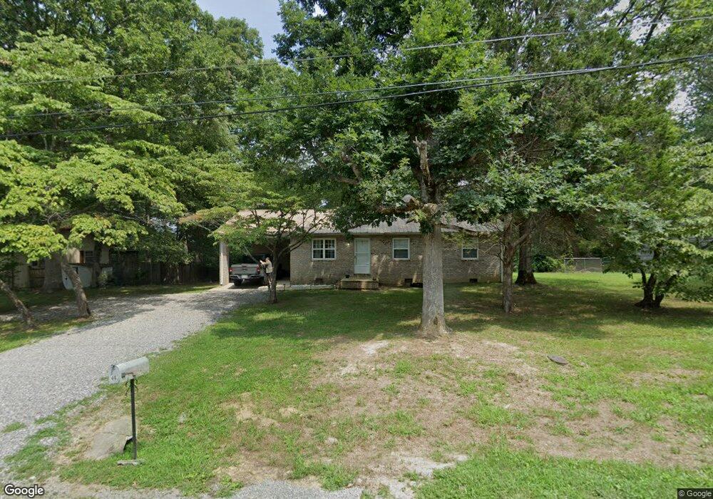
443 Norman Dr Crossville, TN 38571
Estimated Value: $171,964 - $278,000
--
Bed
2
Baths
1,152
Sq Ft
$200/Sq Ft
Est. Value
About This Home
This home is located at 443 Norman Dr, Crossville, TN 38571 and is currently estimated at $230,491, approximately $200 per square foot. 443 Norman Dr is a home located in Cumberland County with nearby schools including Pleasant Hill Elementary School, Cumberland County High School, and Inez Wrenn SDA School.
Ownership History
Date
Name
Owned For
Owner Type
Purchase Details
Closed on
May 19, 2022
Sold by
Barnwell Randy K and Barnwell Ann Judy
Bought by
Lowe Catherine
Current Estimated Value
Home Financials for this Owner
Home Financials are based on the most recent Mortgage that was taken out on this home.
Original Mortgage
$100,000
Outstanding Balance
$88,225
Interest Rate
4.43%
Mortgage Type
Seller Take Back
Estimated Equity
$142,266
Purchase Details
Closed on
Jun 5, 1996
Sold by
Swan Ezra R
Bought by
Barnwell Randy
Create a Home Valuation Report for This Property
The Home Valuation Report is an in-depth analysis detailing your home's value as well as a comparison with similar homes in the area
Home Values in the Area
Average Home Value in this Area
Purchase History
| Date | Buyer | Sale Price | Title Company |
|---|---|---|---|
| Lowe Catherine | $150,000 | Patton & Hyder | |
| Barnwell Randy | $3,500 | -- |
Source: Public Records
Mortgage History
| Date | Status | Borrower | Loan Amount |
|---|---|---|---|
| Open | Lowe Catherine | $100,000 |
Source: Public Records
Tax History Compared to Growth
Tax History
| Year | Tax Paid | Tax Assessment Tax Assessment Total Assessment is a certain percentage of the fair market value that is determined by local assessors to be the total taxable value of land and additions on the property. | Land | Improvement |
|---|---|---|---|---|
| 2025 | $381 | $33,525 | $2,000 | $31,525 |
| 2024 | $381 | $33,525 | $2,000 | $31,525 |
| 2023 | $0 | $33,525 | $0 | $0 |
| 2022 | $381 | $33,525 | $2,000 | $31,525 |
| 2021 | $330 | $21,075 | $2,000 | $19,075 |
| 2020 | $330 | $21,075 | $2,000 | $19,075 |
| 2019 | $330 | $21,075 | $2,000 | $19,075 |
| 2018 | $330 | $21,075 | $2,000 | $19,075 |
| 2017 | $330 | $21,075 | $2,000 | $19,075 |
| 2016 | $316 | $20,700 | $2,000 | $18,700 |
| 2015 | $310 | $20,700 | $2,000 | $18,700 |
| 2014 | $310 | $20,689 | $0 | $0 |
Source: Public Records
Map
Nearby Homes
- 2 Tennessee Ave
- 3 Tennessee Ave
- 171 Red Oak Dr
- 122 Lee Cir
- 150 Dillon St
- 88 acres Sparta Hwy
- 36 White Oak Cir
- 275 Hawthorn Loop
- 0.72 ac Waterview Dr
- 0 Waterview Dr Unit 1306982
- 0
- 41 Hawthorn Cir
- 229 Hawthorn Loop
- 27 Hickory Hollow Cir
- 0 Sparta Hwy 31 65 + - Acres
- 0 Dr
- 0 Sparta Hwy 31 64 + - Acres
- 172 Hawthorn Loop
- 1378 Sparta Hwy Unit 1378
- 78 Our Way Loop