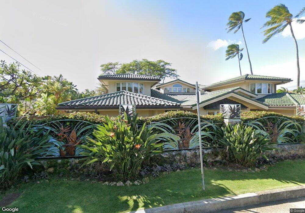
443 Portlock Rd Unit A Honolulu, HI 96825
Hawaii Kai NeighborhoodEstimated Value: $8,671,000 - $9,674,159
6
Beds
8
Baths
7,330
Sq Ft
$1,273/Sq Ft
Est. Value
About This Home
This home is located at 443 Portlock Rd Unit A, Honolulu, HI 96825 and is currently estimated at $9,333,790, approximately $1,273 per square foot. 443 Portlock Rd Unit A is a home located in Honolulu County with nearby schools including Koko Head Elementary School, Niu Valley Middle School, and Honolulu Waldorf School.
Ownership History
Date
Name
Owned For
Owner Type
Purchase Details
Closed on
Oct 22, 2021
Sold by
Buckland Kenneth Michael and Buckland Heather Louise
Bought by
West Brendan and West Meghan
Current Estimated Value
Purchase Details
Closed on
May 3, 2007
Sold by
Anderson Allen W and Anderson Kathleen
Bought by
Buckland Kenneth Michael and Buckland Heather Louise
Purchase Details
Closed on
Dec 29, 2005
Sold by
Melim Margaret M
Bought by
Clark Elizabeth A and Anderson Kathleen
Create a Home Valuation Report for This Property
The Home Valuation Report is an in-depth analysis detailing your home's value as well as a comparison with similar homes in the area
Home Values in the Area
Average Home Value in this Area
Purchase History
| Date | Buyer | Sale Price | Title Company |
|---|---|---|---|
| West Brendan | $8,350,000 | Tg | |
| Buckland Kenneth Michael | $4,500,000 | Tg | |
| Clark Elizabeth A | -- | -- |
Source: Public Records
Tax History Compared to Growth
Tax History
| Year | Tax Paid | Tax Assessment Tax Assessment Total Assessment is a certain percentage of the fair market value that is determined by local assessors to be the total taxable value of land and additions on the property. | Land | Improvement |
|---|---|---|---|---|
| 2025 | $89,182 | $8,484,600 | $4,651,800 | $3,832,800 |
| 2024 | $89,182 | $8,472,100 | $4,369,900 | $4,102,200 |
| 2023 | $30,162 | $8,817,600 | $4,369,900 | $4,447,700 |
| 2022 | $23,717 | $6,876,400 | $3,947,000 | $2,929,400 |
| 2021 | $20,323 | $5,906,600 | $3,270,400 | $2,636,200 |
| 2020 | $22,373 | $6,492,200 | $3,721,500 | $2,770,700 |
| 2019 | $22,371 | $7,059,400 | $3,947,000 | $3,112,400 |
| 2018 | $22,371 | $6,471,700 | $3,749,600 | $2,722,100 |
| 2017 | $22,962 | $6,640,700 | $4,228,900 | $2,411,800 |
| 2016 | $21,838 | $6,319,500 | $3,851,600 | $2,467,900 |
| 2015 | $22,429 | $6,488,400 | $4,534,000 | $1,954,400 |
| 2014 | $12,542 | $5,631,700 | $3,238,600 | $2,393,100 |
Source: Public Records
Map
Nearby Homes
- 469 Portlock Rd Unit A
- 464 Poipu Dr
- 243 Poipu Dr
- 278 Makaweli Place
- 532 Portlock Rd
- 101 Nawiliwili St
- 110 Waialeale St
- 176 Hanapepe Loop
- 255 Portlock Rd
- 243 Portlock Rd
- 221 Portlock Rd
- 7247 Nohili St
- 55 Poipu Dr
- 47 Poipu Dr
- 308 Hanakoa St
- 31 Poipu Dr
- 28 Poipu Dr
- 7269 Kauhako St
- 3 Poipu Dr
- 614 Koko Isle Cir Unit 2002
- 443 Portlock Rd
- 445 Portlock Rd
- 435 Portlock Rd
- 447 Portlock Rd
- 437 Portlock Rd
- 433 Portlock Rd
- 453 Portlock Rd
- 449 Portlock Rd
- 431 Portlock Rd
- 427 Portlock Rd
- 429 Portlock Rd
- 425 Portlock Rd
- 448 Portlock Rd
- 444 Portlock Rd
- 459 Portlock Rd Unit A
- 459 Portlock Rd
- 438 Portlock Rd
- 450 Portlock Rd
- 423 Portlock Rd
- 434 Portlock Rd