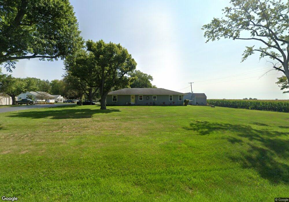
4433 N Rangeline Rd Covington, OH 45318
Estimated Value: $216,312 - $281,000
3
Beds
1
Bath
1,680
Sq Ft
$150/Sq Ft
Est. Value
About This Home
This home is located at 4433 N Rangeline Rd, Covington, OH 45318 and is currently estimated at $251,828, approximately $149 per square foot. 4433 N Rangeline Rd is a home located in Miami County with nearby schools including Covington Elementary/Junior High School, Covington Junior High School, and Covington High School.
Ownership History
Date
Name
Owned For
Owner Type
Purchase Details
Closed on
Jan 24, 2000
Sold by
Dehart Michael E and Dehart Janet A
Bought by
Thomas Patrick E and Thomas Kelly A
Current Estimated Value
Purchase Details
Closed on
May 15, 1992
Bought by
Dehart Michael E
Create a Home Valuation Report for This Property
The Home Valuation Report is an in-depth analysis detailing your home's value as well as a comparison with similar homes in the area
Home Values in the Area
Average Home Value in this Area
Purchase History
| Date | Buyer | Sale Price | Title Company |
|---|---|---|---|
| Thomas Patrick E | $105,000 | -- | |
| Dehart Michael E | $77,900 | -- |
Source: Public Records
Mortgage History
| Date | Status | Borrower | Loan Amount |
|---|---|---|---|
| Closed | Thomas Patrick E | $0 |
Source: Public Records
Tax History Compared to Growth
Tax History
| Year | Tax Paid | Tax Assessment Tax Assessment Total Assessment is a certain percentage of the fair market value that is determined by local assessors to be the total taxable value of land and additions on the property. | Land | Improvement |
|---|---|---|---|---|
| 2024 | $1,707 | $51,170 | $7,070 | $44,100 |
| 2023 | $1,707 | $51,170 | $7,070 | $44,100 |
| 2022 | $1,729 | $51,170 | $7,070 | $44,100 |
| 2021 | $1,424 | $39,350 | $5,430 | $33,920 |
| 2020 | $1,427 | $39,350 | $5,430 | $33,920 |
| 2019 | $1,423 | $39,350 | $5,430 | $33,920 |
| 2018 | $1,164 | $32,730 | $5,320 | $27,410 |
| 2017 | $1,188 | $32,730 | $5,320 | $27,410 |
| 2016 | $1,140 | $32,730 | $5,320 | $27,410 |
| 2015 | $1,081 | $30,880 | $5,010 | $25,870 |
| 2014 | $1,081 | $30,880 | $5,010 | $25,870 |
| 2013 | $1,087 | $30,880 | $5,010 | $25,870 |
Source: Public Records
Map
Nearby Homes
- 8341 W Covington Gettysburg Rd
- 5490 N Rangeline Rd
- 200 Charles Ct
- 202 Charles Ct
- 536 S High St
- 201 Charles Ct
- 203 Charles Ct
- 221 S High St
- 204 Charles Ct
- 221 Henry Ct
- 219 Henry Ct
- 206 Charles Ct
- 205 Charles Ct
- 208 Charles Ct
- 8937 W US Route 36
- 207 Charles Ct
- 210 Charles Ct
- 212 Charles Ct
- 223 Henry Ct
- 133 W Broadway St
- 4435 N Rangeline Rd
- 4455 N Rangeline Rd
- 3242 N Rangeline Rd
- 4444 N Rangeline Rd
- 4457 N Rangeline Rd
- 4477 N Rangeline Rd
- 4390 N Rangeline Rd
- 4470 N Rangeline Rd
- 4499 N Rangeline Rd
- 4459 N Rangeline Rd
- 4366 N Rangeline Rd
- 4511 N Rangeline Rd
- 4437 N Rangeline Rd
- 4545 N Rangeline Rd
- 4530 N Rangeline Rd
- 9055 W Greenville Falls Rd
- 9075 W Greenville Falls Rd
- 9075 W Greenville Falls Rd
- 4585 N Rangeline Rd
- 4288 N Rangeline Rd