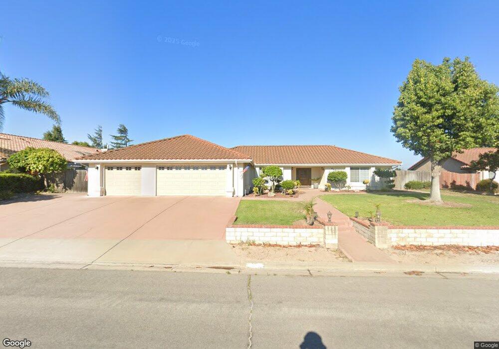
4437 Kris Dr Santa Maria, CA 93455
Estimated Value: $1,004,732 - $1,423,000
4
Beds
3
Baths
2,762
Sq Ft
$456/Sq Ft
Est. Value
About This Home
This home is located at 4437 Kris Dr, Santa Maria, CA 93455 and is currently estimated at $1,259,683, approximately $456 per square foot. 4437 Kris Dr is a home located in Santa Barbara County with nearby schools including Patterson Road Elementary School, Orcutt Junior High School, and Ernest Righetti High School.
Ownership History
Date
Name
Owned For
Owner Type
Purchase Details
Closed on
Jun 12, 1996
Sold by
Stephan Ruffino Construction Inc
Bought by
Lew Timothy Kit and Lew Susan Shuping Wu
Current Estimated Value
Home Financials for this Owner
Home Financials are based on the most recent Mortgage that was taken out on this home.
Original Mortgage
$180,000
Interest Rate
8.33%
Purchase Details
Closed on
Mar 12, 1996
Sold by
Mccutcheon Robert W and Mccutcheon Grace
Bought by
Stephan Ruffino Construction Inc
Create a Home Valuation Report for This Property
The Home Valuation Report is an in-depth analysis detailing your home's value as well as a comparison with similar homes in the area
Home Values in the Area
Average Home Value in this Area
Purchase History
| Date | Buyer | Sale Price | Title Company |
|---|---|---|---|
| Lew Timothy Kit | $103,181 | First American Title Ins Co | |
| Stephan Ruffino Construction Inc | $98,000 | Chicago Title Co |
Source: Public Records
Mortgage History
| Date | Status | Borrower | Loan Amount |
|---|---|---|---|
| Previous Owner | Lew Timothy Kit | $180,000 |
Source: Public Records
Tax History Compared to Growth
Tax History
| Year | Tax Paid | Tax Assessment Tax Assessment Total Assessment is a certain percentage of the fair market value that is determined by local assessors to be the total taxable value of land and additions on the property. | Land | Improvement |
|---|---|---|---|---|
| 2025 | $6,438 | $488,504 | $170,996 | $317,508 |
| 2023 | $6,438 | $469,537 | $164,357 | $305,180 |
| 2022 | $6,253 | $460,332 | $161,135 | $299,197 |
| 2021 | $6,123 | $451,307 | $157,976 | $293,331 |
| 2020 | $6,080 | $446,681 | $156,357 | $290,324 |
| 2019 | $6,017 | $437,924 | $153,292 | $284,632 |
| 2018 | $5,936 | $429,338 | $150,287 | $279,051 |
| 2017 | $5,721 | $420,921 | $147,341 | $273,580 |
| 2016 | $5,499 | $412,668 | $144,452 | $268,216 |
| 2015 | $5,383 | $406,471 | $142,283 | $264,188 |
| 2014 | -- | $398,509 | $139,496 | $259,013 |
Source: Public Records
Map
Nearby Homes
- 1430 Solomon Rd
- 1418 Solomon Rd
- 4347 Manchester Ct
- 4695 Blackstone Ct
- 4408 Countrywood Dr
- 684 Clubhouse Dr
- 315 Soares Ave
- 166 Tallyho Rd
- 175 Wilson Dr
- 5344 Orcutt Rd
- 4654 Hummel Dr
- 0 Northpoint Cir
- 218 Highland Dr
- 374 Mountain View Dr
- 5750 Robin Ct
- 4623 Marlene Dr
- 4300 Ridgecrest St
- 385 Hassett Ct
- 5800 Morning Glory Dr
- 5631 Aidan Way