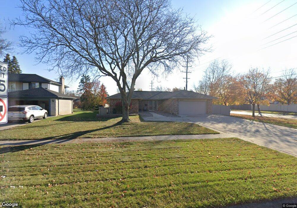
44387 Hanford Rd Canton, MI 48187
Estimated Value: $330,000 - $375,952
3
Beds
2
Baths
1,488
Sq Ft
$241/Sq Ft
Est. Value
About This Home
This home is located at 44387 Hanford Rd, Canton, MI 48187 and is currently estimated at $358,238, approximately $240 per square foot. 44387 Hanford Rd is a home located in Wayne County with nearby schools including Canton High School, Discovery Middle School, and Salem High School.
Ownership History
Date
Name
Owned For
Owner Type
Purchase Details
Closed on
Jul 8, 2014
Sold by
Ascencio Ralph and Ascencio Patricia
Bought by
Arold Kristopher
Current Estimated Value
Home Financials for this Owner
Home Financials are based on the most recent Mortgage that was taken out on this home.
Original Mortgage
$144,128
Outstanding Balance
$44,294
Interest Rate
3.5%
Mortgage Type
FHA
Estimated Equity
$313,944
Purchase Details
Closed on
May 16, 2005
Sold by
Lashbrook Leah
Bought by
Ascencio Ralph
Purchase Details
Closed on
Mar 15, 2005
Sold by
Riley Gregory E and Estate Of Floyd Riley
Bought by
Lashbrook Leah
Purchase Details
Closed on
Dec 23, 2004
Sold by
Riley Floyd and Riley Ann
Bought by
Keybank Na
Purchase Details
Closed on
Feb 10, 2004
Sold by
Ascencio Ralph and Ascencio Patricia
Bought by
Arold Kristopher
Create a Home Valuation Report for This Property
The Home Valuation Report is an in-depth analysis detailing your home's value as well as a comparison with similar homes in the area
Home Values in the Area
Average Home Value in this Area
Purchase History
| Date | Buyer | Sale Price | Title Company |
|---|---|---|---|
| Arold Kristopher | $157,900 | Fatic | |
| Ascencio Ralph | $152,500 | Metropolitan Title Exchange | |
| Lashbrook Leah | $120,000 | Multiple | |
| Keybank Na | $70,837 | -- | |
| Arold Kristopher | -- | None Available |
Source: Public Records
Mortgage History
| Date | Status | Borrower | Loan Amount |
|---|---|---|---|
| Open | Arold Kristopher | $144,128 |
Source: Public Records
Tax History Compared to Growth
Tax History
| Year | Tax Paid | Tax Assessment Tax Assessment Total Assessment is a certain percentage of the fair market value that is determined by local assessors to be the total taxable value of land and additions on the property. | Land | Improvement |
|---|---|---|---|---|
| 2025 | $1,679 | $174,300 | $0 | $0 |
| 2024 | $1,679 | $165,300 | $0 | $0 |
| 2023 | $1,601 | $137,500 | $0 | $0 |
| 2022 | $3,626 | $127,300 | $0 | $0 |
| 2021 | $3,513 | $123,900 | $0 | $0 |
| 2020 | $3,459 | $116,900 | $0 | $0 |
| 2019 | $3,398 | $111,860 | $0 | $0 |
| 2018 | $1,361 | $100,680 | $0 | $0 |
| 2017 | $3,603 | $99,600 | $0 | $0 |
| 2016 | $3,120 | $96,000 | $0 | $0 |
| 2015 | $7,476 | $87,390 | $0 | $0 |
| 2013 | $7,243 | $77,320 | $0 | $0 |
| 2010 | -- | $73,870 | $37,989 | $35,881 |
Source: Public Records
Map
Nearby Homes
- 6171 Gloucester Dr
- 44018 Bannockburn Dr
- 835 Coldrose Way
- 44585 Nantucket Dr
- 44661 Jeffrey Cir
- 43875 Leeann Ln
- 43706 Westminister Way
- 43737 Westminister Way
- 6832 New Providence Way Unit 1007
- 6972 Harvard Ln
- 6986 Harvard Ln Unit 129
- 43625 Westminister Way
- 43530 Westminister Way
- 6011 Beaufort Dr
- 6877 Pittsford St
- 45139 Indian Creek Dr
- 44409 Newburyport Dr Unit 133
- 43168 Hanford Rd
- 6514 Carriage Hills Dr
- 50782 Ross St
- 44371 Hanford Rd
- 6251 Botsford Ct
- 44355 Hanford Rd
- 44409 Hanford Rd
- 47559 Ellery Ln
- 49551 Shoreline
- 7050 Shelley Ln
- 49525 Shoreline
- 49991 Ocean Dr
- 47514 Ellery Ln
- 47479 Ellery Ln
- 49416 Shoreline Dr
- 49499 Shoreline
- 49917 Ocean Dr Unit Bldg-Unit
- 50015 Ocean Dr Unit Bldg-Unit
- 49499 Shoreline Unit Bldg-Unit
- 990 Backshore Dr Unit Bldg-Unit
- 47527 Ellery Ln Unit Bldg-Unit
- 47463 Ellery Ln Unit Bldg-Unit
- 47415 Ellery Ln Unit Bldg-Unit