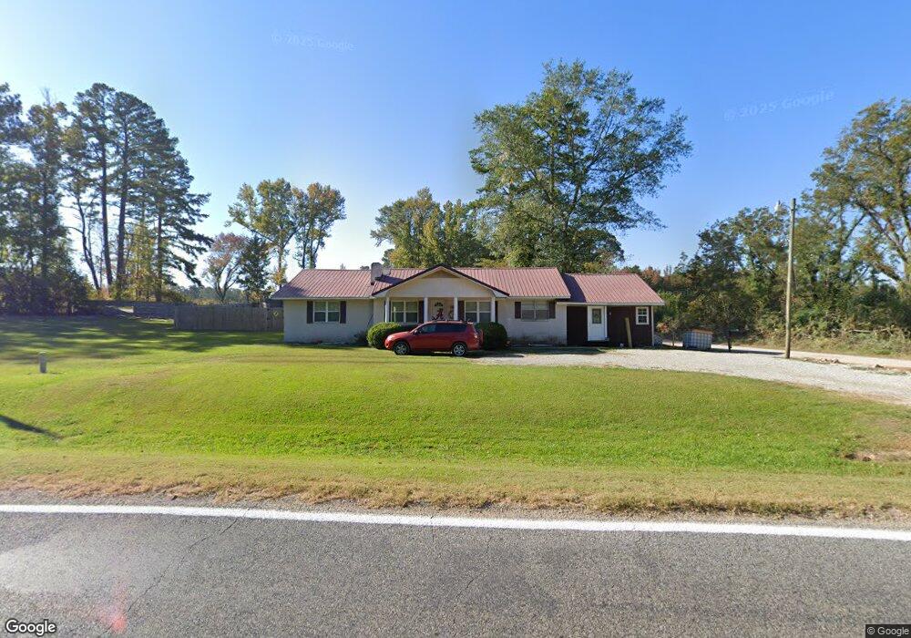
4439 Highway 494 Little Rock, MS 39337
Estimated Value: $117,384 - $166,000
--
Bed
2
Baths
1,835
Sq Ft
$75/Sq Ft
Est. Value
About This Home
This home is located at 4439 Highway 494, Little Rock, MS 39337 and is currently estimated at $137,795, approximately $75 per square foot. 4439 Highway 494 is a home located in Newton County with nearby schools including Newton County Elementary School and Newton County High School.
Ownership History
Date
Name
Owned For
Owner Type
Purchase Details
Closed on
Nov 17, 2014
Sold by
Williams Ralin and Williams Maske
Bought by
Maske James Austin and Maske Hannah Marie
Current Estimated Value
Home Financials for this Owner
Home Financials are based on the most recent Mortgage that was taken out on this home.
Original Mortgage
$75,264
Outstanding Balance
$57,655
Interest Rate
4%
Mortgage Type
New Conventional
Estimated Equity
$80,140
Purchase Details
Closed on
Mar 21, 2013
Sold by
Federal Home Loan Mortgage Corporation
Bought by
Williams Ralin and Williams Megan
Home Financials for this Owner
Home Financials are based on the most recent Mortgage that was taken out on this home.
Original Mortgage
$38,601
Interest Rate
3.65%
Purchase Details
Closed on
Feb 23, 2007
Sold by
Williams Wes Lamar and Williams Tina Ann
Bought by
Roberson Jason T and Roberson Kristina A
Home Financials for this Owner
Home Financials are based on the most recent Mortgage that was taken out on this home.
Original Mortgage
$67,200
Interest Rate
6.17%
Create a Home Valuation Report for This Property
The Home Valuation Report is an in-depth analysis detailing your home's value as well as a comparison with similar homes in the area
Home Values in the Area
Average Home Value in this Area
Purchase History
| Date | Buyer | Sale Price | Title Company |
|---|---|---|---|
| Maske James Austin | -- | -- | |
| Williams Ralin | -- | -- | |
| Roberson Jason T | -- | -- |
Source: Public Records
Mortgage History
| Date | Status | Borrower | Loan Amount |
|---|---|---|---|
| Open | Maske James Austin | $75,264 | |
| Previous Owner | Williams Ralin | $38,601 | |
| Previous Owner | Roberson Jason T | $67,200 |
Source: Public Records
Tax History Compared to Growth
Tax History
| Year | Tax Paid | Tax Assessment Tax Assessment Total Assessment is a certain percentage of the fair market value that is determined by local assessors to be the total taxable value of land and additions on the property. | Land | Improvement |
|---|---|---|---|---|
| 2024 | $651 | $7,887 | $0 | $0 |
| 2023 | $636 | $7,887 | $0 | $0 |
| 2022 | $619 | $7,846 | $0 | $0 |
| 2021 | $572 | $7,346 | $0 | $0 |
| 2020 | $572 | $7,346 | $0 | $0 |
| 2019 | $577 | $7,346 | $0 | $0 |
| 2018 | $531 | $7,176 | $0 | $0 |
| 2017 | $494 | $6,810 | $0 | $0 |
| 2016 | $486 | $6,810 | $0 | $0 |
| 2015 | -- | $6,810 | $0 | $0 |
| 2014 | -- | $6,299 | $0 | $0 |
Source: Public Records
Map
Nearby Homes
- 4188 Greenland Rd
- 1421 Chesney Town Rd
- 0 Little Rock County Line Rd
- 8976 Mississippi 494
- 0 Mississippi 15
- 704 E Jackson Rd
- 702 E Jackson Rd
- 18159 Hwy 15
- 18159 Mississippi 15
- 309 Conehatta Rd
- 408 North St
- 0 North St
- 0 Stratton Rd
- 26 Lakeview Dr
- 0 Lakeview Dr
- 0 Road 270
- 1873 E L Johnson Rd
- 0 Newton Martin Rd
- 66 Pete Freeman Rd
- 13068 Newton County Martin Rd
- 2430 Eshee Rd
- 4378 Highway 494
- 4648 Highway 494
- 4674 Highway 494
- 4270 Highway 494
- 4114 Highway 494
- 7466 Little Rock Decatur Rd
- 4840 Highway 494
- 7242 Little Rock Decatur Rd
- 4880 Highway 494
- 7195 Little Rock Decatur Rd
- 7140 Little Rock Decatur Rd
- 3923 Highway 494
- 5177 Greenland Rd
- 4959 Highway 494
- 4940 Highway 494
- 4960 Highway 494
- 7231 Little Rock Decatur Rd
- 16130 Hickory Little Rock Rd
- 7123 Little Rock Decatur Rd