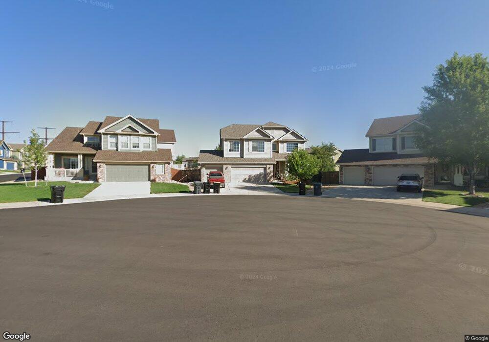
444 High Plains St Castle Rock, CO 80104
Founders Village NeighborhoodEstimated Value: $609,000 - $630,000
4
Beds
3
Baths
2,539
Sq Ft
$245/Sq Ft
Est. Value
About This Home
This home is located at 444 High Plains St, Castle Rock, CO 80104 and is currently estimated at $623,267, approximately $245 per square foot. 444 High Plains St is a home located in Douglas County with nearby schools including Flagstone Elementary School, Mesa Middle School, and Douglas County High School.
Ownership History
Date
Name
Owned For
Owner Type
Purchase Details
Closed on
Oct 28, 2025
Sold by
Public Trustee In And For The County Of
Bought by
Ent Credit Union
Current Estimated Value
Purchase Details
Closed on
Nov 22, 2005
Sold by
Engle Homes Colorado
Bought by
Amescua Jose L and Sanchez Amescua Maria D
Home Financials for this Owner
Home Financials are based on the most recent Mortgage that was taken out on this home.
Original Mortgage
$278,535
Interest Rate
6.06%
Mortgage Type
Fannie Mae Freddie Mac
Create a Home Valuation Report for This Property
The Home Valuation Report is an in-depth analysis detailing your home's value as well as a comparison with similar homes in the area
Home Values in the Area
Average Home Value in this Area
Purchase History
| Date | Buyer | Sale Price | Title Company |
|---|---|---|---|
| Ent Credit Union | -- | None Listed On Document | |
| Ent Credit Union | -- | None Listed On Document | |
| Amescua Jose L | $348,200 | -- |
Source: Public Records
Mortgage History
| Date | Status | Borrower | Loan Amount |
|---|---|---|---|
| Previous Owner | Amescua Jose L | $278,535 |
Source: Public Records
Tax History Compared to Growth
Tax History
| Year | Tax Paid | Tax Assessment Tax Assessment Total Assessment is a certain percentage of the fair market value that is determined by local assessors to be the total taxable value of land and additions on the property. | Land | Improvement |
|---|---|---|---|---|
| 2024 | $6,656 | $44,210 | $9,960 | $34,250 |
| 2023 | $6,695 | $44,210 | $9,960 | $34,250 |
| 2022 | $4,881 | $30,830 | $7,190 | $23,640 |
| 2021 | $4,973 | $30,830 | $7,190 | $23,640 |
| 2020 | $4,714 | $30,090 | $6,000 | $24,090 |
| 2019 | $4,717 | $30,090 | $6,000 | $24,090 |
| 2018 | $4,245 | $26,880 | $4,600 | $22,280 |
| 2017 | $4,087 | $26,880 | $4,600 | $22,280 |
| 2016 | $3,444 | $23,650 | $4,310 | $19,340 |
| 2015 | $3,488 | $23,650 | $4,310 | $19,340 |
| 2014 | $3,151 | $20,510 | $3,420 | $17,090 |
Source: Public Records
Map
Nearby Homes
- 5282 Devon Ave
- 5391 E Kensington Ave
- 157 S Quicksilver Ave
- 5181 Devon Ave
- 5864 Turnstone Place
- 596 S Lindsey St
- 5931 Wescroft Ave
- 510 Fairhaven St
- 630 Fairhaven St
- 176 S Pembrook St
- 5230 E Kensington Ave
- 109 N Quicksilver Ave
- 5323 E Sandpiper Ave
- 6110 Raleigh Cir
- 5839 Raleigh Cir
- 1037 Rosedale Ct
- 5326 E Howe St
- 364 N Willow St
- 5428 Suffolk Ave
- 330 N Wagonwheel Trail
- 428 High Plains St
- 412 High Plains St
- 460 High Plains St
- 396 High Plains St
- 476 High Plains St
- 345 S Cherry St
- 415 High Plains St
- 399 High Plains St
- 383 High Plains St
- 367 High Plains St
- 351 High Plains St
- 278 Laramie Ct
- 335 High Plains St
- 262 Laramie Ct
- 319 High Plains St
- 246 Laramie Ct
- 303 High Plains St
- 248 High Plains St
- 228 Laramie Ct
- 232 High Plains St