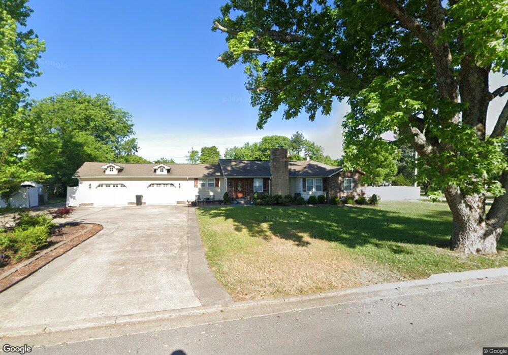
444 High Point Rd Clarksville, TN 37042
Estimated Value: $321,000 - $385,473
--
Bed
2
Baths
2,356
Sq Ft
$150/Sq Ft
Est. Value
About This Home
This home is located at 444 High Point Rd, Clarksville, TN 37042 and is currently estimated at $352,868, approximately $149 per square foot. 444 High Point Rd is a home located in Montgomery County with nearby schools including Liberty Elementary School, New Providence Middle School, and Northwest High School.
Ownership History
Date
Name
Owned For
Owner Type
Purchase Details
Closed on
Dec 22, 2010
Sold by
Pelham James C
Bought by
Mayes George T
Current Estimated Value
Home Financials for this Owner
Home Financials are based on the most recent Mortgage that was taken out on this home.
Original Mortgage
$172,000
Outstanding Balance
$117,451
Interest Rate
4.4%
Estimated Equity
$235,417
Purchase Details
Closed on
Nov 5, 2009
Sold by
Pensco Co Custodian
Bought by
Pelham James C
Purchase Details
Closed on
Feb 12, 2004
Sold by
Wells Fargo Home Mortgage
Bought by
Andrew Milutin
Purchase Details
Closed on
Feb 11, 2004
Sold by
Wells Fargo Home Mortgage
Bought by
Andrew Milutin
Purchase Details
Closed on
May 27, 2003
Sold by
Etal Morrison John A
Bought by
Wells Fargo Home Mortgage
Purchase Details
Closed on
Jan 13, 1995
Sold by
Morrison Harry J
Bought by
Arthur Morrison John
Create a Home Valuation Report for This Property
The Home Valuation Report is an in-depth analysis detailing your home's value as well as a comparison with similar homes in the area
Home Values in the Area
Average Home Value in this Area
Purchase History
| Date | Buyer | Sale Price | Title Company |
|---|---|---|---|
| Mayes George T | $172,000 | -- | |
| Pelham James C | $13,000 | -- | |
| Andrew Milutin | $31,900 | -- | |
| Andrew Milutin | $31,900 | -- | |
| Wells Fargo Home Mortgage | $59,000 | -- | |
| Arthur Morrison John | -- | -- |
Source: Public Records
Mortgage History
| Date | Status | Borrower | Loan Amount |
|---|---|---|---|
| Open | Mayes George T | $172,000 |
Source: Public Records
Tax History Compared to Growth
Tax History
| Year | Tax Paid | Tax Assessment Tax Assessment Total Assessment is a certain percentage of the fair market value that is determined by local assessors to be the total taxable value of land and additions on the property. | Land | Improvement |
|---|---|---|---|---|
| 2024 | $3,041 | $102,050 | $0 | $0 |
| 2023 | $3,041 | $57,300 | $0 | $0 |
| 2022 | $2,418 | $57,300 | $0 | $0 |
| 2021 | $2,418 | $57,300 | $0 | $0 |
| 2020 | $2,303 | $57,300 | $0 | $0 |
| 2019 | $2,303 | $57,300 | $0 | $0 |
| 2018 | $1,956 | $22,250 | $0 | $0 |
| 2017 | $563 | $45,375 | $0 | $0 |
| 2016 | $1,393 | $45,375 | $0 | $0 |
| 2015 | $1,393 | $45,375 | $0 | $0 |
| 2014 | $1,887 | $45,375 | $0 | $0 |
| 2013 | $1,668 | $38,075 | $0 | $0 |
Source: Public Records
Map
Nearby Homes
- 2079 Skyview Cir
- 2065 Lintwood Dr
- 504 Linda Ln
- 583 Orman Dr
- 534 Dover Rd
- 638 Linda Ln
- 2042 Lintwood Dr
- 586 Somerset Ln
- 508 Woodtrace Dr
- 578 Cabot Cove
- 576 Cabot Cove
- 547 Woodtrace Dr
- 503 Aurelia Lynn Dr
- 513 Aurelia Lynn Dr
- 640 Wolfchase Dr
- 628 Wolfchase Dr
- 430 Woodtrace Dr
- 567 Matthew Ct
- 1 Dotsonville Rd
- 652 Deer Ridge Dr
- 450 High Point Rd
- 4 Mississippi Ave
- 505 Alabama Ave
- 438 High Point Rd
- 503 Alabama Ave
- 1 Mississippi Ave
- 447 High Point Rd
- 443 High Point Rd
- 449 High Point Rd
- 451 High Point Rd
- 3 Mississippi Ave
- 501 Alabama Ave
- 2090 Skyview Cir
- 434 High Point Rd
- 6 Mississippi Ave
- 439 Alabama Ave
- 439 High Point Rd
- 574 Kentucky Ave
- 454 High Point Rd
- 2088 Skyview Cir