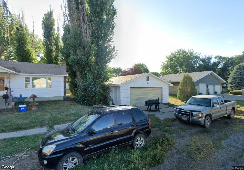
444 N 6th Ave Forsyth, MT 59327
Estimated Value: $375,000 - $403,075
4
Beds
3
Baths
3,366
Sq Ft
$116/Sq Ft
Est. Value
About This Home
This home is located at 444 N 6th Ave, Forsyth, MT 59327 and is currently estimated at $389,038, approximately $115 per square foot. 444 N 6th Ave is a home with nearby schools including Forsyth Elementary School, Forsyth Junior High School, and Forsyth High School.
Ownership History
Date
Name
Owned For
Owner Type
Purchase Details
Closed on
Nov 17, 2021
Sold by
Batey Charolais Inc
Bought by
Lebie Cynthia
Current Estimated Value
Home Financials for this Owner
Home Financials are based on the most recent Mortgage that was taken out on this home.
Original Mortgage
$249,496
Interest Rate
2.36%
Mortgage Type
New Conventional
Purchase Details
Closed on
Jan 15, 2007
Sold by
Batey Ray R and Batey Thaida E
Bought by
Batey Charolais Inc
Create a Home Valuation Report for This Property
The Home Valuation Report is an in-depth analysis detailing your home's value as well as a comparison with similar homes in the area
Home Values in the Area
Average Home Value in this Area
Purchase History
| Date | Buyer | Sale Price | Title Company |
|---|---|---|---|
| Lebie Cynthia | $311,870 | Attorney Only | |
| Batey Charolais Inc | -- | -- |
Source: Public Records
Mortgage History
| Date | Status | Borrower | Loan Amount |
|---|---|---|---|
| Closed | Lebie Cynthia | $249,496 |
Source: Public Records
Tax History Compared to Growth
Tax History
| Year | Tax Paid | Tax Assessment Tax Assessment Total Assessment is a certain percentage of the fair market value that is determined by local assessors to be the total taxable value of land and additions on the property. | Land | Improvement |
|---|---|---|---|---|
| 2025 | $3,051 | $384,500 | $0 | $0 |
| 2024 | $3,896 | $328,800 | $0 | $0 |
| 2023 | $3,678 | $328,800 | $0 | $0 |
| 2022 | $3,299 | $285,000 | $0 | $0 |
| 2021 | $2,584 | $285,000 | $0 | $0 |
| 2020 | $3,813 | $379,371 | $0 | $0 |
| 2019 | $3,672 | $379,371 | $0 | $0 |
| 2018 | $4,125 | $427,040 | $0 | $0 |
| 2017 | $3,588 | $427,040 | $0 | $0 |
| 2016 | $3,916 | $421,800 | $0 | $0 |
| 2015 | $3,839 | $421,800 | $0 | $0 |
| 2014 | $2,900 | $181,745 | $0 | $0 |
Source: Public Records
Map
Nearby Homes