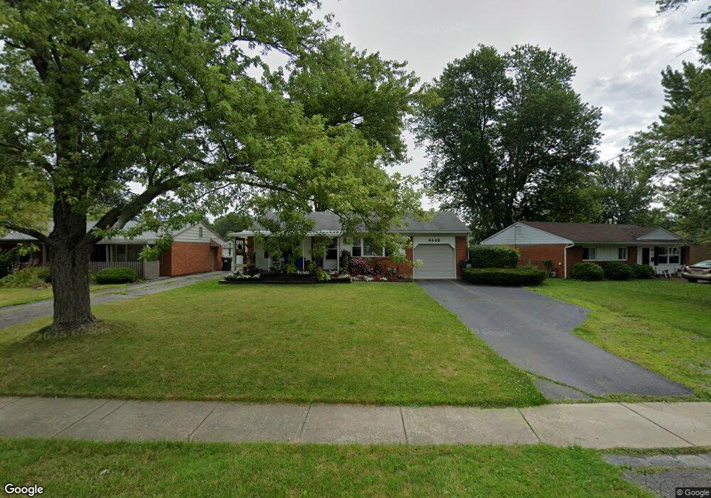
4442 Burkey Rd Youngstown, OH 44515
Austintown NeighborhoodEstimated Value: $131,000 - $155,567
3
Beds
1
Bath
912
Sq Ft
$159/Sq Ft
Est. Value
About This Home
This home is located at 4442 Burkey Rd, Youngstown, OH 44515 and is currently estimated at $144,892, approximately $158 per square foot. 4442 Burkey Rd is a home located in Mahoning County with nearby schools including Austintown Elementary School, Austintown Intermediate School, and Austintown Middle School.
Ownership History
Date
Name
Owned For
Owner Type
Purchase Details
Closed on
Aug 20, 2013
Sold by
Gora Rhonda G
Bought by
Hager Amy L
Current Estimated Value
Home Financials for this Owner
Home Financials are based on the most recent Mortgage that was taken out on this home.
Original Mortgage
$50,076
Outstanding Balance
$37,319
Interest Rate
4.75%
Mortgage Type
FHA
Estimated Equity
$107,573
Purchase Details
Closed on
Jun 7, 2012
Bought by
Amy L Hager
Purchase Details
Closed on
Nov 16, 1992
Sold by
Gora Rhonda G
Bought by
Ralph Gertrude L
Create a Home Valuation Report for This Property
The Home Valuation Report is an in-depth analysis detailing your home's value as well as a comparison with similar homes in the area
Home Values in the Area
Average Home Value in this Area
Purchase History
We collect this data history from publicly available records. To have your information removed, we recommend requesting removal directly through your county’s website.
| Date | Buyer | Sale Price | Title Company |
|---|---|---|---|
| Hager Amy L | $57,000 | Attorney | |
| Amy L Hager | -- | -- | |
| Ralph Gertrude L | -- | -- |
Source: Public Records
Mortgage History
We collect this data history from publicly available records. To have your information removed, we recommend requesting removal directly through your county’s website.
| Date | Status | Borrower | Loan Amount |
|---|---|---|---|
| Open | Hager Amy L | $50,076 |
Source: Public Records
Tax History
| Year | Tax Paid | Tax Assessment Tax Assessment Total Assessment is a certain percentage of the fair market value that is determined by local assessors to be the total taxable value of land and additions on the property. | Land | Improvement |
|---|---|---|---|---|
| 2025 | $1,887 | $39,070 | $6,700 | $32,370 |
| 2024 | $1,803 | $39,070 | $6,700 | $32,370 |
| 2023 | $1,772 | $39,070 | $6,700 | $32,370 |
| 2022 | $1,363 | $24,080 | $5,370 | $18,710 |
| 2021 | $1,365 | $24,080 | $5,370 | $18,710 |
| 2020 | $1,358 | $23,870 | $5,370 | $18,500 |
| 2019 | $1,254 | $19,900 | $4,480 | $15,420 |
| 2018 | $1,208 | $19,900 | $4,480 | $15,420 |
| 2017 | $1,196 | $19,900 | $4,480 | $15,420 |
| 2016 | $1,480 | $24,440 | $6,160 | $18,280 |
| 2015 | $1,436 | $24,440 | $6,160 | $18,280 |
| 2014 | $1,442 | $24,440 | $6,160 | $18,280 |
| 2013 | $1,426 | $24,440 | $6,160 | $18,280 |
Source: Public Records
Map
Nearby Homes
- 4445 Burkey Rd
- 4463 Nantucket Dr
- 4365 Burkey Rd
- 4226 Burkey Rd
- 406 S Raccoon Rd
- 425 Southward Dr
- 4138 Burkey Rd
- 431 Westgate Blvd
- 4102 Burkey Rd
- 4230 Selkirk Ave
- 3955 Dunbar St
- 252 Parkgate Ave
- 4829 New Rd
- 1281 Signature Dr
- 4617 Crabwood Dr
- 4259 Carlisle Ave
- 4285 Kerrybrook Dr
- 221 Parkgate Ave
- 533 Forest Hill Dr
- 4266 Sprucewood Dr
- 4446 Burkey Rd
- 4438 Burkey Rd
- 4434 Burkey Rd
- 4450 Burkey Rd
- 4430 Burkey Rd
- 4454 Burkey Rd
- 4449 Burkey Rd
- 4457 Burkey Rd
- 4426 Burkey Rd
- 4441 Burkey Rd
- 4461 Burkey Rd
- 4458 Burkey Rd
- 4437 Burkey Rd
- 4422 Burkey Rd
- 4433 Burkey Rd
- 4429 Burkey Rd
- 4462 Burkey Rd
- 4418 Burkey Rd
- 1235 Woodhurst Dr
- 1243 Woodhurst Dr
Your Personal Tour Guide
Ask me questions while you tour the home.