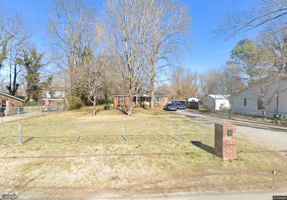
445 Forrest St Murfreesboro, TN 37130
Estimated Value: $274,000 - $405,000
Studio
2
Baths
1,731
Sq Ft
$195/Sq Ft
Est. Value
About This Home
This home is located at 445 Forrest St, Murfreesboro, TN 37130 and is currently estimated at $338,406, approximately $195 per square foot. 445 Forrest St is a home located in Rutherford County with nearby schools including Mitchell-Neilson Elementary, Siegel Middle School, and Siegel High School.
Ownership History
Date
Name
Owned For
Owner Type
Purchase Details
Closed on
Aug 8, 2002
Sold by
Bank Of New York Tr
Bought by
Travis Lytle
Current Estimated Value
Home Financials for this Owner
Home Financials are based on the most recent Mortgage that was taken out on this home.
Original Mortgage
$58,700
Outstanding Balance
$24,786
Interest Rate
6.52%
Estimated Equity
$313,620
Purchase Details
Closed on
Dec 11, 2001
Sold by
Sneed James E and Sneed Connie J
Bought by
Bank Of New York Tr
Purchase Details
Closed on
Nov 14, 2001
Sold by
Sneed James E and Sneed Connie
Bought by
Bank Of New York
Create a Home Valuation Report for This Property
The Home Valuation Report is an in-depth analysis detailing your home's value as well as a comparison with similar homes in the area
Home Values in the Area
Average Home Value in this Area
Purchase History
| Date | Buyer | Sale Price | Title Company |
|---|---|---|---|
| Travis Lytle | $58,710 | -- | |
| Bank Of New York Tr | $59,625 | -- | |
| Bank Of New York | $59,625 | -- |
Source: Public Records
Mortgage History
| Date | Status | Borrower | Loan Amount |
|---|---|---|---|
| Open | Bank Of New York | $58,700 |
Source: Public Records
Tax History
| Year | Tax Paid | Tax Assessment Tax Assessment Total Assessment is a certain percentage of the fair market value that is determined by local assessors to be the total taxable value of land and additions on the property. | Land | Improvement |
|---|---|---|---|---|
| 2025 | $1,776 | $62,775 | $13,750 | $49,025 |
| 2024 | $1,776 | $62,775 | $13,750 | $49,025 |
| 2023 | $1,178 | $62,775 | $13,750 | $49,025 |
| 2022 | $1,015 | $62,775 | $13,750 | $49,025 |
| 2021 | $833 | $37,550 | $7,500 | $30,050 |
| 2020 | $833 | $37,550 | $7,500 | $30,050 |
| 2019 | $833 | $37,550 | $7,500 | $30,050 |
| 2018 | $1,144 | $37,550 | $0 | $0 |
| 2017 | $1,034 | $26,600 | $0 | $0 |
| 2016 | $1,034 | $26,600 | $0 | $0 |
| 2015 | $1,034 | $26,600 | $0 | $0 |
| 2014 | $661 | $26,600 | $0 | $0 |
| 2013 | -- | $23,325 | $0 | $0 |
Source: Public Records
Map
Nearby Homes
- 725 N Highland Ave
- 805 N Highland Ave
- 445 Jackson St
- 638 N Academy St Unit 640
- 422 N Academy St
- 412 N Church St
- 520 N Maple St Unit 3
- 520 N Maple St Unit 2
- 520 N Maple St Unit 1
- 225 N Academy St
- 807 N Maple St
- 812 Greenland Dr
- 904 N Maple St
- 1212 N Spring St
- 513 N Maple St
- 801 E Burton St
- 730 E Burton St
- 613 Fairview Ave
- 121 Gayle Ln
- 920 Ewing Blvd
- 453 Forrest St
- 439 Forrest St
- 433 Forrest St
- 716 Lee St
- 718 Lee St
- 707 N Highland Ave
- 457 Forrest St Unit 459
- 715 N Highland Ave
- 444 Forrest St
- 724 Lee St
- 450 Forrest St
- 442 Forrest St
- 711 N Highland Ave
- 454 Forrest St
- 616 Lee St
- 709 N Highland Ave
- 726 Lee St
- 429 Forrest St
- 715 Lee St
- 444 Evergreen St
Your Personal Tour Guide
Ask me questions while you tour the home.