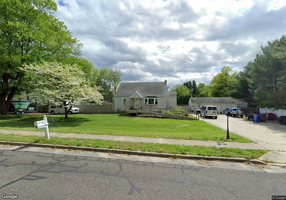
445 Jessup Mill Rd Mantua, NJ 08051
Mantua Township NeighborhoodEstimated Value: $310,000 - $361,000
3
Beds
1
Bath
1,189
Sq Ft
$282/Sq Ft
Est. Value
About This Home
This home is located at 445 Jessup Mill Rd, Mantua, NJ 08051 and is currently estimated at $335,840, approximately $282 per square foot. 445 Jessup Mill Rd is a home located in Gloucester County with nearby schools including Centre City School, Clearview Regional Middle School, and Clearview Regional High School.
Ownership History
Date
Name
Owned For
Owner Type
Purchase Details
Closed on
Sep 4, 2013
Sold by
Hoose Gerald K
Bought by
Hoose Gerald K and Hoose Maryann
Current Estimated Value
Purchase Details
Closed on
Aug 30, 2013
Sold by
Hoose Gerald Kenneth
Bought by
Hoose Gerald Kinney and Hoose Maryann
Purchase Details
Closed on
May 21, 2012
Sold by
Hoose Kelly A
Bought by
Hoose Gerald K
Purchase Details
Closed on
May 11, 1995
Sold by
Blemings William P and Blemings Emory N
Bought by
Blemings Kelly A and Hoose Gerald K
Create a Home Valuation Report for This Property
The Home Valuation Report is an in-depth analysis detailing your home's value as well as a comparison with similar homes in the area
Home Values in the Area
Average Home Value in this Area
Purchase History
| Date | Buyer | Sale Price | Title Company |
|---|---|---|---|
| Hoose Gerald K | $160,000 | -- | |
| Hoose Gerald Kinney | $160,000 | -- | |
| Hoose Gerald K | -- | None Available | |
| Blemings Kelly A | $70,000 | Pilgrim Title Agency |
Source: Public Records
Tax History Compared to Growth
Tax History
| Year | Tax Paid | Tax Assessment Tax Assessment Total Assessment is a certain percentage of the fair market value that is determined by local assessors to be the total taxable value of land and additions on the property. | Land | Improvement |
|---|---|---|---|---|
| 2025 | $5,717 | $222,000 | $78,700 | $143,300 |
| 2024 | $5,657 | $222,000 | $78,700 | $143,300 |
| 2023 | $5,657 | $222,000 | $78,700 | $143,300 |
| 2022 | $5,464 | $156,200 | $64,800 | $91,400 |
| 2021 | $5,504 | $156,200 | $64,800 | $91,400 |
| 2020 | $5,461 | $156,200 | $64,800 | $91,400 |
| 2019 | $5,369 | $156,200 | $64,800 | $91,400 |
| 2018 | $5,292 | $156,200 | $64,800 | $91,400 |
| 2017 | $5,212 | $156,200 | $64,800 | $91,400 |
| 2016 | $5,153 | $156,200 | $64,800 | $91,400 |
| 2015 | $5,027 | $156,200 | $64,800 | $91,400 |
| 2014 | $4,858 | $156,200 | $64,800 | $91,400 |
Source: Public Records
Map
Nearby Homes
- 190 Mockingbird Ln
- 155 Whippoorwill Way
- 36 Bluebird Rd
- 485 Harrison Ave
- 204 W Landing Rd
- 261 Tony Cir
- 131 Firth Dr
- 590 Bridgeton Pike
- 19 Marathon Dr
- 106 Firth Dr
- 205 Redbud Ln Unit 205
- 1433 Tristram Cir
- 26 Woodstream Ct
- 27 Kristen Ln
- 465 Berkley Rd
- 325 Bridgeton Pike
- 433 Berkley Rd
- 119 Monroe Ave
- 1147 Tristram Cir Unit 1147
- 1145 Tristram Cir
- 21 Arena St
- 5 Boxwood Ct
- 20 Arena St
- 3 Boxwood Ct
- 16 Arena St
- 19 Arena St
- 61 Meadowlark Ave
- 50 Meadowlark Ave
- 53 Meadowlark Ave
- 42 Meadowlark Ave
- 57 Meadowlark Ave
- 60 Meadowlark Ave
- 43 Meadowlark Ave
- 58 Meadowlark Ave
- 46 Meadowlark Ave
- 48 Meadowlark Ave
- 49 Meadowlark Ave
- 51 Meadowlark Ave
- 64 Meadowlark Ave