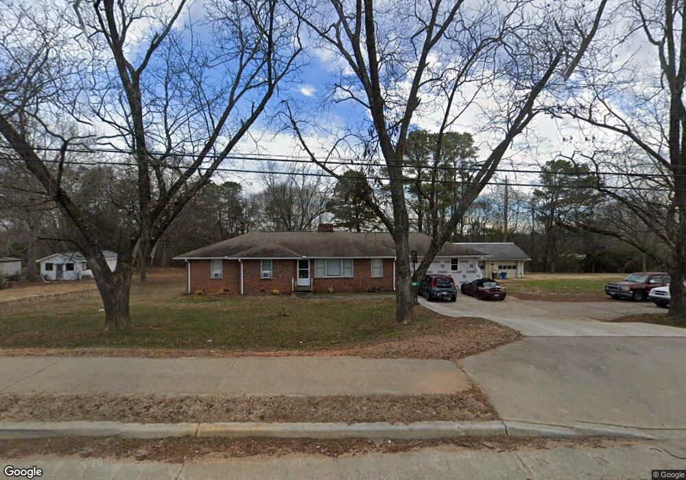
4451 Highway 17 Eastanollee, GA 30538
Estimated Value: $448,000 - $495,000
4
Beds
3
Baths
1,351
Sq Ft
$357/Sq Ft
Est. Value
About This Home
This home is located at 4451 Highway 17, Eastanollee, GA 30538 and is currently estimated at $482,071, approximately $356 per square foot. 4451 Highway 17 is a home located in Stephens County with nearby schools including Stephens County High School.
Ownership History
Date
Name
Owned For
Owner Type
Purchase Details
Closed on
May 15, 2020
Sold by
Rlw Hemphill Llc
Bought by
Thomas Edward H
Current Estimated Value
Home Financials for this Owner
Home Financials are based on the most recent Mortgage that was taken out on this home.
Original Mortgage
$114,880
Outstanding Balance
$101,800
Interest Rate
3.3%
Estimated Equity
$380,271
Purchase Details
Closed on
Oct 31, 2003
Bought by
<Buyer Info Not Present>
Purchase Details
Closed on
Sep 5, 2000
Bought by
<Buyer Info Not Present>
Purchase Details
Closed on
Aug 15, 2000
Bought by
Lee Street Properties Llp
Create a Home Valuation Report for This Property
The Home Valuation Report is an in-depth analysis detailing your home's value as well as a comparison with similar homes in the area
Home Values in the Area
Average Home Value in this Area
Purchase History
| Date | Buyer | Sale Price | Title Company |
|---|---|---|---|
| Thomas Edward H | $117,000 | -- | |
| <Buyer Info Not Present> | $178,000 | -- | |
| <Buyer Info Not Present> | $225,300 | -- | |
| Lee Street Properties Llp | $225,000 | -- |
Source: Public Records
Mortgage History
| Date | Status | Borrower | Loan Amount |
|---|---|---|---|
| Open | Thomas Edward H | $114,880 |
Source: Public Records
Tax History Compared to Growth
Tax History
| Year | Tax Paid | Tax Assessment Tax Assessment Total Assessment is a certain percentage of the fair market value that is determined by local assessors to be the total taxable value of land and additions on the property. | Land | Improvement |
|---|---|---|---|---|
| 2024 | $305 | $45,064 | $3,195 | $41,869 |
| 2023 | $216 | $42,139 | $3,195 | $38,944 |
| 2022 | $153 | $40,030 | $3,195 | $36,835 |
| 2021 | $1,154 | $36,888 | $3,195 | $33,693 |
| 2020 | $1,152 | $36,475 | $3,195 | $33,280 |
| 2019 | $931 | $29,358 | $3,043 | $26,315 |
| 2018 | $911 | $28,725 | $3,043 | $25,682 |
| 2017 | $925 | $28,725 | $3,043 | $25,682 |
| 2016 | $911 | $28,725 | $3,042 | $25,682 |
| 2015 | $940 | $28,307 | $3,042 | $25,264 |
| 2014 | $1,099 | $32,565 | $3,043 | $29,522 |
| 2013 | -- | $39,644 | $3,804 | $35,840 |
Source: Public Records
Map
Nearby Homes
- 54 Stonewood Forest Rd
- 3089 Georgia 17 Alternate
- 3013 Hwy 17 A
- 56 Crawford Manor Dr
- 672 Crawford Cir
- 7 Jottings Dr
- 151 Rock Creek Rd
- 0 Brookhaven Cir Unit 10616964
- 5.10 ACRES Hwy 123
- 17 Pinetree Rd
- 290 Indian Dr
- 160 Buena Vista Dr
- 535 Deer Chase
- 919 Deer Chase Rd
- 140 Julia Ct
- 136 Julia Ct
- 0 Switchback Run Unit 10437289
- 275 Southern Trace
- 255 Southern Trace
- 160 Oak Way Dr
- 4451 Highway 17
- 4451 Georgia 17 Unit 30-35-pt29
- 4444 Georgia 17 Unit 4.3AC
- 4444 Georgia 17
- 4513 Highway 17
- 4427 Highway 17
- 4444 Highway 17
- 4387 Highway 17
- 3842 Georgia 17
- 3814 Georgia 17
- 3016 Georgia 17
- 2692 Georgia 17
- 4339 Highway 17
- 4576 Highway 17
- 4576 Georgia 17
- 106 Sheltered Dr
- 130 Fieldcrest Dr
- 421 Fieldcrest Dr
- 231 Fieldcrest Dr
- 94 Meadowbrook Dr