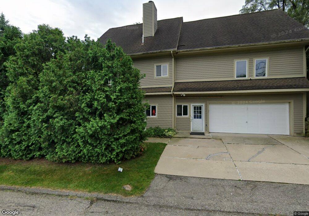
4454 Borland St West Bloomfield, MI 48323
West Bloomfield Township NeighborhoodEstimated Value: $428,664 - $578,000
3
Beds
2
Baths
2,514
Sq Ft
$199/Sq Ft
Est. Value
About This Home
This home is located at 4454 Borland St, West Bloomfield, MI 48323 and is currently estimated at $501,166, approximately $199 per square foot. 4454 Borland St is a home located in Oakland County with nearby schools including Walled Lake Central High School, The Susan And Rabbi Harold Loss Ecc, and Brookfield Academy - West Bloomfield.
Ownership History
Date
Name
Owned For
Owner Type
Purchase Details
Closed on
Feb 25, 2014
Sold by
Qonja Wadii Butros and Qonja Wadi Butros
Bought by
Qonja Wadii Butros
Current Estimated Value
Home Financials for this Owner
Home Financials are based on the most recent Mortgage that was taken out on this home.
Original Mortgage
$170,000
Outstanding Balance
$127,960
Interest Rate
4.39%
Mortgage Type
Credit Line Revolving
Estimated Equity
$373,206
Purchase Details
Closed on
Aug 17, 2010
Sold by
Johnson Lenore and Johnson David W
Bought by
Qonja Wadi Butros
Purchase Details
Closed on
Apr 8, 2003
Sold by
German Lenore
Bought by
Johnson David W and Germann Lenore
Purchase Details
Closed on
Sep 9, 1999
Sold by
Ebejer Peter J
Bought by
Germann Lenore
Purchase Details
Closed on
Feb 12, 1998
Sold by
Roy Donna T
Bought by
Ebejer Peter Jay
Create a Home Valuation Report for This Property
The Home Valuation Report is an in-depth analysis detailing your home's value as well as a comparison with similar homes in the area
Home Values in the Area
Average Home Value in this Area
Purchase History
| Date | Buyer | Sale Price | Title Company |
|---|---|---|---|
| Qonja Wadii Butros | -- | None Available | |
| Qonja Wadi Butros | $168,900 | Multiple | |
| Johnson David W | -- | Devon Title Agency | |
| Germann Lenore | $329,400 | -- | |
| Ebejer Peter Jay | -- | -- |
Source: Public Records
Mortgage History
| Date | Status | Borrower | Loan Amount |
|---|---|---|---|
| Open | Qonja Wadii Butros | $170,000 |
Source: Public Records
Tax History
| Year | Tax Paid | Tax Assessment Tax Assessment Total Assessment is a certain percentage of the fair market value that is determined by local assessors to be the total taxable value of land and additions on the property. | Land | Improvement |
|---|---|---|---|---|
| 2025 | $4,241 | $216,340 | $40,730 | $175,610 |
| 2024 | $2,453 | $196,820 | $0 | $0 |
| 2022 | $2,312 | $186,990 | $40,730 | $146,260 |
| 2021 | $3,771 | $179,000 | $0 | $0 |
| 2020 | $2,266 | $171,050 | $40,730 | $130,320 |
| 2018 | $3,671 | $137,470 | $40,730 | $96,740 |
| 2015 | -- | $114,650 | $0 | $0 |
| 2014 | -- | $105,070 | $0 | $0 |
| 2011 | -- | $93,060 | $0 | $0 |
Source: Public Records
Map
Nearby Homes
- 4405 Green Lake Rd
- 4383 Green Lake Rd
- 6980 Hambro St
- 4335 Crestdale Ave
- 6978 Colony Dr
- 3991 Fieldview Ave
- 3965 Carrick Ave
- 4765 Woodbine Cir
- 4212 Greendale Ave
- 6790 Grassland Ave
- 3765 Woodview Ave
- 7545/7585 Pontiac Trail
- 7585/7548 Pontiac Trail
- 6100 Pontiac Trail
- 6140 Pontiac Trail
- 3666 Walnut
- 5148 Woodrun Ct
- 3575 Knollview Ave
- 6018 Glen Eagles Dr
- 6885 Aeroview St
- 4466 Borland St
- 4442 Borland St
- 4461 Borland St
- 4459 Bethune Ct
- 4465 Bethune Ct
- 4490 Borland St
- 4481 Borland St
- 4485 Bethune Ct
- 4437 Borland St
- 6868 Renshaw St
- 4495 Bethune Ct
- 4495 Borland St
- 6858 Renshaw St
- 4410 Borland St
- 4415 Rolling Pine Dr
- 4409 Rolling Pine Dr
- 4510 Borland St
- 4425 Borland St
- 4515 Borland St
- 4460 Bethune Ct
Your Personal Tour Guide
Ask me questions while you tour the home.