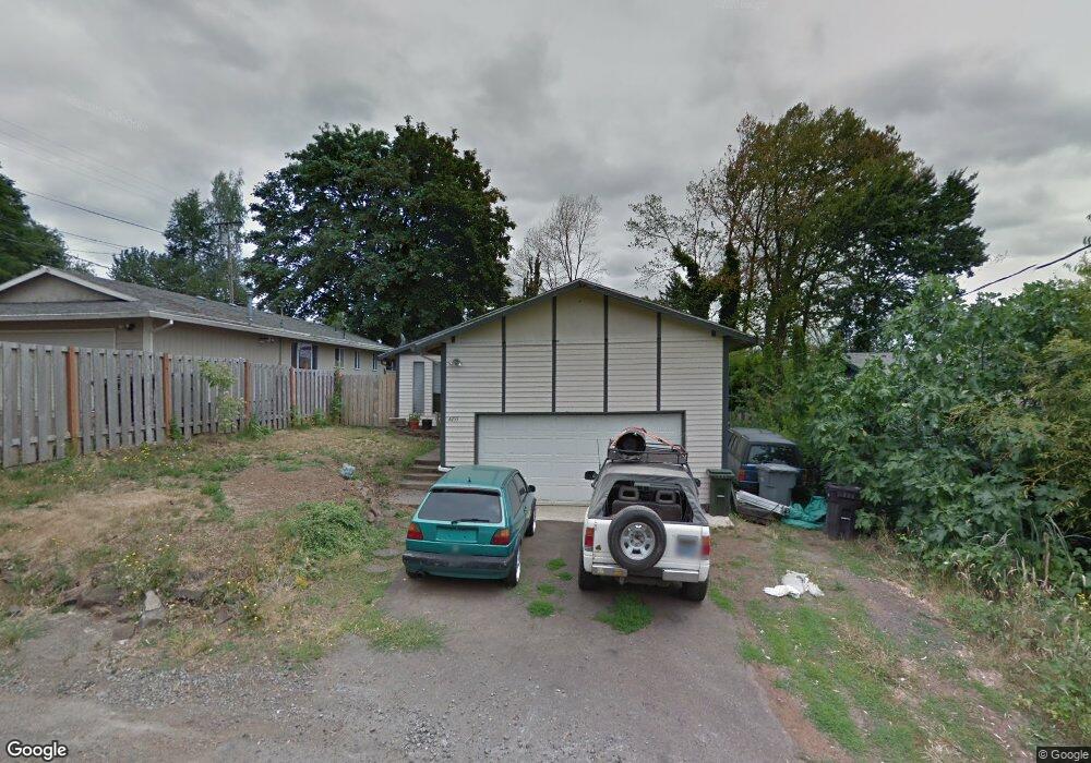
4455 Simpson St West Linn, OR 97068
Sunset NeighborhoodEstimated Value: $468,000 - $599,000
3
Beds
2
Baths
1,080
Sq Ft
$479/Sq Ft
Est. Value
About This Home
This home is located at 4455 Simpson St, West Linn, OR 97068 and is currently estimated at $517,828, approximately $479 per square foot. 4455 Simpson St is a home located in Clackamas County with nearby schools including Sunset Primary School, Rosemont Ridge Middle School, and West Linn High School.
Ownership History
Date
Name
Owned For
Owner Type
Purchase Details
Closed on
Jun 6, 2024
Sold by
Guy Julianna M
Bought by
Guy Julianna M and Trout Jessica S
Current Estimated Value
Purchase Details
Closed on
Sep 14, 2016
Sold by
Latham Dennis C and Latham Carol L
Bought by
Guy Julianna M
Home Financials for this Owner
Home Financials are based on the most recent Mortgage that was taken out on this home.
Original Mortgage
$255,290
Interest Rate
3.25%
Mortgage Type
FHA
Purchase Details
Closed on
Sep 22, 2005
Sold by
Latham Dennis C
Bought by
Latham Dennis C and Latham Carol L
Create a Home Valuation Report for This Property
The Home Valuation Report is an in-depth analysis detailing your home's value as well as a comparison with similar homes in the area
Home Values in the Area
Average Home Value in this Area
Purchase History
| Date | Buyer | Sale Price | Title Company |
|---|---|---|---|
| Guy Julianna M | -- | None Listed On Document | |
| Guy Julianna M | $260,000 | Fidelity Natl Title Of Or | |
| Latham Dennis C | -- | -- |
Source: Public Records
Mortgage History
| Date | Status | Borrower | Loan Amount |
|---|---|---|---|
| Previous Owner | Guy Julianna M | $255,290 |
Source: Public Records
Tax History Compared to Growth
Tax History
| Year | Tax Paid | Tax Assessment Tax Assessment Total Assessment is a certain percentage of the fair market value that is determined by local assessors to be the total taxable value of land and additions on the property. | Land | Improvement |
|---|---|---|---|---|
| 2025 | $4,285 | $222,364 | -- | -- |
| 2024 | $4,125 | $215,888 | -- | -- |
| 2023 | $4,125 | $209,600 | $0 | $0 |
| 2022 | $3,893 | $203,496 | $0 | $0 |
| 2021 | $3,696 | $197,569 | $0 | $0 |
| 2020 | $3,721 | $191,815 | $0 | $0 |
| 2019 | $3,548 | $186,229 | $0 | $0 |
| 2018 | $3,390 | $180,805 | $0 | $0 |
| 2017 | $3,258 | $175,539 | $0 | $0 |
| 2016 | $3,174 | $170,426 | $0 | $0 |
| 2015 | $3,021 | $165,462 | $0 | $0 |
| 2014 | $2,855 | $160,643 | $0 | $0 |
Source: Public Records
Map
Nearby Homes
- 4405 Grant St
- 2325 Sunset Ave
- 4578 Norfolk St
- 22881 Oregon City Loop
- 4249 Riverview Dr
- 2525 Sunset Ave
- 1870 Hemlock St
- 2530 Cambridge St
- 4253 Sussex St
- 4645 Pine St
- 22691 Oregon City Loop
- 4425 Cornwall St Unit 7
- 4711 Alder St
- 4123 Cornwall St Unit Lot 2
- 4147 Cornwall St
- 4192 Cornwall St
- 4190 Cornwall St
- 4194 Cornwall St
- 4110 Cornwall St
- 3776 Landis St
- 4475 Simpson St
- 4415 Simpson St
- 2150 Charman St
- 4412 Simpson St
- 2206 Charman St
- 2086 Canemah St
- 2185 Charman St
- 2163 Charman St
- Tumwater Unit Lt 5
- 2085 Tumwater St
- 2225 Leonard St
- 2159 Charman St
- 2221 Charman St
- 2246 Charman St
- 2235 Leonard St
- 2233 Charman St
- 2081 Canemah St
- 2060 Canemah St
- 4522 Simpson St
- 2065 Tumwater St