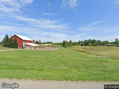
4469 92nd St SW Byron Center, MI 49315
Estimated Value: $274,000 - $483,000
--
Bed
--
Bath
--
Sq Ft
11
Acres
About This Home
This home is located at 4469 92nd St SW, Byron Center, MI 49315 and is currently estimated at $378,500. 4469 92nd St SW is a home located in Kent County with nearby schools including Brown Elementary School, Robert L. Nickels Intermediate School, and Byron Center West Middle School.
Ownership History
Date
Name
Owned For
Owner Type
Purchase Details
Closed on
Sep 10, 2007
Sold by
Abbott James and Abbott Dalene
Bought by
Folkert John D and Folkert Melynda D
Current Estimated Value
Home Financials for this Owner
Home Financials are based on the most recent Mortgage that was taken out on this home.
Original Mortgage
$200,000
Interest Rate
6.55%
Mortgage Type
Credit Line Revolving
Purchase Details
Closed on
Jul 10, 2003
Sold by
Wever James A and Wever Peggy L
Bought by
Dalene L Abbott Trust
Create a Home Valuation Report for This Property
The Home Valuation Report is an in-depth analysis detailing your home's value as well as a comparison with similar homes in the area
Home Values in the Area
Average Home Value in this Area
Purchase History
| Date | Buyer | Sale Price | Title Company |
|---|---|---|---|
| Folkert John D | $1,430,000 | None Available | |
| Dalene L Abbott Trust | $150,000 | -- |
Source: Public Records
Mortgage History
| Date | Status | Borrower | Loan Amount |
|---|---|---|---|
| Open | Folkert John D | $417,000 | |
| Closed | Folkert John D | $200,000 | |
| Closed | Folkert John | $200,000 | |
| Closed | Folkert John D | $850,000 |
Source: Public Records
Tax History Compared to Growth
Tax History
| Year | Tax Paid | Tax Assessment Tax Assessment Total Assessment is a certain percentage of the fair market value that is determined by local assessors to be the total taxable value of land and additions on the property. | Land | Improvement |
|---|---|---|---|---|
| 2025 | $2,141 | $88,700 | $0 | $0 |
| 2024 | $2,141 | $80,700 | $0 | $0 |
| 2023 | $2,045 | $76,800 | $0 | $0 |
| 2022 | $3,132 | $73,200 | $0 | $0 |
| 2021 | $3,042 | $73,200 | $0 | $0 |
| 2020 | $1,323 | $73,200 | $0 | $0 |
| 2019 | $1,875 | $69,700 | $0 | $0 |
| 2018 | $1,836 | $66,200 | $66,200 | $0 |
| 2017 | $1,787 | $57,700 | $0 | $0 |
| 2016 | $1,722 | $60,500 | $0 | $0 |
| 2015 | $1,692 | $60,500 | $0 | $0 |
| 2013 | -- | $55,200 | $0 | $0 |
Source: Public Records
Map
Nearby Homes
- 1109 Kenowa Ave SW
- 9875 Brin Point Ct SW
- 8475 Homerich Ave SW
- 8441 Homerich Ave SW
- 621 Kenowa Ave SW
- 2280 8th Ave SW Unit Parcel 6
- 2280 8th Ave SW Unit Parcel 3
- 3432 Conrail Dr
- 3447 Conrail Dr
- 3545 Conrail Dr
- 3527 Conrail Dr
- 4390 104th St SW
- 8130 Byron Depot Dr SW
- 8123 Byron Depot Dr SW
- 8115 Byron Depot Dr SW
- 484 8th Ave SW
- 10711 Windward Ave SW
- 2845 Ridgecrest St SW
- 3280 Amtrak Dr SW
- 10725 Windward Ave SW
- 4469 92nd St SW
- 4445 92nd St SW
- 4553 92nd St SW
- 4521 92nd St SW
- 4500 88th St SW
- 4488 92nd St SW
- 4595 92nd St SW
- 4530 92nd St SW
- 4588 92nd St SW
- 4544 88th St SW
- 4540 92nd St SW
- 4440 88th St SW
- 4420 92nd St SW
- 4620 92nd St SW
- 4293 92nd St SW
- 4682 92nd St SW
- 4580 88th St SW
- 4251 92nd St SW
- 4250 92nd St SW
- 4760 92nd St SW
