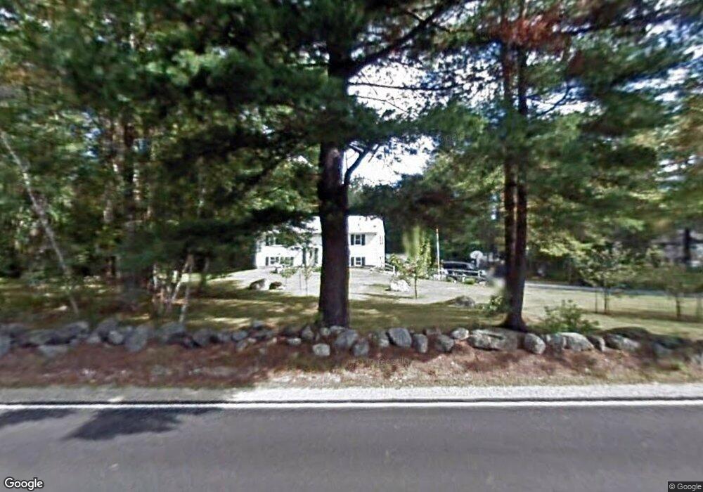
447 Greenfield Rd Peterborough, NH 03458
Estimated Value: $395,427 - $538,000
3
Beds
2
Baths
1,196
Sq Ft
$384/Sq Ft
Est. Value
About This Home
This home is located at 447 Greenfield Rd, Peterborough, NH 03458 and is currently estimated at $459,107, approximately $383 per square foot. 447 Greenfield Rd is a home with nearby schools including Peterborough Elementary School, South Meadow School, and Conval Regional High School.
Ownership History
Date
Name
Owned For
Owner Type
Purchase Details
Closed on
Nov 20, 2022
Sold by
Wallis Audrey L
Bought by
Wallis 2022 Lt
Current Estimated Value
Purchase Details
Closed on
Aug 17, 1999
Sold by
Hanson John A
Bought by
Teates Thomas N and Teates Karen J Johnson
Home Financials for this Owner
Home Financials are based on the most recent Mortgage that was taken out on this home.
Original Mortgage
$111,150
Interest Rate
7.65%
Create a Home Valuation Report for This Property
The Home Valuation Report is an in-depth analysis detailing your home's value as well as a comparison with similar homes in the area
Home Values in the Area
Average Home Value in this Area
Purchase History
| Date | Buyer | Sale Price | Title Company |
|---|---|---|---|
| Wallis 2022 Lt | -- | None Available | |
| Teates Thomas N | $152,200 | -- | |
| Wallis Audrey L | $117,000 | -- |
Source: Public Records
Mortgage History
| Date | Status | Borrower | Loan Amount |
|---|---|---|---|
| Previous Owner | Wallis Audrey L | $20,000 | |
| Previous Owner | Wallis Audrey L | $111,150 | |
| Previous Owner | Wallis Audrey L | $136,950 |
Source: Public Records
Tax History Compared to Growth
Tax History
| Year | Tax Paid | Tax Assessment Tax Assessment Total Assessment is a certain percentage of the fair market value that is determined by local assessors to be the total taxable value of land and additions on the property. | Land | Improvement |
|---|---|---|---|---|
| 2024 | $7,426 | $228,500 | $72,100 | $156,400 |
| 2023 | $6,441 | $228,500 | $72,100 | $156,400 |
| 2022 | $5,909 | $228,500 | $72,100 | $156,400 |
| 2021 | $5,886 | $228,500 | $72,100 | $156,400 |
| 2020 | $5,724 | $185,600 | $60,600 | $125,000 |
| 2019 | $5,522 | $185,600 | $60,600 | $125,000 |
| 2018 | $5,585 | $185,600 | $60,600 | $125,000 |
| 2017 | $5,093 | $161,900 | $57,900 | $104,000 |
| 2016 | $4,993 | $161,900 | $57,900 | $104,000 |
| 2015 | $4,810 | $161,900 | $57,900 | $104,000 |
| 2014 | $4,712 | $154,200 | $60,500 | $93,700 |
Source: Public Records
Map
Nearby Homes
- 21 Burke Rd
- 215 General Miller Rd
- 18 E Ridge Dr
- 514 Old Greenfield Rd
- 185 General Miller Rd
- 27 Trail's Edge Common
- 11 Trail's Edge Common
- 302 Southfield Ln
- 51 Lucy Ln
- 39 Lucy Ln
- 49 Lucy Ln
- 77 Hancock Rd
- 91 Swamp Rd
- 29 Lounsbury Ln
- 102 Taylor Rd
- off Wilder Farm Rd
- 1388 Forest Rd
- 32 Keenan Dr
- 94 Currier Ave
- 69 Murphy Rd
- 439 Greenfield Rd
- 457 Greenfield Rd
- 432 Greenfield Rd
- 465 Greenfield Rd
- 440 Greenfield Rd
- 458 Greenfield Rd
- 415 Greenfield Rd
- 489 Greenfield Rd
- 491 Greenfield Rd
- 406 Greenfield Rd
- 538 Greenfield Rd
- 497 Greenfield Rd
- 16 Burke Rd
- 498 Greenfield Rd
- 507 Greenfield Rd
- 514 Greenfield Rd
- 519 Greenfield Rd
- 523 Greenfield Rd
- 358 Greenfield Rd Unit R12-5-2
- 55 Burke Rd