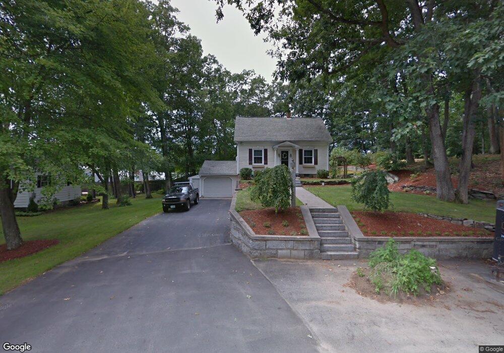
447 Main Dunstable Rd Nashua, NH 03062
West Hollis NeighborhoodEstimated Value: $494,670 - $569,000
3
Beds
2
Baths
1,299
Sq Ft
$411/Sq Ft
Est. Value
About This Home
This home is located at 447 Main Dunstable Rd, Nashua, NH 03062 and is currently estimated at $533,418, approximately $410 per square foot. 447 Main Dunstable Rd is a home located in Hillsborough County with nearby schools including Main Dunstable School, Elm Street Middle School, and Nashua High School South.
Ownership History
Date
Name
Owned For
Owner Type
Purchase Details
Closed on
Jul 19, 2022
Sold by
C A Dion 1999 Ret and Dion
Bought by
Dion
Current Estimated Value
Purchase Details
Closed on
Nov 29, 2021
Sold by
Value Hm Of New Eng Corp
Bought by
B Dion Holdings Inc
Purchase Details
Closed on
May 6, 2015
Sold by
Dion Christine A
Bought by
Christine A Dion Ret and Dion
Purchase Details
Closed on
Jul 19, 1993
Bought by
Christine A Dion Ret
Create a Home Valuation Report for This Property
The Home Valuation Report is an in-depth analysis detailing your home's value as well as a comparison with similar homes in the area
Home Values in the Area
Average Home Value in this Area
Purchase History
| Date | Buyer | Sale Price | Title Company |
|---|---|---|---|
| Dion | -- | None Available | |
| B Dion Holdings Inc | -- | None Available | |
| Christine A Dion Ret | -- | -- | |
| Christine A Dion Ret | $38,500 | -- |
Source: Public Records
Mortgage History
| Date | Status | Borrower | Loan Amount |
|---|---|---|---|
| Previous Owner | Christine A Dion Ret | $650,000 | |
| Previous Owner | Christine A Dion Ret | $250,000 | |
| Previous Owner | Christine A Dion Ret | $100,000 |
Source: Public Records
Tax History
| Year | Tax Paid | Tax Assessment Tax Assessment Total Assessment is a certain percentage of the fair market value that is determined by local assessors to be the total taxable value of land and additions on the property. | Land | Improvement |
|---|---|---|---|---|
| 2025 | $7,631 | $453,400 | $169,900 | $283,500 |
| 2024 | $7,209 | $453,400 | $169,900 | $283,500 |
| 2023 | $6,811 | $373,600 | $135,900 | $237,700 |
| 2022 | $6,751 | $373,600 | $135,900 | $237,700 |
| 2021 | $6,223 | $268,000 | $90,600 | $177,400 |
| 2020 | $6,087 | $269,200 | $90,600 | $178,600 |
| 2019 | $5,858 | $269,200 | $90,600 | $178,600 |
| 2018 | $5,272 | $269,200 | $90,600 | $178,600 |
| 2017 | $5,199 | $201,600 | $78,500 | $123,100 |
| 2016 | $5,054 | $201,600 | $78,500 | $123,100 |
| 2015 | $4,945 | $201,600 | $78,500 | $123,100 |
| 2014 | $4,875 | $202,700 | $78,500 | $124,200 |
Source: Public Records
Map
Nearby Homes
- 10 Houston Dr
- 27 Hyacinth Dr
- 12 Pioneer Dr
- 17 Twilight Dr
- 5 Ronnie Dr
- 103 Saranac Dr
- 36 Hibiscus Way
- 16 Champagne Dr Unit U31
- 5 Wilderness Dr
- 36 Silverton Dr Unit U85
- 70 Tenby Dr
- 4 Burlington Rd
- 4 Kittery Dr
- 154 Westwood Dr
- 61 Wilderness Dr
- 15 Wilderness Dr
- 59 Wilderness Dr
- 7 Wilderness Dr
- 6 Wilderness Dr
- 57 Wilderness Dr
- 449 Main Dunstable Rd
- 443 Main Dunstable Rd
- 3 Whitford Rd
- 6 Clark Rd
- 5 Clark Rd
- 5 Whitford Rd
- 4 Clark Rd
- 4 Whitford Rd
- 451 Main Dunstable Rd
- 440 Main Dunstable Rd
- 6 Whitford Rd
- 7 Whitford Rd
- 438 Main Dunstable Rd
- 8 Whitford Rd
- 16 Houston Dr
- 14 Houston Dr
- 15 Houston Dr
- 9 Whitford Rd
- 12 Houston Dr
- 2 Clark Rd
Your Personal Tour Guide
Ask me questions while you tour the home.