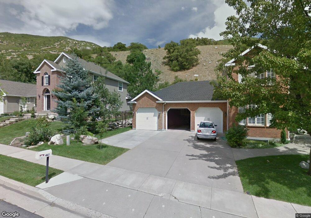
447 Spencer Way Farmington, UT 84025
Estimated Value: $805,000 - $947,108
6
Beds
4
Baths
4,296
Sq Ft
$203/Sq Ft
Est. Value
About This Home
This home is located at 447 Spencer Way, Farmington, UT 84025 and is currently estimated at $873,777, approximately $203 per square foot. 447 Spencer Way is a home located in Davis County with nearby schools including Farmington Elementary School, Farmington High, and Farmington Junior High School.
Ownership History
Date
Name
Owned For
Owner Type
Purchase Details
Closed on
Oct 7, 2022
Sold by
Snow Brian and Snow Janet
Bought by
Farmington Property Holdings Llc
Current Estimated Value
Purchase Details
Closed on
Aug 27, 2022
Sold by
Brian Snow
Bought by
Snow Family Trust
Purchase Details
Closed on
Aug 3, 2018
Sold by
Ashworth James B and Ashworth Joni P
Bought by
Snow Brian
Home Financials for this Owner
Home Financials are based on the most recent Mortgage that was taken out on this home.
Original Mortgage
$419,920
Interest Rate
4.5%
Mortgage Type
New Conventional
Purchase Details
Closed on
Jul 16, 2010
Sold by
Ashworth James B and Ashworth Joni
Bought by
Ashworth James B and Ashworth Joni P
Home Financials for this Owner
Home Financials are based on the most recent Mortgage that was taken out on this home.
Original Mortgage
$310,000
Interest Rate
4.71%
Mortgage Type
New Conventional
Create a Home Valuation Report for This Property
The Home Valuation Report is an in-depth analysis detailing your home's value as well as a comparison with similar homes in the area
Home Values in the Area
Average Home Value in this Area
Purchase History
| Date | Buyer | Sale Price | Title Company |
|---|---|---|---|
| Farmington Property Holdings Llc | -- | -- | |
| Snow Family Trust | -- | -- | |
| Snow Family Trust | -- | None Listed On Document | |
| Snow Brian | -- | Surety Title | |
| Ashworth James B | -- | Pinnacle Title Ins Agency |
Source: Public Records
Mortgage History
| Date | Status | Borrower | Loan Amount |
|---|---|---|---|
| Previous Owner | Snow Brian | $419,920 | |
| Previous Owner | Ashworth James B | $310,000 |
Source: Public Records
Tax History Compared to Growth
Tax History
| Year | Tax Paid | Tax Assessment Tax Assessment Total Assessment is a certain percentage of the fair market value that is determined by local assessors to be the total taxable value of land and additions on the property. | Land | Improvement |
|---|---|---|---|---|
| 2024 | $3,955 | $395,450 | $189,168 | $206,282 |
| 2023 | $3,963 | $722,000 | $228,410 | $493,590 |
| 2022 | $3,923 | $405,901 | $125,241 | $280,660 |
| 2021 | $3,331 | $513,000 | $192,509 | $320,491 |
| 2020 | $3,063 | $460,000 | $165,183 | $294,817 |
| 2019 | $3,096 | $451,000 | $153,030 | $297,970 |
| 2018 | $2,857 | $410,000 | $149,865 | $260,135 |
| 2016 | $2,774 | $204,985 | $58,803 | $146,182 |
| 2015 | $2,688 | $188,485 | $58,803 | $129,682 |
| 2014 | $2,522 | $181,709 | $58,803 | $122,906 |
| 2013 | -- | $178,208 | $60,381 | $117,827 |
Source: Public Records
Map
Nearby Homes
- 432 E Greystone Dr Unit 308
- 247 Paulette Way
- 467 Island View Cir
- 13 Sunset Dr
- 431 E Greystone Dr
- 436 E Greystone Dr S Unit 309
- 334 E Cottrell Ln
- 79 S 300 E
- 1603 S 200 E
- 1597 S 200 E
- 903 S 200 E
- 434 W 450 S Unit 815
- 250 S 200 W
- 800 S Rice Rd
- 292 N Flag Rock Dr
- 170 N Main St
- 21 N 100 W Unit 3
- 38 S 300 W
- 139 E 400 N
- 442 W Randys Ct Unit 808