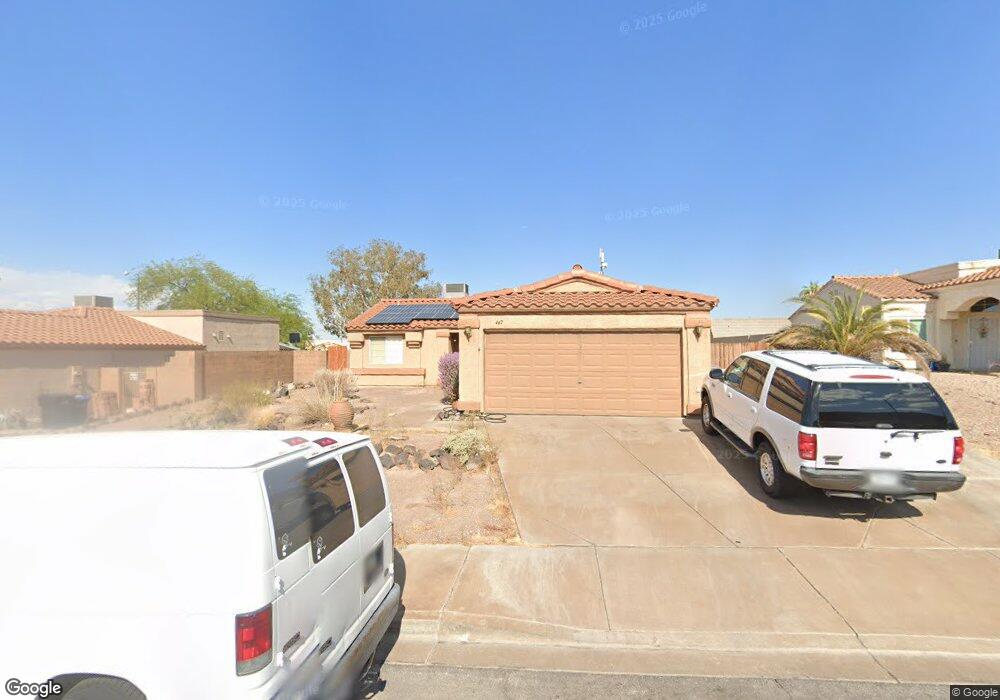
447 Wright Way Henderson, NV 89015
Black Mountain NeighborhoodEstimated Value: $374,832 - $429,000
3
Beds
2
Baths
1,189
Sq Ft
$340/Sq Ft
Est. Value
About This Home
This home is located at 447 Wright Way, Henderson, NV 89015 and is currently estimated at $404,208, approximately $339 per square foot. 447 Wright Way is a home located in Clark County with nearby schools including Ulis Newton Elementary School, Jack & Terry Mannion Middle School, and Foothill High School.
Ownership History
Date
Name
Owned For
Owner Type
Purchase Details
Closed on
Feb 11, 2026
Sold by
Jacob Joseph J and Joseph J Jacob Family Trust
Bought by
Joseph J Jacob Family Trust and Jacob
Current Estimated Value
Home Financials for this Owner
Home Financials are based on the most recent Mortgage that was taken out on this home.
Original Mortgage
$35,000
Outstanding Balance
$35,000
Interest Rate
5.44%
Mortgage Type
Credit Line Revolving
Estimated Equity
$369,208
Purchase Details
Closed on
Jun 9, 2020
Sold by
Jacob Joseph J
Bought by
The Joseph J Jacob Family Trust
Purchase Details
Closed on
May 9, 1995
Sold by
National Heritage Corp Of Nevada
Bought by
Jacob Joseph J and Jacob Lou Ann
Home Financials for this Owner
Home Financials are based on the most recent Mortgage that was taken out on this home.
Original Mortgage
$30,000
Interest Rate
7.83%
Create a Home Valuation Report for This Property
The Home Valuation Report is an in-depth analysis detailing your home's value as well as a comparison with similar homes in the area
Home Values in the Area
Average Home Value in this Area
Purchase History
| Date | Buyer | Sale Price | Title Company |
|---|---|---|---|
| Joseph J Jacob Family Trust | -- | One Real Title Of Nevada | |
| The Joseph J Jacob Family Trust | -- | None Available | |
| Jacob Joseph J | $91,500 | Old Republic Title Company |
Source: Public Records
Mortgage History
| Date | Status | Borrower | Loan Amount |
|---|---|---|---|
| Open | Joseph J Jacob Family Trust | $35,000 | |
| Previous Owner | Jacob Joseph J | $30,000 |
Source: Public Records
Tax History
| Year | Tax Paid | Tax Assessment Tax Assessment Total Assessment is a certain percentage of the fair market value that is determined by local assessors to be the total taxable value of land and additions on the property. | Land | Improvement |
|---|---|---|---|---|
| 2026 | $1,274 | $80,514 | $35,350 | $45,164 |
| 2025 | $1,237 | $73,004 | $26,950 | $46,054 |
| 2024 | $1,201 | $73,004 | $26,950 | $46,054 |
| 2023 | $1,201 | $78,527 | $34,650 | $43,877 |
| 2022 | $1,166 | $66,083 | $25,900 | $40,183 |
| 2021 | $1,133 | $60,719 | $22,400 | $38,319 |
| 2020 | $1,097 | $60,534 | $22,400 | $38,134 |
| 2019 | $1,083 | $57,907 | $20,300 | $37,607 |
| 2018 | $1,034 | $52,440 | $16,100 | $36,340 |
| 2017 | $1,506 | $51,940 | $15,050 | $36,890 |
| 2016 | $969 | $44,400 | $7,350 | $37,050 |
| 2015 | $965 | $40,328 | $7,350 | $32,978 |
| 2014 | $937 | $33,851 | $6,825 | $27,026 |
Source: Public Records
Map
Nearby Homes
- 435 Nancy Dr
- 472 Wright Way
- 403 Leighann Rd
- 422 Tiger Lily Way
- 437 Palegold St
- 422 Bottle Brush Way
- 463 Palegold St
- 603 Buchanan Ave
- 459 Potomac St
- 107 Mauve St
- 405 Box Elder Way
- 256 Hillcrest Dr
- 128 Mauve St
- 260 Quail Ranch Dr
- 64 Brown Swallow Way
- 478 Potomac St
- 727 Florence Isle Ave
- 752 Sleeping City Ave
- 483 Tiger Lily Way
- 325 W Rochell Dr
Your Personal Tour Guide
Ask me questions while you tour the home.