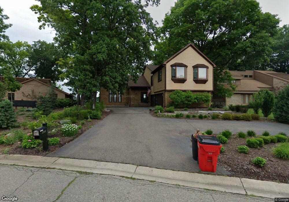
4475 Rolling Pine Dr West Bloomfield, MI 48323
Estimated Value: $577,000 - $1,657,000
3
Beds
4
Baths
2,682
Sq Ft
$465/Sq Ft
Est. Value
About This Home
This home is located at 4475 Rolling Pine Dr, West Bloomfield, MI 48323 and is currently estimated at $1,247,319, approximately $465 per square foot. 4475 Rolling Pine Dr is a home located in Oakland County with nearby schools including Walled Lake Central High School, The Susan And Rabbi Harold Loss Ecc, and Brookfield Academy - West Bloomfield.
Ownership History
Date
Name
Owned For
Owner Type
Purchase Details
Closed on
Nov 21, 2008
Sold by
Lukacs William B and Lukacs Jane
Bought by
Kheynson Alexsey and Barg Viktoriya
Current Estimated Value
Home Financials for this Owner
Home Financials are based on the most recent Mortgage that was taken out on this home.
Original Mortgage
$408,000
Interest Rate
4.95%
Mortgage Type
New Conventional
Purchase Details
Closed on
Nov 6, 2007
Sold by
Shepard David R
Bought by
Wells Fargo Bank Na and West Bloomfield
Purchase Details
Closed on
Nov 4, 1997
Sold by
Barbara Ann Wenokur Tr
Bought by
Shepard David R
Create a Home Valuation Report for This Property
The Home Valuation Report is an in-depth analysis detailing your home's value as well as a comparison with similar homes in the area
Home Values in the Area
Average Home Value in this Area
Purchase History
| Date | Buyer | Sale Price | Title Company |
|---|---|---|---|
| Kheynson Alexsey | $540,000 | None Available | |
| Wells Fargo Bank Na | $829,488 | None Available | |
| Shepard David R | $615,000 | -- |
Source: Public Records
Mortgage History
| Date | Status | Borrower | Loan Amount |
|---|---|---|---|
| Previous Owner | Kheynson Alexsey | $408,000 |
Source: Public Records
Tax History
| Year | Tax Paid | Tax Assessment Tax Assessment Total Assessment is a certain percentage of the fair market value that is determined by local assessors to be the total taxable value of land and additions on the property. | Land | Improvement |
|---|---|---|---|---|
| 2025 | $16,644 | $830,420 | $475,760 | $354,660 |
| 2024 | $9,544 | $805,440 | $0 | $0 |
| 2022 | $8,998 | $673,680 | $396,470 | $277,210 |
| 2021 | $13,314 | $671,720 | $0 | $0 |
| 2020 | $7,964 | $634,100 | $396,470 | $237,630 |
| 2018 | $13,469 | $581,150 | $377,910 | $203,240 |
| 2015 | -- | $466,820 | $0 | $0 |
| 2014 | -- | $418,050 | $0 | $0 |
| 2011 | -- | $345,200 | $0 | $0 |
Source: Public Records
Map
Nearby Homes
- 4442 Borland St
- 6980 Hambro St
- 4383 Green Lake Rd
- 3991 Fieldview Ave
- 3965 Carrick Ave
- 6978 Colony Dr
- 7545/7585 Pontiac Trail
- 7585/7548 Pontiac Trail
- 6100 Pontiac Trail
- 6140 Pontiac Trail
- 6903 Dandison Blvd
- 6790 Grassland Ave
- 4522 Twin Beach Ct
- 5148 Woodrun Ct
- 6018 Glen Eagles Dr
- 7381 Crestmore St
- 3701 Northwood
- 6433 Walnut Lake Rd
- 6885 Aeroview St
- 3584 Ashview St
- 4481 Rolling Pine Dr
- 4469 Rolling Pine Dr
- 4463 Rolling Pine Dr
- 4491 Rolling Pine Dr
- 6556 Lakeshore St
- 4457 Rolling Pine Dr
- 4468 Rolling Pine Dr
- 4478 Rolling Pine Dr
- 4460 Rolling Pine Dr
- 4510 Rolling Pine Ct
- 4499 Rolling Pine Dr
- 6550 Lakeshore St
- 4516 Rolling Pine Ct
- 4448 Rolling Pine Dr
- 4551 Rolling Pine Dr
- 4445 Rolling Pine Dr
- 4522 Rolling Pine Ct
- 6540 Lakeshore St
- 4442 Rolling Pine Dr Unit Bldg-Unit
- 4442 Rolling Pine Dr
Your Personal Tour Guide
Ask me questions while you tour the home.