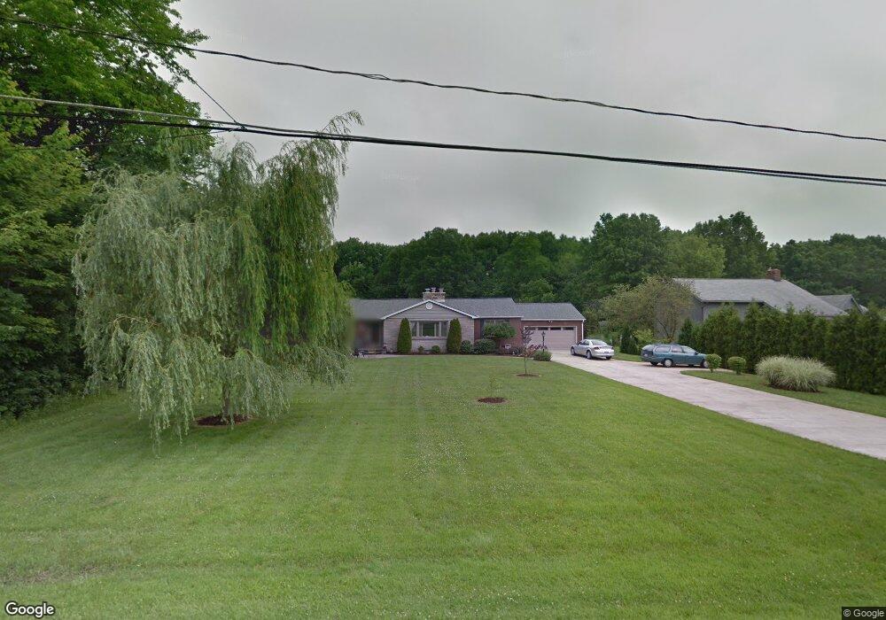
4476 Lanterman Rd Youngstown, OH 44515
Austintown NeighborhoodEstimated Value: $186,000 - $237,000
3
Beds
2
Baths
1,602
Sq Ft
$127/Sq Ft
Est. Value
About This Home
This home is located at 4476 Lanterman Rd, Youngstown, OH 44515 and is currently estimated at $202,786, approximately $126 per square foot. 4476 Lanterman Rd is a home located in Mahoning County with nearby schools including Austintown Elementary School, Austintown Intermediate School, and Austintown Middle School.
Ownership History
Date
Name
Owned For
Owner Type
Purchase Details
Closed on
Aug 9, 2002
Sold by
Greene Mary J Trustee
Bought by
Greene Mary J
Current Estimated Value
Home Financials for this Owner
Home Financials are based on the most recent Mortgage that was taken out on this home.
Original Mortgage
$53,300
Interest Rate
6.07%
Purchase Details
Closed on
Feb 23, 1994
Bought by
Cholensky Albert J
Create a Home Valuation Report for This Property
The Home Valuation Report is an in-depth analysis detailing your home's value as well as a comparison with similar homes in the area
Home Values in the Area
Average Home Value in this Area
Purchase History
| Date | Buyer | Sale Price | Title Company |
|---|---|---|---|
| Greene Mary J | -- | -- | |
| Cholensky Albert J | -- | -- |
Source: Public Records
Mortgage History
| Date | Status | Borrower | Loan Amount |
|---|---|---|---|
| Closed | Greene Mary J | $53,300 |
Source: Public Records
Tax History
| Year | Tax Paid | Tax Assessment Tax Assessment Total Assessment is a certain percentage of the fair market value that is determined by local assessors to be the total taxable value of land and additions on the property. | Land | Improvement |
|---|---|---|---|---|
| 2025 | $2,007 | $51,980 | $6,210 | $45,770 |
| 2024 | $1,932 | $51,980 | $6,210 | $45,770 |
| 2023 | $1,930 | $51,980 | $6,210 | $45,770 |
| 2022 | $1,935 | $43,170 | $5,460 | $37,710 |
| 2021 | $1,936 | $43,170 | $5,460 | $37,710 |
| 2020 | $1,944 | $43,170 | $5,460 | $37,710 |
| 2019 | $1,683 | $35,870 | $5,460 | $30,410 |
| 2018 | $1,619 | $35,870 | $5,460 | $30,410 |
| 2017 | $1,619 | $35,870 | $5,460 | $30,410 |
| 2016 | $1,622 | $35,710 | $5,460 | $30,250 |
| 2015 | $1,573 | $35,710 | $5,460 | $30,250 |
| 2014 | $1,580 | $35,710 | $5,460 | $30,250 |
| 2013 | $1,563 | $35,710 | $5,460 | $30,250 |
Source: Public Records
Map
Nearby Homes
- 613 N Raccoon Rd
- 527 N Raccoon Rd
- 4154 Belle Ave
- 262 Idlewood Rd
- 3990 Crum Rd
- 181 N Yorkshire Blvd
- 151 N Yorkshire Blvd
- 5133 Winslow Dr
- 220 Carnegie Ave
- 97 Idlewood Rd
- 1085 Beaver Dr
- 1317 Cedarwood Dr
- 1945 Farmdale Ave
- 3727 Riblett Rd
- 4258 Mahoning Ave
- 50 N Main St
- 1913 Cloverbrook Dr
- 0 Norquest Blvd Unit 5175953
- 0 Norquest Blvd Unit 5175593
- 0 N Navarre Ave
- 4474 Lanterman Rd
- 4580 Lanterman Rd
- 4468 Lanterman Rd
- 4581 Lanterman Rd
- 4585 Lanterman Rd
- 4594 Lanterman Rd
- 4464 Lanterman Rd
- 900 N Four Mile Run Rd
- 4595 Lanterman Rd
- 4571 Lanterman Rd
- 745 Carlin Dr
- 711 Carlin Dr
- 4452 Lanterman Rd
- 4453 Lanterman Rd
- 4605 Lanterman Rd
- 4443 Lanterman Rd
- 925 N Four Mile Run Rd
- 901 N Four Mile Run Rd
- 4436 Lanterman Rd
- 949 N Four Mile Run Rd
Your Personal Tour Guide
Ask me questions while you tour the home.